Coles, South Australia

Last updated

Coles
South Australia
Australia South Australia location map.svg
Red pog.svg
Coles
Coordinates 37°12′45″S140°27′39″E / 37.212412°S 140.460758°E / -37.212412; 140.460758 Coordinates: 37°12′45″S140°27′39″E / 37.212412°S 140.460758°E / -37.212412; 140.460758 [1]
Population 39 (2016 census) [2]
Established 3 December 1998 [1]
Postcode(s) 5272 [3]
Time zone ACST (UTC+9:30)
 • Summer (DST) ACST (UTC+10:30)
Location
LGA(s) Naracoorte Lucindale Council [1]
Region Limestone Coast [1]
County Robe [1]
State electorate(s) MacKillop [4]
Federal Division(s) Barker [5]
Mean max temp [6] Mean min temp [6] Annual rainfall [6]
21.2 °C
70 °F
8.4 °C
47 °F
603.5 mm
23.8 in
Suburbs around Coles:
Lucindale Lucindale
Spence
Spence
Fox Coles Spence
Bool Lagoon
Maaoupe
Furner Short Wattle Range East
Footnotes Locations [3]
Adjoining localities [1]

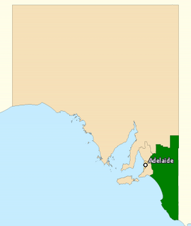
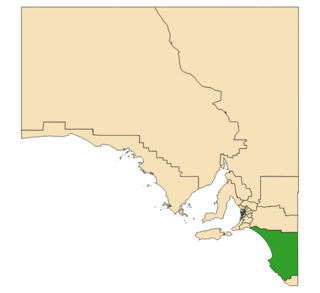
Coles is a locality in the Australian state of South Australia located in the state's south-east within the Limestone Coast region about 316 kilometres (196 mi) south east of the state capital of Adelaide and about 39 kilometres (24 mi) south-west of the municipal seat of Naracoorte. [3]

South Australia State of Australia

South Australia is a state in the southern central part of Australia. It covers some of the most arid parts of the country. With a total land area of 983,482 square kilometres (379,725 sq mi), it is the fourth-largest of Australia's states and territories by area, and fifth largest by population. It has a total of 1.7 million people, and its population is the second most highly centralised in Australia, after Western Australia, with more than 77 percent of South Australians living in the capital, Adelaide, or its environs. Other population centres in the state are relatively small; Mount Gambier, the second largest centre, has a population of 28,684.

Limestone Coast Region in South Australia

The Limestone Coast is a name used since the early twenty-first century for a South Australian government region located in the south east of South Australia which immediately adjoins the continental coastline and the Victorian border. The name is also used for a tourist region and a wine zone both located in the same part of South Australia.

Adelaide city centre Suburb of Adelaide, South Australia

Adelaide city centre is the innermost locality of Greater Adelaide, the capital city of South Australia. It is known by locals simply as "The City" or "Town" to distinguish it from Greater Adelaide and from the City of Adelaide. The locality is split into two key geographical distinctions: the city "square mile", bordered by North, East, South and West Terraces; and the section of the parklands south of the River Torrens which separates the built up part of the city from the surrounding suburbs and North Adelaide.

Boundaries for the locality were created and was given the name of Coles on 3 December 1998. The name is derived from the cadastral unit of the Hundred of Coles in which the locality is located. [1] The hundred itself was named after Jenkin Coles who was a member of the South Australian House of Assembly from 1875 to 1911. [7]

Jenkin Coles Australian politician

Sir Jenkin Coles was a South Australian politician. He was a member of the South Australian House of Assembly from 1875 to 1878 and 1881 to 1911, representing the electorates of Light and Wooroora (1902–1911). He was Leader of the Opposition from 1886 to 1887 and later served as Speaker of the House of Assembly from 1890 to 1911.

South Australian House of Assembly lower house of the Parliament of South Australia

The House of Assembly, or lower house, is one of the two chambers of the Parliament of South Australia. The other is the Legislative Council. It sits in Parliament House in the state capital, Adelaide.

The 2016 Australian census which was conducted in August 2016 reports that Coles had a population of 39 people. [2]

The 2016 Australian census was the seventeenth national population census held in Australia. The census was officially conducted with effect on Tuesday, 9 August 2016. The total population of the Commonwealth of Australia was counted as 23,401,892 – an increase of 8.8 per cent or 1,894,175 people since the 2011 census. Norfolk Island joined the census for the first time in 2016, adding 1,748 to the population.

Coles is located within the federal division of Barker, the state electoral district of MacKillop and the local government area of the Naracoorte Lucindale Council. [5] [4] [1]

Division of Barker Australian federal electoral division

The Division of Barker is an Australian Electoral Division in the south-east of South Australia. The division was established on 2 October 1903, when South Australia's original single multi-member division was split into seven single-member divisions. It is named for Collet Barker, an early explorer of the region at the mouth of the Murray River. The 63,886 km² seat currently stretches from Morgan in the north to Port MacDonnell in the south, taking in the Murray Mallee, the Riverland, the Murraylands and most of the Barossa Valley, and includes the towns of Barmera, Berri, Bordertown, Coonawarra, Keith, Kingston SE, Loxton, Lucindale, Mannum, Millicent, Mount Gambier, Murray Bridge, Naracoorte, Penola, Renmark, Robe, Tailem Bend, Waikerie, and parts of Nuriootpa and Tanunda.

Electoral district of MacKillop state electoral district of South Australia

MacKillop is a single-member electoral district for the South Australian House of Assembly. It was named in 1991 after Sister Mary MacKillop who served the local area, and later became the first Australian to be canonised as a Roman Catholic saint. MacKillop is a 25,313 km² rural electorate in the south-east of the state, stretching south and west from the mouth of the Murray River to the Victorian State border, but excluding the far-southern point of the state,. It contains the Kingston District Council, Naracoorte Lucindale Council, District Council of Robe, Tatiara District Council, Wattle Range Council, as well as parts of The Coorong District Council. The main population centres are Bordertown, Keith, Kingston SE, Meningie, Millicent, Naracoorte, Penola and Robe.

Naracoorte Lucindale Council Local government area in South Australia

The Naracoorte Lucindale Council is a local government area in the Australian state of South Australia located in the Limestone Coast region in the south-east of the state adjacent to the Victorian border.

Related Research Articles

Kalangadoo, South Australia Town in South Australia

Kalangadoo is a locality in the Australian state of South Australia located about 348 kilometres (216 mi) south-east of the state capital of Adelaide and about 31 kilometres (19 mi) north of the regional centre of Mount Gambier.

Thornlea, South Australia Suburb of Wattle Range Council , South Australia

Thornlea is a locality in the Australian state of South Australia located in the state's south-east within the Limestone Coast region about 309 kilometres (192 mi) south east of the state capital of Adelaide and about 25 kilometres (16 mi) north-west of the municipal seat of Millicent.

Avenue Range, South Australia Town in South Australia

Avenue Range is a locality in the Australian state of South Australia located in the state's south-east within the Limestone Coast region about 265 kilometres south east of the Adelaide city centre.

Binnum, South Australia Town in South Australia

Binnum is a locality in the Australian state of South Australia.

Frances, South Australia Town in South Australia

Frances is a locality in the Australian state of South Australia located about 291 kilometres (181 mi) south-east of the state capital, Adelaide and about 40 kilometres (25 mi) north-east of the municipal seat of Naracoorte in the state's Limestone Coast region and adjoining the border with the State of Victoria.

Hynam, South Australia Town in South Australia

Hynam is a town and locality in the Australian state of South Australia located in the state's south-east within the Limestone Coast region on the border with the state of Victoria about 302 kilometres south east of the state capital of Adelaide and about 11 kilometres east of the municipal seat of Naracoorte.

Kybybolite Town in South Australia

Kybybolite is a locality in the Australian state of South Australia located in the state's south-east within the Limestone Coast region on the border with the state of Victoria about 301 kilometres south east of the state capital of Adelaide and about 19 kilometres north-east of the municipal seat of Naracoorte.

Wrattonbully, South Australia Town in South Australia

Wrattonbully is a locality located within the Naracoorte Lucindale Council in the Limestone Coast in the south east of South Australia about 327 kilometres south east of the Adelaide city centre. Wrattonbully gives its name to the wine region surrounding it, the Wrattonbully wine region.

Bool Lagoon, South Australia Suburb of Naracoorte Lucindale Council, Wattle Range Council, South Australia

Bool Lagoon is a locality in the Australian state of South Australia located in the south-east of the state in the Limestone Coast region about 311 kilometres south east of the state capital of Adelaide.

Keppoch, South Australia Suburb of Naracoorte Lucindale Council, South Australia

Keppoch is a locality in the Australian state of South Australia located in the state's south-east within the Limestone Coast region about 269 kilometres south east of the state capital of Adelaide and about 29 kilometres north-east of the municipal seat of Naracoorte.

Cadgee, South Australia Suburb of Naracoorte Lucindale Council, South Australia

Cadgee is a locality in the Australian state of South Australia located in the state's south-east within the Limestone Coast region about 280 kilometres south east of the state capital of Adelaide and about 18 kilometres north of the municipal seat of Naracoorte.

Stewart Range, South Australia Suburb of Naracoorte Lucindale Council, South Australia

Stewart Range is a locality in the Australian state of South Australia located about 289 kilometres (180 mi) south-east of the state capital of Adelaide and about 12 kilometres (7.5 mi) west of the municipal seat of Naracoorte.

Joanna, South Australia Town in South Australia

Joanna is a locality in the Australian state of South Australia located in the state's south-east within the state’s Limestone Coast region about 325 kilometres south east of the state capital of Adelaide, about 19.5 kilometres south-east of the municipal seat of Naracoorte.

Fox, South Australia Suburb of Naracoorte Lucindale Council, South Australia

Fox is a locality in the Australian state of South Australia located in the state's south-east within the Limestone Coast region about 298 kilometres (185 mi) south east of the state capital of Adelaide and about 45 kilometres (28 mi) south-west of the municipal seat of Naracoorte.

Laurie Park, South Australia Town in South Australia

Laurie Park is a locality located within the Naracoorte Lucindale Council in the Limestone Coast region of South Australia.

Field, South Australia Suburb of Coorong District Council , South Australia

Field is a locality in the Australian state of South Australia located in the state’s south-east about 139 kilometres (86 mi) south-east of the state capital of Adelaide and about 61 kilometres (38 mi) south-east of the municipal seat in Tailem Bend.

Meningie West, South Australia Suburb of Coorong District Council , South Australia

Meningie West is a locality in the Australian state of South Australia located in the state’s south-east about 99 kilometres (62 mi) south-east of the state capital of Adelaide and about 50 kilometres (31 mi) south-west of the municipal seat in Tailem Bend.

Clay Wells, South Australia Suburb of District Council of Robe, South Australia

Clay Wells is a locality in the Australian state of South Australia located in the state's south-east within the Limestone Coast region about 300 kilometres (190 mi) south east of the state capital of Adelaide, and about 39 kilometres (24 mi) south-east and about 35 kilometres (22 mi) north-west respectively of the municipal seats of Robe and Millicent.

Kangaroo Inn, South Australia Suburb of District Council of Robe, South Australia

Kangaroo Inn is a locality in the Australian state of South Australia located in the state's south-east within the Limestone Coast region about 306 kilometres (190 mi) south-east of the state capital of Adelaide, and about 30 kilometres (19 mi) south-east and about 46 kilometres (29 mi) north-west respectively of the municipal seats of Robe and Millicent.

Magarey, South Australia Suburb of Wattle Range Council, South Australia

Magarey is a locality in the Australian state of South Australia located in the state’s south-east about 307 kilometres (191 mi) south-east of the state capital of Adelaide and about 35 kilometres (22 mi) west of the municipal seat in Millicent.

References

  1. 1 2 3 4 5 6 7 8 "Search results for 'Coles, LOCB' with the following datasets being selected – 'Suburbs and Localities', 'Government Towns', 'Counties', 'Local Government Areas', 'SA Government Regions', 'Gazetteer' and 'Roads'". Location SA Map Viewer. Government of South Australia. Retrieved 18 May 2018.
  2. 1 2 Australian Bureau of Statistics (27 June 2017). "Coles (State Suburb)". 2016 Census QuickStats. Retrieved 5 August 2017. Blue pencil.svg
  3. 1 2 3 "Postcode for Coles, South Australia". Postcodes Australia. Retrieved 18 May 2018.
  4. 1 2 "District of MacKillop (map)". Electoral Commission SA. Retrieved 17 May 2018.
  5. 1 2 "Federal electoral division of Barker" (PDF). Australian Electoral Commission. Retrieved 28 December 2017.
  6. 1 2 3 "Monthly climate statistics: Summary statistics LUCINDALE POST OFFICE (nearest weather station)". Commonwealth of Australia , Bureau of Meteorology. Retrieved 18 May 2018.
  7. Manning, Geoffrey. "South Australian Names - C" (PDF). Manning Index of South Australian History. State Library of South Australia. Retrieved 18 May 2018.