
The Limestone Coast is a name used since the early twenty-first century for a South Australian government region located in the south east of South Australia which immediately adjoins the continental coastline and the Victorian border. The name is also used for a tourist region and a wine zone both located in the same part of South Australia.

Coorong is a locality in the Australian state of South Australia which is associated with the lagoon known as the Coorong in the south-east of the state and which overlooks the continental coastline from the mouth of the Murray River about 80 kilometres south-east of the state capital of Adelaide to the immediate north of the town of Kingston SE extending for a distance of at least 140 kilometres (87 mi).

Thornlea is a locality in the Australian state of South Australia located in the state's south-east within the Limestone Coast region about 309 kilometres (192 mi) south east of the state capital of Adelaide and about 25 kilometres (16 mi) north-west of the municipal seat of Millicent.

Avenue Range is a locality in the Australian state of South Australia located in the state's south-east within the Limestone Coast region about 265 kilometres south east of the Adelaide city centre.

Binnum is a locality in the Australian state of South Australia.

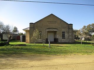
Frances is a town in the Australian state of South Australia located about 291 kilometres (181 mi) south-east of the state capital, Adelaide and about 40 kilometres (25 mi) north-east of the municipal seat of Naracoorte in the state's Limestone Coast region and adjoining the border with the State of Victoria.
Hynam is a town and locality in the Australian state of South Australia located in the state's south-east within the Limestone Coast region on the border with the state of Victoria about 302 kilometres south east of the state capital of Adelaide and about 11 kilometres east of the municipal seat of Naracoorte.
Kybybolite is a locality in the Australian state of South Australia located in the state's south-east within the Limestone Coast region on the border with the state of Victoria about 301 kilometres south east of the state capital of Adelaide and about 19 kilometres north-east of the municipal seat of Naracoorte.

Wrattonbully is a locality located within the Naracoorte Lucindale Council in the Limestone Coast in the south east of South Australia about 327 kilometres south east of the Adelaide city centre. Wrattonbully gives its name to the wine region surrounding it, the Wrattonbully wine region.

Ngarkat is a locality in the Australian state of South Australia located in the south-east of the state at the border with the state of Victoria in both the Murray Mallee and the Limestone Coast regions about 227 kilometres south east of the state capital of Adelaide.

Canunda is a locality in the Australian state of South Australia located on the state’s south-east coast overlooking the body of water known in Australia as the Southern Ocean and by international authorities as the Great Australian Bight. It is about 339 kilometres south-east of the state capital of Adelaide and 49 kilometres south of the centre of Mount Gambier.
Nora Creina is a locality in the Australian state of South Australia located on the state’s south-east coast overlooking the body of water known in Australia as the Southern Ocean and by international authorities as the Great Australian Bight. It is about 99 kilometres to the north-west of the city of Mount Gambier and about 290 kilometres south-east of the state capital of Adelaide.
Keppoch is a locality in the Australian state of South Australia located in the state's south-east within the Limestone Coast region about 269 kilometres south east of the state capital of Adelaide and about 29 kilometres north-east of the municipal seat of Naracoorte.
Cadgee is a locality in the Australian state of South Australia located in the state's south-east within the Limestone Coast region about 280 kilometres south east of the state capital of Adelaide and about 18 kilometres north of the municipal seat of Naracoorte.
Stewart Range is a locality in the Australian state of South Australia located about 289 kilometres (180 mi) south-east of the state capital of Adelaide and about 12 kilometres (7.5 mi) west of the municipal seat of Naracoorte.
Joanna is a locality in the Australian state of South Australia located in the state's south-east within the state’s Limestone Coast region about 325 kilometres south east of the state capital of Adelaide, about 19.5 kilometres south-east of the municipal seat of Naracoorte.
Coles is a locality in the Australian state of South Australia located in the state's south-east within the Limestone Coast region about 316 kilometres (196 mi) south east of the state capital of Adelaide and about 39 kilometres (24 mi) south-west of the municipal seat of Naracoorte.
Fox is a locality in the Australian state of South Australia located in the state's south-east within the Limestone Coast region about 298 kilometres (185 mi) south east of the state capital of Adelaide and about 45 kilometres (28 mi) south-west of the municipal seat of Naracoorte.
Laurie Park is a locality located within the Naracoorte Lucindale Council in the Limestone Coast region of South Australia.
Clay Wells is a locality in the Australian state of South Australia located in the state's south-east within the Limestone Coast region about 300 kilometres (190 mi) south east of the state capital of Adelaide, and about 39 kilometres (24 mi) south-east and about 35 kilometres (22 mi) north-west respectively of the municipal seats of Robe and Millicent.

