Custon, South Australia

Last updated

Custon
South Australia
Australia South Australia location map.svg
Red pog.svg
Custon
Coordinates 36°26′15″S140°55′16″E / 36.43753974°S 140.92105556°E / -36.43753974; 140.92105556 Coordinates: 36°26′15″S140°55′16″E / 36.43753974°S 140.92105556°E / -36.43753974; 140.92105556 [1]
Population20 (2016 census) [2]
Established8 December 1881 (town)
16 March 2000 (locality) [3] [4]
Abolished1 July 1993 (town) [5]
Postcode(s) 5270 [6]
Time zone ACST (UTC+9:30)
 • Summer (DST) ACST (UTC+10:30)
Location
LGA(s) Tatiara District Council [1]
Region Limestone Coast [7]
County Buckingham [1]
State electorate(s) MacKillop [8]
Federal Division(s) Barker [9]
Mean max tempMean min tempAnnual rainfall
21.5 °C
71 °F
8.6 °C
47 °F
453.8 mm
17.9 in
Localities around Custon:
Wolseley Wolseley Serviceton
Pooginagoric Custon Serviceton
Bangham Bangham Serviceton
FootnotesCoordinates [1]
Locations [1] [6]
Climatic data [10]
Adjoining Localities [1] [11]

Custon is a locality in the Australian state of South Australia located in the state's south-east within the Limestone Coast region about 267 kilometres (166 miles) south east of the state capital of Adelaide, about 19.5 kilometres (12.1 miles) south-east of the municipal seat of Bordertown and adjoining the border with the State of Victoria. [1] [7] [6]

Custon began as a government town which was surveyed in September 1881 and was proclaimed on 8 December 1881. It was named after the Reverend Percy Cust who married Lucy Caroline Jervois, the second daughter of William Jervois, the then Governor of South Australia. In 1961, a portion of the government town was ceased and was subsequently declared as ceasing to exist in 1993. In 2000, boundaries were declared for the locality which includes the extent of the ceased government town and which was given the “long established name.” [1] [3] [12] [5] [4]

The Mount Gambier railway line which closed on 12 April 1995 passes through the locality from north to south with the former railway station with the name of Custon being located to the immediate south in the locality of Wolseley. [1] [13]

The majority land use within the locality is primary production. The locality includes land proclaimed for conservation purposes as the Custon Conservation Park. [1] [14]

The 2016 Australian census which was conducted in August 2016 reports that Custon had a population of 20 people. [2]

Custon is located within the federal division of Barker, the state electoral district of MacKillop and the local government area of the Tatiara District Council. [1] [8] [9]

Related Research Articles

Keith, South Australia Town in South Australia

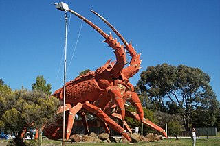
Keith is a town and a locality in the Australian state of South Australia located in the state's south-east about 225 kilometres (140 mi) from the state capital of Adelaide at the junction of the Dukes Highway and the Riddoch Highway. It is sometimes referred to as the 'lucerne capital of Australia' due to the high number of lucerne growers in the region.

Kingston SE Town in South Australia

Kingston SE is a town in the Australian state of South Australia located in the state's south-east coastline on the shores of Lacepede Bay. It is located about 240 kilometres southeast of the state capital of Adelaide and 138 kilometres north-west of the centre of the city of Mount Gambier. At the 2016 census, Kingston SE had a population of 1,648.

Bordertown, South Australia Town in South Australia

Bordertown, formerly Border Town, is a town and locality in the Australian state of South Australia located in the state's east near the state border with Victoria about 250 kilometres (160 mi) east of the state capital of Adelaide. It is where the Dukes Highway and the railway line cross the Tatiara Creek between Adelaide and Melbourne, the capital of Victoria.

Tantanoola, South Australia Town in South Australia

Tantanoola is a town in regional South Australia. The name is derived from the aboriginal word tentunola, which means boxwood / brushwood hill or camp. Tantanoola was originally named 'Lucieton' by Governor Jervois after his daughter Lucy Caroline, on 10 July 1879. It was changed by Governor Robinson to 'Tantanoola' on 4 October 1888. At the 2006 census, Tantanoola had a population of 255.

Wolseley, South Australia Town in South Australia

Wolseley is a small South Australian town near the Victorian border. It is five kilometres south of the Dukes Highway and 13 kilometres east of Bordertown. It was first proclaimed a town in 1884.

Hynam, South Australia Town in South Australia

Hynam is a town and locality in the Australian state of South Australia located in the state's south-east within the Limestone Coast region on the border with the state of Victoria about 302 kilometres south east of the state capital of Adelaide and about 11 kilometres east of the municipal seat of Naracoorte.

Walloway, South Australia Town in South Australia

Walloway is a locality in the Australian state of South Australia located about 255 kilometres (158 mi) north of the state capital of Adelaide and about 10 kilometres (6.2 mi) north of the municipal seat of Orroroo.

Willalooka, South Australia Town in South Australia

Willalooka is a small service town and locality in the Limestone Coast region of South Australia. it is located on the Riddoch Highway between Keith and Padthaway. Christmas Rocks Conservation Park is north of the town adjacent to the highway.

Bangham, South Australia Town in South Australia

Bangham is a locality in the Australian state of South Australia located in the state's south-east within the Limestone Coast region about 279 kilometres south east of the state capital of Adelaide, about 31.5 kilometres south-east of the municipal seat of Bordertown and adjoining the border with the State of Victoria.

Sherwood, South Australia Suburb of Tatiara District Council, South Australia

Sherwood is a locality in the Australian state of South Australia located about 222 kilometres (138 mi) south-east of the state capital of Adelaide and about 30 kilometres (19 mi) north-west of the municipal seat of Bordertown.

Laurie Park, South Australia Town in South Australia

Laurie Park is a locality located within the Naracoorte Lucindale Council in the Limestone Coast region of South Australia.

Yalpara, South Australia Suburb of District Council of Orroroo Carrieton , South Australia

Yalpara is a locality in the Australian state of South Australia located about 265 kilometres (165 mi) north of the state capital of Adelaide and about 29 kilometres (18 mi) north-east of the municipal seat in Orroroo.

Petherick, South Australia Suburb of Tatiara District Council , South Australia

Petherick is a locality in the Australian state of South Australia located in the state’s south-east about 211 kilometres (131 mi) south-east of the state capital of Adelaide and about 55 kilometres (34 mi) west of the municipal seat in Bordertown.

Makin, South Australia Suburb of Tatiara District Council, South Australia

Makin is a locality in the Australian state of South Australia located on the state’s south-east about 208 kilometres (129 mi) south-east of the state capital of Adelaide and about 50 kilometres (31 mi) north-west of the municipal seat of Bordertown.

Laffer, South Australia Suburb of Tatiara District Council , South Australia

Laffer is a locality in the Australian state of South Australia located in the state’s south-east about 199 kilometres (124 mi) south-east of the state capital of Adelaide and about 57 kilometres (35 mi) west of the municipal seat in Bordertown.

Western Flat, South Australia Suburb of Tatiara District Council , South Australia

Western Flat is a locality in the Australian state of South Australia located in the state's south-east within the Limestone Coast region about 264 kilometres (164 mi) south east of the state capital of Adelaide and about 22 kilometres (14 mi) south of the municipal seat of Bordertown.

Amyton, South Australia Suburb of Mount Remarkable , South Australia

Amyton is a locality in the Australian state of South Australia located on the eastern side of the Flinders Ranges about 259 kilometres (161 mi) north of the state capital of Adelaide and about 28 kilometres (17 mi) north-east of the municipal seat of Melrose.

Johnburgh, South Australia Suburb of District Council of Orroroo Carrieton, South Australia

Johnburgh is a town and a locality in the Australian state of South Australia located on the eastern side of the Flinders Ranges about 275 kilometres (171 mi) north of the state capital of Adelaide and about 32 kilometres (20 mi) north-east of the municipal seat of Orroroo.

Clay Wells, South Australia Suburb of District Council of Robe, South Australia

Clay Wells is a locality in the Australian state of South Australia located in the state's south-east within the Limestone Coast region about 300 kilometres (190 mi) south east of the state capital of Adelaide, and about 39 kilometres (24 mi) south-east and about 35 kilometres (22 mi) north-west respectively of the municipal seats of Robe and Millicent.

Bordertown South, South Australia Suburb of Tatiara District Council, South Australia

Bordertown South is a locality in the Australian state of South Australia located in the state's south-east within the Limestone Coast region about 255 kilometres (158 mi) east of the state capital of Adelaide and about 14 kilometres (8.7 mi) south of the municipal seat of Bordertown.

References

  1. 1 2 3 4 5 6 7 8 9 10 11 "Search result for "Custon (Locality Bounded)" (Record no SA0017462) with the following layers selected - "Suburbs and Localities", "Place names (gazetteer)", "Road Labels" and "Development Plan Layers"". Property Location Browser. Government of South Australia. Archived from the original on 12 October 2016. Retrieved 2 March 2017.
  2. 1 2 Australian Bureau of Statistics (27 June 2017). "Custon". 2016 Census QuickStats. Retrieved 24 April 2018. OOjs UI icon edit-ltr-progressive.svg
  3. 1 2 "Proclamation (Town of Custon proclaimed)" (PDF). The South Australian Government Gazette. Government of South Australia: 1677. 8 December 1881. Retrieved 3 March 2017.
  4. 1 2 Lawson, Robert (16 March 2000). "GEOGRAPHICAL NAMES ACT 1991 Notice to Assign Names and Boundaries to Places (in the District Council of Tatiara)" (PDF). The South Australian Government Gazette. South Australian Government. p. 1434. Retrieved 24 April 2018.
  5. 1 2 "CROWN LANDS ACT, 1929: SECTION 5 (i.e. Town of Custon ... shall cease to exist.)" (PDF). The South Australian Government Gazette. Government of South Australia: 422. 1 July 1993. Retrieved 3 March 2017.
  6. 1 2 3 "Postcode for Custon, South Australia". postcodes-australia.com. Retrieved 3 March 2017.
  7. 1 2 "Limestone Coast SA Government region" (PDF). The Government of South Australia. Retrieved 10 October 2014.
  8. 1 2 "District of MacKillop Background Profile". Electoral Commission SA. Retrieved 29 March 2016.
  9. 1 2 "Federal electoral division of Barker" (PDF). Australian Electoral Commission. Retrieved 28 March 2016.
  10. "Monthly climate statistics: Summary statistics Padthaway South (nearest weather station)". Commonwealth of Australia , Bureau of Meteorology. Retrieved 24 February 2017.
  11. "Search result for "Serviceton (Locality Bounded)" (Vicmap ID 205407455)". Vicnames - The Register of Geographic Names. Government of Victoria. Retrieved 24 February 2017.
  12. "CROWN LANDS ACT, 1929-1960: PORTION OF TOWN OF CUSTON DECLARED TO CEASE TO EXIST" (PDF). The South Australian Government Gazette. Government of South Australia: 739. 24 August 1961. Retrieved 3 March 2017.
  13. Quinlan, Howard; Newland, John (2000). Australian Railway Routes 1854 – 2000. Redfern: Australian Railway Historical Society. pp. 53, 58, 59. ISBN   0 909650 49 7.
  14. "Development Plan, Tatiara Council, Consolidated - 24 October 2013" (PDF). Government of South Australia. pp. 120–121, 134–135 and 205, 206. Retrieved 25 February 2017.