Bangham, South Australia

Last updated

Bangham
South Australia
Bangham Hall 2016 01.jpg
Bangham hall is the size of a small house
Australia South Australia location map.svg
Red pog.svg
Bangham
Coordinates 36°33′51″S140°56′13″E / 36.564290°S 140.936830°E / -36.564290; 140.936830 Coordinates: 36°33′51″S140°56′13″E / 36.564290°S 140.936830°E / -36.564290; 140.936830 [1]
Population65 (2016 census) [2]
Established16 March 2000 [3]
Postcode(s) 5268 [4]
Elevation105 m (344 ft) [5]
Time zone ACST (UTC+9:30)
 • Summer (DST) ACST (UTC+10:30)
Location
LGA(s) Tatiara District Council [1]
Region Limestone Coast [6]
County MacDonnell [1]
State electorate(s) MacKillop [7]
Federal Division(s) Barker [8]
Mean max temp [9] Mean min temp [9] Annual rainfall [9]
21.5 °C
71 °F
8.6 °C
47 °F
453.8 mm
17.9 in
Localities around Bangham:
Western Flat Pooginagoric
Custon
Serviceton
Western Flat Bangham Serviceton
Neuarpurr
The Gap Frances Neuarpurr
FootnotesLocations [1] [4]
Adjoining Localities [1] [10] [11]

Bangham is a locality in the Australian state of South Australia located in the state's south-east within the Limestone Coast region about 279 kilometres (173 miles) south east of the state capital of Adelaide, about 31.5 kilometres (19.6 miles) south-east of the municipal seat of Bordertown and adjoining the border with the State of Victoria. [1] [6]

Boundaries were created in March 2000 for the “long established name” which is derived from existing geographical features such as the Bangham Railway Station. The name is ultimately derived from Edward Bangham who “held adjacent land under occupation licence in the 1840s.” [1] [12] [13]

The Frances Road which is a road maintained by the Government of South Australia, passes through the locality from Bordertown in the north to Frances in the south. [14] The Mount Gambier railway line which has been closed since 12 April 1995[ citation needed ], passes from north to south through the locality on its east side. Infrastructure exists for two railway stations - one named Bangham in the locality’s centre and the other named Geegeela in the locality’s north. [1] [15]

The majority land use within the locality is primary production. Three areas of land have been proclaimed for conservation purposes as the Bangham Conservation Park, the Geegeela Conservation Park and the Pine Hill Soak Conservation Park. [1] [16]

The 2016 Australian census which was conducted in August 2016 reports that Bangham had a population of 65 people. [2]

Bangham is located within the federal division of Barker, the state electoral district of MacKillop and the local government area of the Tatiara District Council. [1] [7] [8]

Related Research Articles

Padthaway, South Australia Town in South Australia

Padthaway is a small town in the Australian state of South Australia located in the state's south-east within the Limestone Coast region about 253 kilometres south east of the state capital of Adelaide and about 41 kilometres south-east of the municipal seat of Bordertown. The name is derived from the Potawurutj, the Aboriginal name for Good Water. Padthaway is in the Tatiara District Council, the state electorate of MacKillop and the federal Division of Barker.

Keith, South Australia Town in South Australia

Keith is a town and a locality in the Australian state of South Australia located in the state's south-east about 225 kilometres (140 mi) from the state capital of Adelaide at the junction of the Dukes Highway and the Riddoch Highway. It is sometimes referred to as the 'lucerne capital of Australia' due to the high number of lucerne growers in the region.

Bordertown, South Australia Town in South Australia

Bordertown, formerly Border Town, is a town and locality in the Australian state of South Australia located in the state's east near the state border with Victoria about 250 kilometres (160 mi) east of the state capital of Adelaide. It is where the Dukes Highway and the railway line cross the Tatiara Creek between Adelaide and Melbourne, the capital of Victoria.

Wolseley, South Australia Town in South Australia

Wolseley is a small South Australian town near the Victorian border. It is five kilometres south of the Dukes Highway and 13 kilometres east of Bordertown. It was first proclaimed a town in 1884.

Thornlea, South Australia Suburb of Wattle Range Council , South Australia

Thornlea is a locality in the Australian state of South Australia located in the state's south-east within the Limestone Coast region about 309 kilometres (192 mi) south east of the state capital of Adelaide and about 25 kilometres (16 mi) north-west of the municipal seat of Millicent.

Frances, South Australia Town in South Australia

Frances is a town in the Australian state of South Australia located about 291 kilometres (181 mi) south-east of the state capital, Adelaide and about 40 kilometres (25 mi) north-east of the municipal seat of Naracoorte in the state's Limestone Coast region and adjoining the border with the State of Victoria.

Hynam, South Australia Town in South Australia

Hynam is a town and locality in the Australian state of South Australia located in the state's south-east within the Limestone Coast region on the border with the state of Victoria about 302 kilometres south east of the state capital of Adelaide and about 11 kilometres east of the municipal seat of Naracoorte.

Ngarkat, South Australia Suburb of Coorong District Council, Tatiara District Council, Southern Mallee District Council, South Australia

Ngarkat is a locality in the Australian state of South Australia located in the south-east of the state at the border with the state of Victoria in both the Murray Mallee and the Limestone Coast regions about 227 kilometres south east of the state capital of Adelaide.

Willalooka, South Australia Town in South Australia

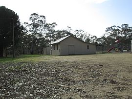
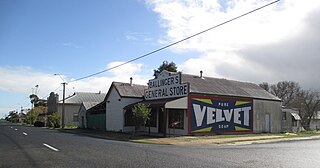
Willalooka is a small service town and locality in the Limestone Coast region of South Australia. it is located on the Riddoch Highway between Keith and Padthaway. Christmas Rocks Conservation Park is north of the town adjacent to the highway.

Bangham Conservation Park Protected area in South Australia

Bangham Conservation Park is a protected area in the Australian state of South Australia located in the state's Limestone Coast in the gazetted locality of Bangham about 45 kilometres (28 mi) north-east of the town centre in Naracoorte.

Custon, South Australia Town in South Australia

Custon is a locality in the Australian state of South Australia located in the state's south-east within the Limestone Coast region about 267 kilometres south east of the state capital of Adelaide, about 19.5 kilometres south-east of the municipal seat of Bordertown and adjoining the border with the State of Victoria.

Sherwood, South Australia Suburb of Tatiara District Council, South Australia

Sherwood is a locality in the Australian state of South Australia located about 222 kilometres (138 mi) south-east of the state capital of Adelaide and about 30 kilometres (19 mi) north-west of the municipal seat of Bordertown.

Joanna, South Australia Town in South Australia

Joanna is a locality in the Australian state of South Australia located in the state's south-east within the state’s Limestone Coast region about 325 kilometres south east of the state capital of Adelaide, about 19.5 kilometres south-east of the municipal seat of Naracoorte.

Petherick, South Australia Suburb of Tatiara District Council , South Australia

Petherick is a locality in the Australian state of South Australia located in the state’s south-east about 211 kilometres (131 mi) south-east of the state capital of Adelaide and about 55 kilometres (34 mi) west of the municipal seat in Bordertown.

Makin, South Australia Suburb of Tatiara District Council, South Australia

Makin is a locality in the Australian state of South Australia located on the state’s south-east about 208 kilometres (129 mi) south-east of the state capital of Adelaide and about 50 kilometres (31 mi) north-west of the municipal seat of Bordertown.

Laffer, South Australia Suburb of Tatiara District Council , South Australia

Laffer is a locality in the Australian state of South Australia located in the state’s south-east about 199 kilometres (124 mi) south-east of the state capital of Adelaide and about 57 kilometres (35 mi) west of the municipal seat in Bordertown.

Western Flat, South Australia Suburb of Tatiara District Council , South Australia

Western Flat is a locality in the Australian state of South Australia located in the state's south-east within the Limestone Coast region about 264 kilometres (164 mi) south east of the state capital of Adelaide and about 22 kilometres (14 mi) south of the municipal seat of Bordertown.

Cannawigara, South Australia Town in South Australia

Cannawigara is a locality in the Limestone Coast region of South Australia. It is crossed by the Dukes Highway and Adelaide-Melbourne railway line northwest of Bordertown. The southern end of the Ngarkat Highway is the Dukes Highway adjacent to the Cannawigara railway station. While the Dukes Highway runs northwest from Bordertown, Cannawigara Road runs due west.

Clay Wells, South Australia Suburb of District Council of Robe, South Australia

Clay Wells is a locality in the Australian state of South Australia located in the state's south-east within the Limestone Coast region about 300 kilometres (190 mi) south east of the state capital of Adelaide, and about 39 kilometres (24 mi) south-east and about 35 kilometres (22 mi) north-west respectively of the municipal seats of Robe and Millicent.

Bordertown South, South Australia Suburb of Tatiara District Council, South Australia

Bordertown South is a locality in the Australian state of South Australia located in the state's south-east within the Limestone Coast region about 255 kilometres (158 mi) east of the state capital of Adelaide and about 14 kilometres (8.7 mi) south of the municipal seat of Bordertown.

References

  1. 1 2 3 4 5 6 7 8 9 10 "Search results for "Finniss, LOCB" with the following datasets selected - 'Suburbs and Localities', 'Counties', 'Local Government Areas', 'SA Government Regions', 'Gazetter', 'Land Development Plan Zone Categories' and 'Roads'". Location SA Map Viewer. Government of South Australia. Retrieved 9 December 2018.
  2. 1 2 Australian Bureau of Statistics (27 June 2017). "Bangham". 2016 Census QuickStats. Retrieved 29 December 2017. OOjs UI icon edit-ltr-progressive.svg
  3. Lawson, Robert (16 March 2000). "GEOGRAPHICAL NAMES ACT 1991 Notice to Assign Names and Boundaries to Places (in the District Council of Tatiara)" (PDF). The South Australian Government Gazette. South Australian Government. p. 1434. Retrieved 24 April 2018.
  4. 1 2 "Postcode for Bangham, South Australia". postcodes-australia.com. Retrieved 24 February 2017.
  5. "Search result for "Bangham Railway Station" with the following datasets selected - "Suburbs and Localities", "Gazetteer" and "Roads"". Location SA Map Viewer. Government of South Australia. Retrieved 9 December 2018.
  6. 1 2 "Limestone Coast SA Government region" (PDF). The Government of South Australia. Retrieved 10 October 2014.
  7. 1 2 "District of MacKillop Background Profile". Electoral Commission SA. Retrieved 29 March 2016.
  8. 1 2 "Federal electoral division of Barker" (PDF). Australian Electoral Commission. Retrieved 28 March 2016.
  9. 1 2 3 "Monthly climate statistics: Summary statistics Padthaway South (nearest weather station)". Commonwealth of Australia , Bureau of Meteorology. Retrieved 24 February 2017.
  10. "Search result for "Serviceton (Locality Bounded)" (Vicmap ID 205407455)". Vicnames - The Register of Geographic Names. Government of Victoria. Retrieved 24 February 2017.
  11. "Search result for "Neuarpurr (Locality Bounded)" (Vicmap ID n205407526)". Vicnames - The Register of Geographic Names. Government of Victoria. Retrieved 24 February 2017.
  12. "GEOGRAPHICAL NAMES ACT 1991, Notice to Assign Names and Boundaries to Places" (PDF). The South Australian Government Gazette. Government of South Australia: 1434. 16 March 2000. Retrieved 24 February 2017.
  13. "Place Names of South Australia - B". The Manning Index of South Australian History. State Library of South Australia. Retrieved 24 February 2017.
  14. "DPTI maintained roads, South Australia" (PDF). Government of South Australia. Retrieved 26 February 2017.
  15. "UPPER SOUTH - EAST LINE, Wolseley to Hynam". Johnny's Pages, Old S.A.R. Shunter's Memories. Government of South Australia. Archived from the original on 12 April 2017. Retrieved 25 November 2018.
  16. "Development Plan, Tatiara Council, Consolidated - 24 October 2013" (PDF). Government of South Australia. pp. 120–121, 134–135 and 205, 206. Retrieved 25 February 2017.