Coorong is a locality in the Australian state of South Australia which is associated with the lagoon known as the Coorong in the south-east of the state and which overlooks the continental coastline from the mouth of the Murray River about 80 kilometres south-east of the state capital of Adelaide to the immediate north of the town of Kingston SE extending for a distance of at least 140 kilometres (87 mi).
Danggali is a locality in the Australian state of South Australia located about 70 kilometres north of the town of Renmark and about 230 kilometres north east of the state capital of Adelaide.
Taylorville Station is a locality in the Australian state of South Australia located about 250 kilometres north-east of the Adelaide and about 35 kilometres to the north-west of the municipal seat of Renmark.

Katarapko is a locality in the Australian state of South Australia located in the Riverland about 188 kilometres north-east of the state capital of Adelaide and about 6.6 kilometres (4.1 mi) north of Loxton.

Bool Lagoon is a locality in the Australian state of South Australia located in the south-east of the state in the Limestone Coast region about 311 kilometres south east of the state capital of Adelaide.
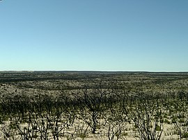
Billiatt is a locality in the Australian state of South Australia located in the south-east of the state in the Murray Mallee region about 168 kilometres north-east of the state capital of Adelaide.

Goolwa South is a locality in the Australian state of South Australia located about 67 kilometres south of the state capital of Adelaide on both on the southern continental coastline and the south-western coast of Lake Alexandrina. It occupies the full extent of the Sir Richard Peninsula, land to the immediate west and part of the Goolwa Channel in the lake system to its north.
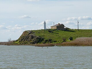
Poltalloch is a locality in the Australian state of South Australia located on land between the water bodies of Lake Alexandrina and Lake Albert about 87 kilometres south-east of the state capital of Adelaide.
Bangham is a locality in the Australian state of South Australia located in the state's south-east within the Limestone Coast region about 279 kilometres south east of the state capital of Adelaide, about 31.5 kilometres south-east of the municipal seat of Bordertown and adjoining the border with the State of Victoria.
Sherwood is a locality in the Australian state of South Australia located about 222 kilometres (138 mi) south-east of the state capital of Adelaide and about 30 kilometres (19 mi) north-west of the municipal seat of Bordertown.
Field is a locality in the Australian state of South Australia located in the state’s south-east about 139 kilometres (86 mi) south-east of the state capital of Adelaide and about 61 kilometres (38 mi) south-east of the municipal seat in Tailem Bend.
Petherick is a locality in the Australian state of South Australia located in the state’s south-east about 211 kilometres (131 mi) south-east of the state capital of Adelaide and about 55 kilometres (34 mi) west of the municipal seat in Bordertown.
Makin is a locality in the Australian state of South Australia located on the state’s south-east about 208 kilometres (129 mi) south-east of the state capital of Adelaide and about 50 kilometres (31 mi) north-west of the municipal seat of Bordertown.
Deepwater is a locality in the Australian state of South Australia located in the state’s south-east about 190 kilometres (120 mi) south-east of the state capital of Adelaide and about 104 kilometres (65 mi) south-east of the municipal seat in Tailem Bend.
Laffer is a locality in the Australian state of South Australia located in the state’s south-east about 199 kilometres (124 mi) south-east of the state capital of Adelaide and about 57 kilometres (35 mi) west of the municipal seat in Bordertown.
Colebatch is a locality in the Australian state of South Australia located in the state’s south-east about 162 kilometres (101 mi) south-east of the state capital of Adelaide and about 81 kilometres (50 mi) south-east of the municipal seat in Tailem Bend.
Meningie West is a locality in the Australian state of South Australia located in the state’s south-east about 99 kilometres (62 mi) south-east of the state capital of Adelaide and about 50 kilometres (31 mi) south-west of the municipal seat in Tailem Bend.
Pooginook is a locality in the Australian state of South Australia located in the state’s east about 167 kilometres (104 mi) north-east of the state capital of Adelaide and about 60 kilometres (37 mi) north-west of the municipal seat in Loxton.
Carcuma is a locality in the Australian state of South Australia located about 150 kilometres (93 mi) south-east of the state capital of Adelaide and about 67 kilometres (42 mi) south-east of the municipal seat in Tailem Bend.
Coombe is a locality in the Australian state of South Australia located about 186 kilometres (116 mi) south-east of the state capital of Adelaide and about 105 kilometres (65 mi) south-east of the municipal seat in Tailem Bend.