Peake, South Australia

Last updated • 2 min readFrom Wikipedia, The Free Encyclopedia

Peake
South Australia
Pollys Well.jpg
Polly's Well, at Peake
Australia South Australia location map.svg
Red pog.svg
Peake
Coordinates 35°21′S139°57′E / 35.350°S 139.950°E / -35.350; 139.950 [1]
Population117 (2016 census) [2]
Established8 August 1907 (town)
24 August 2000 (locality) [3] [4]
Postcode(s) 5301
Elevation24 m (79 ft) [5]
Time zone ACST (UTC+9:30)
 • Summer (DST) ACDT (UTC+10:30)
LGA(s) Coorong District Council [1]
Region Murray and Mallee [1]
County Buccleuch [1]
State electorate(s) Hammond [6]
Federal division(s) Barker [7]
Mean max temp [8] Mean min temp [8] Annual rainfall [8]
23.6 °C
74 °F
9.2 °C
49 °F
341.5 mm
13.4 in
Localities around Peake:
Sherlock Sherlock
Karoonda
Karoonda
Sherlock Peake Jabuk
Yumali
Yumali
Yumali
Netherton
Jabuk
FootnotesAdjoining localities [1]

Peake is a town and locality in the Australian state of South Australia situated along the Mallee Highway (B12), approximately 150 kilometres (93 mi) east of the state capital of Adelaide. [1]

Contents

At the 2016 census, Peake had a population of 117. [2]

History

The town of Peake was proclaimed on 8 August 1907. [3] It was surveyed during May 1907 and its name is derived from the cadastral unit of the Hundred of Peake which itself is derived from Archibald Henry Peake, a South Australian politician who served three terms as the Premier of South Australia. [1] [9]

Along the Pinnaroo railway line, one of the major railway lines of the time, many settlers and travelers passed along the route. [10]

The town of Peake was the seat for the District Council of Peake which was established on 16 November 1911. [11] [12] In 1997, the district council was amalgamated with the District Council of Coonalpyn Downs and the District Council of Meningie to form the Coorong District Council. [13]

Boundaries for the locality of Peake were created on 24 August 2000. [4]

Peake Historical Walk

The Baptist Church, and former bakery, at Peake Baptist Church at Peake.jpg
The Baptist Church, and former bakery, at Peake

A walk established for visitors to show the historic landmarks of Peake. The relatively short walk takes highlights all of the first facilities built when the town was settled in the 1900s.

The first historical landmark is Polly's Well which is located next to the rest stop. Polly's Well was sunk in 1877 and supplied the whole town with water. The next stop on the walk is the old Station Masters house which was built in 1912. The last station master died in the house and was found weeks later. Next there is the Peake store (built 1937) which is now used as the Tavern. The other historic facilities that are still being used to this day are the Post Office (1912) and the Bakehouse/Church (1908). The final landmarks include Peake School (1929), Butcher Shop (1900s), Saddlery (1912) and the town Garage which was used from 1956 to 1974.

Pamphlets are available at the rest stop opposite the town oval.

Events

A Christian youth music festival, Silos 07, organised by former residents of Peake and the local Baptist church, was held in early March 2007 at the local football ground. Following the success of this event, Silos 08 was held on 11 October 2008, featuring Matt Corby and Fatis Valor as the headline artists. The town population grows by 10 fold during the festival.

Related Research Articles

Parilla is a town and a locality in the Australian state of South Australia located in the state's Murray Mallee region about 192 kilometres (119 mi) east of the state capital of Adelaide, about 32 kilometres (20 mi) west of the municipal seat of Pinnaroo and about 14 kilometres (8.7 mi) east of the town of Lameroo.

<span class="mw-page-title-main">Jabuk, South Australia</span> Town in South Australia

Jabuk is a locality in the Australian state of South Australia located about 142 kilometres (88 mi) south-east of the state capital of Adelaide and respectively about 78 kilometres (48 mi) west and 58 kilometres (36 mi) east of the municipal seats of Pinnaroo and Tailem Bend.

<span class="mw-page-title-main">Coonalpyn, South Australia</span> Town in South Australia

Coonalpyn is a town and a locality in the Australian state of South Australia located about 143 kilometres (89 mi) south-east of the state capital of Adelaide and about 61 kilometres (38 mi) south-east of the municipal seat in Tailem Bend. It is situated in the local government area of the Coorong District Council and is in the State electoratal district of MacKillop and the Federal division of Barker.

<span class="mw-page-title-main">Meningie, South Australia</span> Town in South Australia

Meningie is a town on the south-east side of Lake Albert in South Australia. It is on the Princes Highway near The Coorong and was surveyed in 1866. At the 2016 census, the locality of Meningie had a population of 1118 with a median age of 51 while its town centre had a population of 852.

<span class="mw-page-title-main">Coorong, South Australia</span> Suburb of Coorong, Kingston, (north to south), South Australia

Coorong is a locality in the Australian state of South Australia which is associated with the lagoon known as the Coorong in the south-east of the state and which overlooks the continental coastline from the mouth of the Murray River about 80 kilometres south-east of the state capital of Adelaide to the immediate north of the town of Kingston SE extending for a distance of at least 140 kilometres (87 mi).

<span class="mw-page-title-main">Coorong District Council</span> Local government area in South Australia

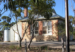
Coorong District Council is a local government area in South Australia located between the River Murray and the Limestone Coast region. The district covers mostly rural areas with small townships, as well as part of the Coorong National Park.

Narrung is a town and locality in the Australian state of South Australia. It is situated at the northern extent of the Narrung Peninsula, which separates The Coorong from Lake Albert adjacent to The Narrows which separates Lake Albert from the larger Lake Alexandrina. The area of Narrung includes the Aboriginal (Ngarrindjeri) community of Raukkan.

<span class="mw-page-title-main">Murraylands</span> Geographic region in the eastern part of South Australia

The Murraylands is a geographical region of the Australian state of South Australia (SA); its name reflects that of the river running through it. Lying due east of South Australia's capital city, Adelaide, it extends from the eastern slopes of the Mount Lofty Ranges to the border with the state of Victoria, a distance of about 180 kilometres. The north-to-south distance is about 130 kilometres. The region's economy is centred on agriculture, and tourism, especially along its 200-kilometre (120-mile) frontage of the River Murray.

<span class="mw-page-title-main">Salt Creek, South Australia</span> Town in South Australia

Salt Creek is a small settlement in South Australia, located along the Coorong, and is also the location of the Coorong National Park Information Centre.

<span class="mw-page-title-main">Ngarkat, South Australia</span> Unpopulated region of South Australia

Ngarkat is a locality in the Australian state of South Australia located in the south-east of the state at the border with the state of Victoria in both the Murray Mallee and the Limestone Coast regions about 227 kilometres south east of the state capital of Adelaide.

Sherlock is a town and locality in the Australian state of South Australia. It is on the Pinnaroo railway line and Mallee Highway.

<span class="mw-page-title-main">Hundred of Roby</span> Cadastral in South Australia

The Hundred of Roby is a hundred within the County of Buccleuch in the Mallee region of South Australia.

Field is a locality in the Australian state of South Australia located in the state’s south-east about 139 kilometres (86 mi) south-east of the state capital of Adelaide and about 61 kilometres (38 mi) south-east of the municipal seat in Tailem Bend.

Meningie West is a locality in the Australian state of South Australia located in the state’s south-east about 99 kilometres (62 mi) south-east of the state capital of Adelaide and about 50 kilometres (31 mi) south-west of the municipal seat in Tailem Bend.

<span class="mw-page-title-main">District Council of Coonalpyn Downs</span> Local government area in South Australia

The District Council of Coonalpyn Downs was a local government area in the Australian state of South Australia that existed from 1957 to 1997 on land in the state’s south-east.

The District Council of Peake was a local government area in the Australian state of South Australia that existed from 1911 to 1997 on land in the state’s south-east.

Netherton is a locality in the Australian state of South Australia located about 137 kilometres (85 mi) south-east of the state capital of Adelaide and about 50 kilometres (31 mi) south-east of the municipal seat in Tailem Bend.

Coombe is a locality in the Australian state of South Australia located about 186 kilometres (116 mi) south-east of the state capital of Adelaide and about 105 kilometres (65 mi) south-east of the municipal seat in Tailem Bend.

Meningie East is a locality in the Australian state of South Australia located about 120 kilometres (75 mi) south-east of the state capital of Adelaide and about 43 kilometres (27 mi) south-east of the municipal seat in Tailem Bend.

The District Council of Meningie was a local government area in the colony and then the Australian state of South Australia that existed from 1888 to 1997 on land in the state’s south-east.

References

  1. 1 2 3 4 5 6 7 "Search results for 'Peake, LOCB' with the following datasets selected – 'Suburbs and localities', 'Counties', 'Government Towns', 'Hundreds', 'Local Government Areas', 'SA Government Regions' and 'Gazetteer'". Location SA Map Viewer. South Australian Government. Retrieved 6 April 2019.
  2. 1 2 Australian Bureau of Statistics (27 June 2017). "Peake (State Suburb)". 2016 Census QuickStats. Retrieved 6 April 2019. OOjs UI icon edit-ltr-progressive.svg
  3. 1 2 Kirkpatrick, A.A. (8 August 1907). "Town of Peake" (PDF). The South Australian Government Gazette. Government of South Australia. p. 299. Retrieved 6 April 2019.
  4. 1 2 "GEOGRAPHICAL NAMES ACT 1991, Notice to Assign Boundaries and Names to Places {within the Coorong District Council)" (PDF), The South Australian Government Gazette: 596, 24 August 2000, retrieved 6 April 2019
  5. "Search results for 'Peake Railway Station' with the following datasets selected – 'Suburbs and localities', 'Government Towns' and 'Gazetteer'". Location SA Map Viewer. South Australian Government. Retrieved 6 April 2019.
  6. "District of Hammond profile". Electoral Commission SA. Retrieved 6 April 2019.
  7. "Federal electoral division of Barker, boundary gazetted 16 December 2011" (PDF). Australian Electoral Commission. Retrieved 6 April 2019.
  8. 1 2 3 "Summary (climate) statistics KAROONDA (nearest weather station)". Commonwealth of Australia, Bureau of Meteorology . Retrieved 6 April 2019.
  9. Manning, Geoffrey. "South Australian Names – P" (PDF). Manning Index of South Australian History. State Library of South Australia. Retrieved 6 April 2019.
  10. "Mallee Bound". South Australia Central. 3 October 2004. Archived from the original on 2 March 2007. Retrieved 4 March 2007.
  11. Wallis, F.S. (16 November 1911). "Constitution of District of Peake" (PDF). The South Australian Government Gazette. Government of South Australia. p. 1004. Retrieved 6 April 2019.
  12. "A NEW DISTRICT COUNCIL". The Mount Barker Courier and Onkaparinga and Gumeracha Advertiser . Vol. 29, no. 1498. South Australia. 2 July 1909. p. 2. Retrieved 6 April 2019 via National Library of Australia.
  13. Kerin, R.G. (13 February 1997). "LOCAL GOVERNMENT ACT 1934 SECTIONS 7 AND 14: AMALGAMATION OF THE DISTRICT COUNCIL OF COONALPYN DOWNS, THE DISTRICT COUNCIL OF MENINGIE AND THE DISTRICT COUNCIL OF PEAKE" (PDF). The Government Gazette of South Australia. Government of South Australia. pp. 900–903. Retrieved 22 November 2016.