This article needs additional citations for verification .(February 2018) |
| Ki Ki South Australia | |||||||||||||||
|---|---|---|---|---|---|---|---|---|---|---|---|---|---|---|---|
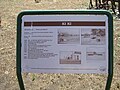
 Sign at the former railway station | |||||||||||||||
 Ki Ki | |||||||||||||||
| Coordinates | 35°34′05″S139°47′34″E / 35.568087°S 139.792683°E [1] | ||||||||||||||
| Population | 47 (SAL 2021) [2] | ||||||||||||||
| Established | 12 June 1913 (town) 24 August 2000 (locality) [3] [4] | ||||||||||||||
| Postcode(s) | 5261 [5] | ||||||||||||||
| Elevation | 28 m (92 ft) [6] | ||||||||||||||
| Location |
| ||||||||||||||
| LGA(s) | Coorong District Council [1] | ||||||||||||||
| Region | Murray and Mallee [1] | ||||||||||||||
| County | Buccleuch [1] | ||||||||||||||
| State electorate(s) | MacKillop | ||||||||||||||
| Federal division(s) | Barker | ||||||||||||||
| |||||||||||||||
| Footnotes | Locations [5] Adjoining localities [1] | ||||||||||||||
Ki Ki is a small town in South Australia. It is on the Dukes Highway (A8) adjacent to the Adelaide-Melbourne railway, the main links between Adelaide and Melbourne. The town is the primary settlement for the Hundred of Livingston.
Contents
The town was proclaimed on 12 June 1913. [3] It got its name from the Kik Ki Well, which in turn was derived from the Aboriginal name for the worms dug out of the nearby soakage. [7] It has a small post office, parking bay, town hall, engineering business "Ki Ki Engineering", and is surrounded by large pastoral properties. At the 2006 census, Ki Ki had a population of 193. [8] Its postcode is 5261.
Ki Ki had a Congregational Church, which was built in 1910 and closed in 1969.
Ki Ki has an active tennis club, which belongs to the Border-Downs Tennis Association.
Australian rules footballer Martin Mattner grew up in the town.