Mallee Highway

Last updated

Mallee Highway

Victoria
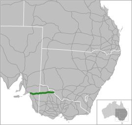
Location Mallee Hwy.svg
General information
TypeHighway
Length374 km (232 mi) [1]
Opened1947 (as Ouyen Highway)
1990 (as Mallee Highway)
Route number(s) AUS Alphanumeric Route B12.svg B12 (1997/1998–present)
Former
route number
Australian national route 12.svg National Route 12 (1955–1997/1998)
Major junctions
West endAUS Alphanumeric Route A8.svg Dukes Highway
Tailem Bend, South Australia
 
East endTooleybuc Road
VIC/NSW border
Location(s)
Region Murray and Mallee, [2] Loddon Mallee [3]
Major settlements Lameroo, Pinnaroo, Murrayville, Walpeup, Ouyen, Manangatang
Highway system

Mallee Highway [4] (formerly Ouyen Highway in Victoria) is a highway in south-eastern South Australia and north-western Victoria, running mostly across the Mallee plains. It forms part of the shortest route between Adelaide and Sydney.

Contents

Route

Mallee Highway begins at the intersection with Dukes Highway just south-east of Tailem Bend in South Australia. It runs east as a dual-lane, single-carriageway road, through cereal-growing farmland at the southern end of the Murray Mallee to Pinnaroo near the border with Victoria. There, it crosses the Ngarkat and Browns Well Highways.

It continues east into Victoria through Ouyen, where it crosses the Calder Highway, travels to Manangatang and eventually to Piangil, where it meets with the Murray Valley Highway. It continues along Tooleybuc Road two kilometres to the north where it continues east, until it meets the New South Wales border and the Murray River at Tooleybuc, where the highway officially ends. The road continues through New South Wales, eventually meeting the Sturt Highway at Balranald.

History

The passing of the Highways and Vehicles Act of 1924 [5] through the Parliament of Victoria provided for the declaration of State Highways, roads two-thirds financed by the State government through the Country Roads Board, now VicRoads. The Ouyen Highway was declared a State Highway within Victoria in the 1947/48 financial year, [6] from the Calder Highway at Ouyen via Murrayville to the South Australian border (for a total of 81 miles); before this declaration, the roads were referred to as Ouyen-Pinnaroo Road. [7]

With the passing of the Transport Act of 1983 , [8] itself an evolution from the original Highways and Vehicles Act of 1924, the name was later changed to the Mallee Highway and extended east along the former Ouyen-Piangil Road and Tooleybuc Road to Piangil in December 1990. [9]

The highway was signed as National Route 12 between Tailem Bend and Ouyen in 1955, later extended with the road to Piangil in 1990. With both states' conversion to their newer alphanumeric systems in the late 1990s, its former route number was updated to B12 in 1997 within Victoria, and in 1998 in South Australia.

The passing of the Road Management Act 2004 [10] granted the responsibility of overall management and development of Victoria's major arterial roads to VicRoads: in 2004, VicRoads re-declared the road as Mallee Highway (Arterial #6650), beginning at the South Australian border at Panitya and ending at the New South Wales border in Piangil. [11]

Major intersections and towns

StateLGA [12] Location [1] [11] [13] km [1] miDestinationsNotes
South Australia The Coorong Tailem Bend 0.00.0AUS Alphanumeric Route A8.svg Dukes Highway (A8)  Adelaide, Keith, Bordertown, Melbourne Western terminus of highway and route B12
Moorlands 14.59.0Old Dukes Highway  Coomandook
Sherlock 29.718.5Kulkawurra Road (north)  Karoonda
Tynan Road (south)  Yumali
Southern Mallee Lameroo 98.561.2Billiat Road  Alawoona Roundabout
Pinnaroo 132.782.5AUS Alphanumeric Route B57.svg Ngarkat Highway (B57 south)  Bordertown, Naracoorte Concurrency with route B57
139.386.6AUS Alphanumeric Route B57.svg Browns Well Highway (B57 north)  Loxton, Renmark
State border145.090.1South Australia – Victoria state border
Victoria Mildura Panitya 148.492.2Panitya Road  Panitya
Murrayville 166.4103.4Murrayville-Nhill Road  Nhill
Boinka 205.9127.9Boinka South Road  Tutye
Underbool 226.3140.6Underbool-Patchewollock Road  Patchewollock
Walpeup 246.1152.9AUS Alphanumeric Route C247.svg Walpeup-Patchewollock Road (C247)  Patchewollock, Hopetoun
Ouyen 273.0169.6Ouyen-Patchewollock Road  Patchewollock, Hopetoun
275.3171.1AUS Alphanumeric Route A79.svg Calder Highway (A79 south)  Ballarat, Bendigo, Melbourne Concurrency with route A79
275.5171.2AUS Alphanumeric Route A79.svg Calder Highway (A79 north)  Red Cliffs, Mildura
Swan Hill Manangatang 330.0205.1AUS Alphanumeric Route C251.svg Robinvale–Sea Lake Road (C251)  Robinvale, Sea Lake
Piangil 371.1230.6AUS Alphanumeric Route B400.svg Murray Valley Highway (B400 south)  Swan Hill, Melbourne Concurrency with route B12
373.0231.8AUS Alphanumeric Route B400.svg Murray Valley Highway (B400 north)  Robinvale
374.4232.6Tooleybuc Road  Tooleybuc, Balranald Eastern terminus of highway and route B12; road continues as Yanga Way to Balranald
State borderVictoria – New South Wales state border
New South Wales Murray River Tooleybuc Bridge
1.000 mi = 1.609 km; 1.000 km = 0.621 mi

See also

Related Research Articles

<span class="mw-page-title-main">Princes Highway</span> Highway in Australia

Princes Highway is a major road in Australia, extending from Sydney via Melbourne to Adelaide through the states of New South Wales, Victoria and South Australia. It has a length of 1,941 kilometres (1,206 mi) or 1,898 kilometres (1,179 mi) via the former alignments of the highway, although these routes are slower and connections to the bypassed sections of the original route are poor in many cases.

<span class="mw-page-title-main">Sturt Highway</span> Australian national highway

Sturt Highway is an Australian national highway in New South Wales, Victoria, and South Australia. It is an important road link for the transport of passengers and freight between Sydney and Adelaide and the regions along the route.

<span class="mw-page-title-main">Calder Highway</span> Highway in Victoria

Calder Highway is a rural highway in Australia, linking Mildura and the Victoria/New South Wales border to Bendigo, in North Central Victoria. South of Bendigo, where the former highway has been upgraded to freeway-standard, Calder Freeway links to Melbourne, subsuming former alignments of Calder Highway; the Victorian Government completed the conversion to freeway standard from Melbourne to Bendigo on 20 April 2009.

Dukes Highway is a 190 kilometre highway corridor in South Australia, which is part of the link between the Australian cities of Adelaide and Melbourne. It is part of the National Highway system spanning Australia, and is signed as route A8.

<span class="mw-page-title-main">Northern Highway (Victoria)</span>

The Northern Highway is a secondary highway in northern Victoria. Along with the M/A79 Calder Highway and the M/A39 Goulburn Valley Highway, it provides primary arterial links in the region. In conjunction with the B280 McIvor Highway, the B75 Northern Highway provides an important link between Melbourne and Bendigo.

<span class="mw-page-title-main">Sunraysia Highway</span> Highway in Victoria

The Sunraysia Highway is a 344 kilometres (214 mi) arterial north-south route in western Victoria. The highway extends north a length of 331 km starting from the Western Freeway near Ballarat to the Calder Highway near Ouyen. It is the north-west arterial road, linking Ballarat and Ouyen, and acts as a secondary route to the Calder Highway, the primary route between Melbourne and Mildura.

<span class="mw-page-title-main">Goulburn Valley Highway</span>

Goulburn Valley Highway is a highway located in Victoria, Australia. The section north of the Hume Freeway is part of the Melbourne to Brisbane National Highway and is the main link between these two cities as well as a major link between Victoria and inland New South Wales. It is also the most direct route between Melbourne and the major regional centre of Shepparton in Victoria.
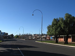
<span class="mw-page-title-main">Murray Valley Highway</span> Highway in Victoria and New South Wales

Murray Valley Highway is a 663-kilometre (412 mi) state highway located in Victoria and New South Wales, Australia. The popular tourist route mostly follows the southern bank of the Murray River and effectively acts as the northernmost highway in Victoria. For all but the western end's last three kilometres, the highway is allocated route B400.

The Murray Mallee is the grain-growing and sheep-farming area of South Australia. It is bounded to the north and west by the Murray River, called the "River Murray" in South Australia, to the east by the Victorian border, and extending about 50 km south of the Mallee Highway.
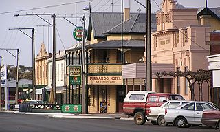
<span class="mw-page-title-main">Pinnaroo, South Australia</span> Town in South Australia

Pinnaroo is a town in the Murray Mallee region of South Australia, near the border with Victoria, 243 km east of Adelaide. Pinnaroo is on the north side of the Mallee Highway, and on the railway line between Tailem Bend and Ouyen. The roadhouse on the highway at Pinnaroo is the first "food and leg-stretch" stop on the bus route from Adelaide to Sydney. At the 2016 census, the locality of Pinnaroo had a population of 712 of which 547 lived in and around its town centre.

<span class="mw-page-title-main">Ouyen</span> Town in Victoria, Australia

Ouyen is a town in Victoria, Australia, located in the Rural City of Mildura at the junction of the Calder Highway and Mallee Highway, 105 kilometres (65 mi) south of Mildura, and 441 km (274 mi) northwest of Melbourne. At the 2016 census, the town had a population of 1,045.

Glenelg Highway is a rural highway in south-eastern Australia, linking Mount Gambier with Ballarat. Most of the highway is located within the Western part of the state of Victoria, though a short, 15 km stretch from the South Australia/Victoria state border near Ardno to Glenburnie is located in South Australia. Some maps identify the South Australian stretch as Casterton Road. Major towns along its route include Casterton, Coleraine and Hamilton.

<span class="mw-page-title-main">Tooleybuc</span> Town in New South Wales, Australia

Tooleybuc is a town in the western Riverina district of New South Wales, Australia. The town is located on the Mallee Highway, 919 kilometres (571 mi) southwest of the state capital, Sydney and 381 kilometres (237 mi) north west of Melbourne. Situated on the banks of the Murray River across from Piangil in the neighbouring state of Victoria, at the 2011 census, Tooleybuc has a population of 277. The town is in the Murray River Council local government area. The Tooleybuc Bridgekeepers Cottage close to the Tooleybuc Bridge is of particular local historic interest. It is open to the public.

<span class="mw-page-title-main">Torrita, Victoria</span> Town in Victoria, Australia

Torrita is a locality situated on the section of the Mallee Highway and Pinnaroo railway line between Ouyen and the South Australian border in the Sunraysia region. The place by road, is situated about 13 kilometres east from Underbool and 8 kilometres west from Walpeup.

<span class="mw-page-title-main">Henty Highway</span> Highway in Victoria

Henty Highway is a rural highway in western Victoria, Australia. It is primarily a north-south route, consisting of a mix of dual-lane, single-carriageway country highway and four-lane arterial road within some of the larger towns along the route. It was named in honour of Edward Henty, a British colonist regarded as the first permanent European settler of the Port Phillip District, in the town eventually named Portland.

<span class="mw-page-title-main">Wimmera Highway</span> Highway in Victoria and South Australia

Wimmera Highway is a 345 kilometre highway that connects the towns of Marong, Victoria and Naracoorte, South Australia, through the major junctions of Sunraysia Highway, Henty Highway and Western Highway.

Bonang Road is a rural road in south-eastern Australia, running generally south–north. It links the Gippsland region coastal town of Orbost, Victoria and the highland Monaro region town of Bombala, New South Wales.
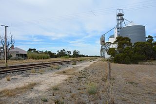
<span class="mw-page-title-main">Pinnaroo railway line, South Australia</span>

The Pinnaroo railway line ran east from the Adelaide to Melbourne line at Tailem Bend to Pinnaroo near the South Australia / Victoria state border. The route continues into Victoria via the Victorian Railways line to Ouyen where it joined the Mildura line.

Browns Well Highway is a road connecting Loxton, South Australia through the Murray Mallee to Pinnaroo in South Australia. It was named in 2008 after the Browns Well district for areas traversed by the highway.

Ngarkat Highway is a road in the southeastern part of South Australia, connecting Pinnaroo and Bordertown. It is designated as part of route B57 which continues north from Pinnaroo along Browns Well Highway to Loxton, and south from Bordertown along Naracoorte Road to Naracoorte.
References

  1. 1 2 3 Google (12 October 2021). "Mallee Highway" (Map). Google Maps . Google. Retrieved 12 October 2021.
  2. "Location SA Map viewer with regional layers". Government of South Australia . Retrieved 16 June 2022.
  3. "Victoria's Regions". Regional Development Victoria. Victoria State Government. 11 August 2021. Retrieved 16 June 2022.
  4. Mallee Highway Touring Route, Design Train. Retrieved on 15 September 2013.
  5. State of Victoria, An Act to make further provision with respect to Highways and Country Roads Motor Cars and Traction Engines and for other purposes 30 December 1924
  6. "Country Roads Board Victoria. Thirty-Fifth Annual Report: for the year ended 30 June 1948". Country Roads Board of Victoria. Melbourne: Victorian Government Library Service. 1 November 1948. p. 7.
  7. "Country Roads Board Victoria. Twenty-Sixth Annual Report: for the year ended 30 June 1939". Country Roads Board of Victoria. Melbourne: Victorian Government Library Service. 10 November 1939. p. 99.
  8. State of Victoria, An Act to Re-enact with Amendments the Law relating to Transport including the Law with respect to Railways, Roads and Tramways... 23 June 1983
  9. "Victorian Government Gazette". State Library of Victoria. 19 December 1990. pp. 3783, 3787, 3793. Retrieved 30 December 2021.
  10. State Government of Victoria. "Road Management Act 2004" (PDF). Government of Victoria. Archived (PDF) from the original on 19 October 2021. Retrieved 19 October 2021.
  11. 1 2 VicRoads. "VicRoads – Register of Public Roads (Part A)" (PDF). Government of Victoria. p. 992. Archived from the original on 1 May 2020. Retrieved 19 October 2021.
  12. "Location SA Map viewer with LGA layers". Government of South Australia . Retrieved 16 June 2022.
  13. "Location SA Map viewer with suburb layers". Government of South Australia . Retrieved 16 June 2022.

Commons-logo.svg Media related to Mallee Highway at Wikimedia Commons