
Princes Highway is a major road in Australia, extending from Sydney via Melbourne to Adelaide through the states of New South Wales, Victoria and South Australia. It has a length of 1,941 kilometres (1,206 mi) or 1,898 kilometres (1,179 mi) via the former alignments of the highway, although these routes are slower and connections to the bypassed sections of the original route are poor in many cases.

Nepean Highway is a major highway in Victoria, running south from St Kilda Junction in inner-southern Melbourne to Portsea, tracing close to the eastern shore of Port Phillip for the majority of its length. It is the primary road route from central Melbourne through Melbourne's southern suburbs. This name covers a few consecutive roads and is not widely known to most drivers except for its central section, as the entire allocation is still best known by the names of its constituent parts: St Kilda Road, Brighton Road and Nepean Highway proper, and Point Nepean Road. This article will deal with the entire length of the corridor for sake of completion.
South Gippsland Highway is a partially divided highway connecting the south-eastern suburbs of Melbourne through the South Gippsland region of in Victoria, Australia to the town of Sale. The highway serves as a gateway from Melbourne to many attractions including Wilsons Promontory and Phillip Island as well as being an important road for farmers in Gippsland.
Hoddle Highway is an urban highway in Melbourne linking CityLink and the Eastern Freeway, itself a sub-section of Hoddle Main Road. Both these names are not widely known to most drivers, as the entire allocation is still best known as by the names of its constituent parts: Hoddle Street, Punt Road and Barkly Street. This article will deal with the entire length of the corridor for sake of completion.
Hamilton Highway is a rural highway through the Barwon South West region of Victoria, Australia, linking Geelong and the town of Hamilton.

Hyland Highway is a rural highway connecting the towns of Traralgon and Yarram in the Gippsland region of Victoria, Australia. It was named after Sir Herbert Hyland, a popular politician for the Country Party in the Gippsland area.

Burke Road is a major north–south thoroughfare in Melbourne, Australia. It runs from Ivanhoe East to Caulfield East and through the major shopping district at Camberwell.

Pyrenees Highway is a rural highway in western Victoria, Australia, linking Glenelg Highway in Glenthompson to Calder Highway in Elphinstone. It intersects with the region's major road freight route, Western Highway in Ararat, in addition to Midland Highway in Castlemaine and Sunraysia Highway in Avoca. It was named after the Pyrenees ranges the highway runs through. This name covers many consecutive roads which are not widely known to most drivers except for the easternmost section, as the entire allocation is best known by the name of its last constituent part: Maroona–Glenthompson Road, Mortlake–Ararat Road and Pyrenees Highway proper. This article will deal with the entire length of the corridor for sake of completion, as well to avoid confusion between declarations.
Burwood Highway is a major transportation link with Melbourne's eastern fringe at the foot of the Dandenong Ranges, linking the suburbs of Hawthorn and Belgrave. The highway is considered a major link for people who live in the Dandenong Ranges and acts as one of the major feeder roadway in the area along with Canterbury Road, Ferntree Gully Road, EastLink and Wellington Road.
Glenelg Highway is a rural highway in south-eastern Australia, linking Mount Gambier with Ballarat. Most of the highway is located within the Western part of the state of Victoria, though a short, 15 km stretch from the South Australia/Victoria state border near Ardno to Glenburnie is located in South Australia. Some maps identify the South Australian stretch as Casterton Road. Major towns along its route include Casterton, Coleraine and Hamilton.
Western Port Highway is a highway in Victoria, Australia, linking the south-eastern fringe of suburban Melbourne to the port of Hastings nearly 30km to the south on the western coast of Western Port, after which the highway is named.
Warrigal Road is a major inner urban road in southeastern Melbourne, Australia. On weekdays, it is heavily trafficked as it runs through many major suburbs along its route, traversing some of Melbourne's eastern and south-eastern suburbs. These suburbs include Chadstone, Oakleigh, and Cheltenham. The Chadstone Shopping Centre can be accessed directly from Warrigal Road at its eastern entrance.
Strzelecki Highway is a short 55 kilometre highway that connects the towns of Leongatha and Morwell in the western Gippsland region of Victoria. It was named after the Strzelecki Ranges, the set of low mountain ridges the road travels through.

Henty Highway is a rural highway in western Victoria, Australia. It is primarily a north-south route, consisting of a mix of dual-lane, single-carriageway country highway and four-lane arterial road within some of the larger towns along the route. It was named in honour of Edward Henty, a British colonist regarded as the first permanent European settler of the Port Phillip District, in the town eventually named Portland.

Wimmera Highway is a 345 kilometre highway that connects the towns of Marong, Victoria and Naracoorte, South Australia, through the major junctions of Sunraysia Highway, Henty Highway and Western Highway.

State Highway, is a major arterial road in the southeastern suburbs of Melbourne, Australia. These names are not widely known to most drivers, as the entire allocation is still best known as by the names of its constituent parts: Lower Dandenong Road, Cheltenham Road, and Foster Street. This article will deal with the entire length of the corridor for sake of completion.

State (Bell/Springvale) Highway, also known as Bell Street/Springvale Road State Highway, is the longest self-contained urban highway in Melbourne, Australia, linking CityLink and Mornington Peninsula Freeway through Melbourne's north-eastern suburbs. These names are not widely known to most drivers, as the entire allocation is still best known as by the names of its constituent parts : Bell Street, Banksia Street, Manningham Road, Williamsons Road, Doncaster Road, Mitcham Road and Springvale Road. This article will deal with the entire length of the corridor for sake of completeness.
Ballarat Road is a major urban arterial road in the western suburbs of Melbourne, Victoria, Australia.
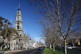
Old Princes Highway is a collection of roads, described as any part of an earlier route designated as Princes Highway, located in Victoria, Australia. Sections of the road run through Geelong, Werribee, and through the outer fringes of south-eastern Melbourne eventually to Morwell East. In the time since their de-listing as Princes Highway, many former sections have since been renamed, or have devolved to their original names.
Bonang Road is a rural road in south-eastern Australia, running generally south–north. It links the Gippsland region coastal town of Orbost, Victoria and the highland Monaro region town of Bombala, New South Wales.
