Related Research Articles

Hume Highway, inclusive of the sections now known as Hume Freeway and Hume Motorway, is one of Australia's major inter-city national highways, running for 840 kilometres (520 mi) between Melbourne in the southwest and Sydney in the northeast. Upgrading of the route from Sydney's outskirts to Melbourne's outskirts to dual carriageway was completed on 7 August 2013.

Princes Highway is a major road in Australia, extending from Sydney via Melbourne to Adelaide through the states of New South Wales, Victoria and South Australia. It has a length of 1,941 kilometres (1,206 mi) or 1,898 kilometres (1,179 mi) via the former alignments of the highway, although these routes are slower and connections to the bypassed sections of the original route are poor in many cases.
The Bass Highway is an 87 kilometre highway in Victoria, Australia, branching off the South Gippsland Highway at the township of Lang Lang and running south, along the eastern shore of Western Port, to Anderson. The Bass Highway continues easterly to Kilcunda, Wonthaggi and Inverloch, then turns north-easterly to rejoin the South Gippsland Highway at Leongatha. It was named due to its proximity to the Bass Strait.
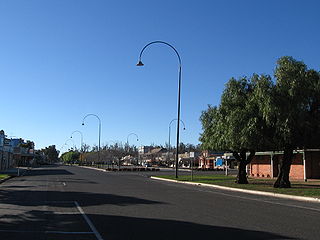
The South Gippsland Highway is a partially divided highway in Victoria, Australia which connects the city of Melbourne with the South Gippsland region of Victoria, ending in the town of Sale. The highway begins at Lonsdale Street, Dandenong. At the Greens Road intersection, it adopts Metropolitan Route 12 until Pound Road, then continues until the South Gippsland Freeway / Western Port Highway interchange where it becomes the M420. The M420 continues through Cranbourne and Koo Wee Rup until the Bass Highway turnoff, at which point the road is then designated A440 onwards to Sale. From the Bass Highway junction, the highway is undivided. The South Gippsland Highway is the gateway from Melbourne to many attractions including Wilsons Promontory and Phillip Island as well as being an important road for farmers in Gippsland.

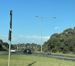
The Monash Freeway is a major urban freeway in Victoria, Australia, linking Melbourne's CBD to its south-eastern suburbs and beyond to the Gippsland region. It carries up to 180,000 vehicles per day and is one of Australia's busiest freeways. The entire stretch of the Monash Freeway bears the designation M1.

Calder Highway is a rural highway in Australia, linking Mildura and the Victoria/New South Wales border to Bendigo, in North Central Victoria. South of Bendigo, where the former highway has been upgraded to freeway-standard, Calder Freeway links to Melbourne, subsuming former alignments of Calder Highway; the Victorian Government completed the conversion to freeway standard from Melbourne to Bendigo on 20 April 2009.

The Mornington Peninsula Freeway is a freeway in Melbourne, Victoria, Australia, that provides a link from south-eastern suburban Melbourne to the Mornington Peninsula. Whilst the entire freeway from Dingley Village to Rosebud is declared by VicRoads as the Mornington Peninsula Freeway, the section between EastLink in Carrum Downs and Moorooduc Highway in Moorooduc is locally and commonly known as Peninsula Link. The entire freeway corridor bears the designation M11.
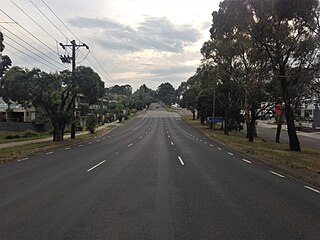
Maroondah Highway is a major east–west thoroughfare in the eastern suburbs of Melbourne, and a highway connecting the north-eastern fringes of Melbourne to the lower alpine region of Victoria, Australia.

The Western Highway is the Victorian part of the principal route linking the Australian cities of Melbourne and Adelaide, with a length of approximately 258 kilometres (160 mi) of single carriageway, then 161 kilometres (100 mi) of dual carriageway known as the Western Freeway. It is a part of the National Highway network and designated routes A8 and M8. The western end continues into South Australia as the Dukes Highway, the next section of the Melbourne–Adelaide National Highway. The Western Freeway joins Melbourne's freeway network via the Western Ring Road, in the western suburbs of Melbourne.

Goulburn Valley Highway is a highway located in Victoria, Australia. The section north of the Hume Freeway is part of the Melbourne to Brisbane National Highway and is the main link between these two cities as well as a major link between Victoria and inland New South Wales. It is also the most direct route between Melbourne and the major regional centre of Shepparton in Victoria.
Murray Valley Highway is a 663-kilometre (412 mi) state highway located in Victoria and New South Wales, Australia. The popular tourist route mostly follows the southern bank of the Murray River and effectively acts as the northernmost highway in Victoria. For all but the western end's last three kilometres, the highway is allocated route B400.

Bellarine Highway is a main arterial highway that runs east from Geelong in Victoria along the Bellarine Peninsula to Queenscliff. The highway also provides the main route to Barwon Heads and Ocean Grove, localities along the southern coast of the peninsula.
Hyland Highway is a road connecting the towns of Traralgon and Yarram in the Gippsland region of Victoria, Australia. The highway was named after Sir Herbert Hyland, a popular politician for the Country Party in the Gippsland area.
VicRoads is a government joint venture in the state of Victoria, Australia. In the state, it is responsible for driver licensing and vehicle registration. It is owned and operated through a joint venture between the Victorian government and a consortium made up of Aware Super, Australian Retirement Trust and Macquarie Asset Management.
Greensborough Highway is a highway in the north-eastern suburbs of Melbourne, Australia, and is an important route for north-east Melbourne. This name is not widely known to most drivers, as the entire allocation is still best known as by the names of its constituent parts: Lower Heidelberg Road, Rosanna Road, Lower Plenty Road, Greensborough Road and Greensborough Bypass. This article will deal with the entire length of the corridor for sake of completion, as well to avoid confusion between declarations.

The Country Roads Board was a government authority responsible for the construction and maintenance of main roads in the state of Victoria, Australia between 1913 and 1983.
Warrigal Road is a major inner urban road in southeastern Melbourne, Australia. On weekdays, it is heavily trafficked as it runs through many major suburbs along its route, traversing some of Melbourne's eastern and south-eastern suburbs. These suburbs include Chadstone, Oakleigh, and Cheltenham. The Chadstone Shopping Centre can be accessed directly from Warrigal Road at its eastern entrance.

State (Bell/Springvale) Highway, also known as Bell Street/Springvale Road State Highway, is the longest self-contained urban highway in Melbourne, Australia, linking Tullamarine Freeway and Nepean Highway through Melbourne's north-eastern suburbs. These names are not widely known to most drivers, as the entire allocation is still best known as by the names of its constituent parts: Bell Street, Banksia Street, Manningham Road, Williamsons Road, Doncaster Road, Mitcham Road, Springvale Road and Edithvale Road. This article will deal with the entire length of the corridor for sake of completion, as well to avoid confusion between declarations.
References
- ↑ Annual Report for year ended 30 June 1984 Road Construction Authority page 5
- ↑ "Transport change makes good sense". The Age. 4 June 1982. p. 13. Retrieved 6 March 2022.
- ↑ Annual Report for year ended 30 June 1989 Road Construction Authority pages 7, 32, 49, 55
- ↑ Annual Report for year ended 30 June 1990 VicRoads page 8
- ↑ Our History VicRoads
- ↑ Roads, Victoria catalogue entry National Library of Australia