
The Onkaparinga River, known as Ngangkiparri or Ngangkiparingga in the Kaurna language, is a river located in the Southern Adelaide region in the Australian state of South Australia. Rising in the Mount Lofty Ranges, the river's estuary extends from Old Noarlunga to the river's mouth between the suburbs of Port Noarlunga and Port Noarlunga South.
Greenhill Road is a major road in Adelaide, South Australia, that provides a connection to the eastern and hills suburbs. Its western section, running along the south side of Adelaide Parklands, forms part of Adelaide's City Ring Route.
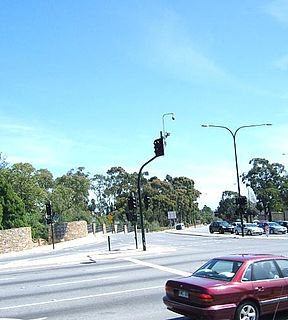
Kensington Road is a main road in the South Australian capital city of Adelaide, linking the Adelaide city centre to its eastern suburbs.
Fullarton Road is a main road in the South Australian capital city of Adelaide.
Cross Road is a major arterial road that travels east–west through the inner southern suburbs of the Australian city of Adelaide. It is designated route A3.
Grand Junction Road is the longest east–west thoroughfare in the Adelaide metropolitan area, traversing through Adelaide's northern suburbs approximately 8 kilometres north of the Adelaide city centre.

Glen Osmond Road is a major section of the Princes Highway in the city of Adelaide, South Australia. Connecting the Adelaide city centre with the Adelaide Hills via the South Eastern Freeway; Glen Osmond Road carries half of Adelaide's freight traffic and is the major commuter route from the southern Adelaide Hills. It is designated part of route A1.
Adelaide–Mannum Road is a road that runs through the northern Adelaide Hills between the South Australian capital, Adelaide and Mannum on the Murray River. It is designated route A10 in the metropolitan area and B10 in rural areas, and is 79 kilometres in length. This name covers many consecutive streets and is not widely known to most drivers, as the entire allocation is still best known as by the names of its constituent parts: Northcote Terrace, North East Road, Torrens Valley Road, Randell Road and Adelaide Road. This article will deal with the entire length of the corridor for sake of completion, as well to avoid confusion between declarations.

Sir Donald Bradman Drive is a major arterial road that travels east–west through the western suburbs of Adelaide, South Australia. It is the main route from the Adelaide city centre to the Adelaide Airport.

Tapleys Hill Road is a north–south arterial road which runs parallel to the coast through western Adelaide, Australia. This name covers many consecutive streets and is not widely known to most drivers except for the northernmost section, as the entire allocation is still best known as by the names of its constituent parts: Tapleys Hill Road proper, Brighton Road, Ocean Boulevard, Lonsdale Road, Dyson Road, Murray Road, and Gawler Street. This article will deal with the entire length of the corridor for sake of completion, as well to avoid confusion between declarations.
Dorset Vale is a rural locality near Adelaide, South Australia. It straddles three local government areas adjacent to the Onkaparinga River, being within the Adelaide Hills, Mount Barker and the Onkaparinga council areas. The precise boundaries were set in April 1994 and extended in November 2003 for the long-established name. The first post office in the area was given the English name Dorset Vale circa 1850, but it was locally known as "Scotts Bottom" as it was downstream from Scott Creek. Scotts Bottom School opened in 1930, its name was changed to Dorset Vale in 1937 and it closed in 1944.
Lower North East Road is an arterial road in the northeastern suburbs of Adelaide, South Australia. It links the north-eastern corner of Adelaide to Houghton in the Adelaide Hills, and is an urban alternative to North East Road.
Whites Valley is a semi-rural suburb of Adelaide, South Australia. It is home to many vineyards.
Wellington Road is a South Australian secondary road, connecting Mount Barker with the towns of Wistow, Highland Valley, Woodchester and Langhorne Creek. Its north-western portion has been designated part of route B37.
Gorge Road is a South Australian secondary road, connecting the Adelaide suburbs of Campbellltown and Athelstone with the towns of Cudlee Creek and Chain of Ponds. It has been designated route B31 for most of its length.

Panalatinga Road is a north-south minor arterial road in the southern suburbs of Adelaide. The Panalatinga Creek runs under the road in the northern section, which gives this road its name. It is derived from the Kaurna name Pandlotinga, with the 'inga' suffix meaning 'path of water' which is often mispronounced as Panatalinga.
Thiele Highway is a road in South Australia connecting the outskirts of Adelaide to the North west bend of the Murray River at Morgan, South Australia. It is named after author Colin Thiele who lived most of his life in towns along the route, and set some of his stories in the area.

Mount Barker Road was once the main road from Adelaide through the Adelaide Hills to Mount Barker on the eastern slopes of the Mount Lofty Ranges. The main route has now been replaced, or subsumed into, the South Eastern Freeway, but two sections of it remain, and are still classified as state roads.
Grange Road is an arterial road in the western suburbs of Adelaide, South Australia. It runs from the coast at Grange to South Road, close to the city centre.

Flagstaff Road is an arterial road in the southern suburbs of Adelaide in South Australia, Australia. It is one of the roads that carries commuter traffic between the city on the coastal plain and residential suburbs in the Adelaide Hills.
