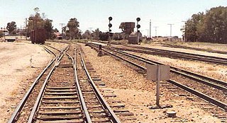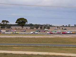
Padthaway is a small town in the Australian state of South Australia located in the state's south-east within the Limestone Coast region about 253 kilometres south east of the state capital of Adelaide and about 41 kilometres south-east of the municipal seat of Bordertown. The name is derived from the Potawurutj, the Aboriginal name word for cover or bury. Padthaway is in the Tatiara District Council, the state electorate of MacKillop and the federal Division of Barker.

Naracoorte is a town in the Limestone Coast region of South Australia, approximately 336 kilometres south-east of Adelaide and 100 kilometres north of Mount Gambier on the Riddoch Highway (A66).

The Limestone Coast is a name used since the early twenty-first century for a South Australian government region located in the south east of South Australia which immediately adjoins the continental coastline and the Victorian border. The name is also used for a tourist region and a wine zone both located in the same part of South Australia.

Riddoch Highway is a rural highway in south-eastern South Australia, designated as route A66 between Keith and Mount Gambier, with the remainder between Mount Gambier and Port MacDonnell designated as route B66. It is named after John Riddoch, the first white settler landholder and vigneron in Coonawarra.
Port MacDonnell, originally known as Ngaranga is the southernmost town in South Australia. The small port located in the Limestone Coast region about 477 kilometres (296 mi) southeast of Adelaide and 28 kilometres (17 mi) south of Mount Gambier in the District Council of Grant local government area. Once a busy shipping port, the town now relies heavily on its fishing and summer tourism industries, particularly rock lobster harvest industry, proclaiming itself "Australia's Southern Rock Lobster Capital".

Coorong is a locality in the Australian state of South Australia which is associated with the lagoon known as the Coorong in the south-east of the state and which overlooks the continental coastline from the mouth of the Murray River about 80 kilometres south-east of the state capital of Adelaide to the immediate north of the town of Kingston SE extending for a distance of at least 140 kilometres (87 mi).

The Kingston District Council is a local government area in the Limestone Coast, South Australia established in 1873. Kingston SE is the largest town of the district and also the seat of council.
Victoria was an electorate in the South Australian House of Assembly from 1857 until 1902 and from 1915 to 1993.

Dudley Peninsula is the peninsula forming the eastern end of Kangaroo Island in the Australian state of South Australia. It was occupied by Aboriginal Australians as recently as 3,100 years BP but was found to be unoccupied by the first European explorers to visit it in the early 19th century. It was first settled by Europeans as early as the 1830s. As of 2011, it had a population of 595 people.
The Hundred of Inkerman is a cadastral unit of hundred located on the northern Adelaide Plains in South Australia and bounded on the north by the Wakefield River. It is one of the eight hundreds of the County of Gawler. It was named in 1856 by Governor Richard MacDonnell after the Crimean War Battle of Inkerman.
The District Councils Act 1887 was an act of the Parliament of South Australia. It received assent on 9 December 1887, and its provisions came into effect when proclaimed by Governor William C. F. Robinson on 5 January 1888.

The County of Robe is one of the 49 cadastral counties of South Australia. It was proclaimed by and named for Governor Frederick Robe in 1846. It covers a portion of the state's south-east from the west coast at Robe to the border with Victoria on the east. This includes the following contemporary local government areas of the state:

County of Young is a cadastral unit located in the Australian state of South Australia covers land located in the state’s east on the north side of the Murray River. It was proclaimed in 1860 by Governor MacDonnell and named after his predecessor, Governor Young. It has been partially divided in the following sub-units of hundreds – Markaranka, Parcoola, Pooginook and Stuart.
Marcollat is a locality in the Australian state of South Australia located in the state’s Limestone Coast region about 236 kilometres (147 mi) south-east of the state capital of Adelaide and about 45 kilometres (28 mi) north of the municipal seat in Kingston SE.

The County of Victoria is one of the 49 cadastral counties of South Australia. It was proclaimed by Governor Richard MacDonnell in 1857 and probably named for Queen Victoria. It covers an area of the Spencer Gulf coast and hinterland in the Mid North of the state from Port Pirie in the northwest to near Mount Bryan in the southeast, including most of the Broughton River watershed.

Lochaber is a locality located within the Naracoorte Lucindale Council in the Limestone Coast region of South Australia.
Keilira is a locality located within the Kingston District Council in the Limestone Coast region of South Australia.

The Hundred of Duffield is a cadastral unit of hundred located in the Australian state of South Australia within the County of MacDonnell and the state government region of the Limestone Coast about 210 kilometres (130 mi) south-east of the state capital of Adelaide and about 29 kilometres (18 mi) north of the municipal seat of Kingston SE.

The Hundred of Grace is a cadastral unit of hundred located on the northern Adelaide Plains of South Australia spanning the township of Mallala and the Grace Plains. The hundred was proclaimed in 1856 in the County of Gawler and named by Governor Richard Graves MacDonnell after Grace Montgomery Farrell, wife of James Farrell, Dean of Adelaide. The hundred spans a significant portion of the lower Light River, which flows from north east to south west through the area.
Jip Jip Conservation Park is a protected area in the Australian state of South Australia located in the state’s south-east in the gazetted locality of Marcollat about 223 kilometres (139 mi) south-east of the state capital of Adelaide and about 50 kilometres (31 mi) north-east of the municipal seat of Kingston SE.


