County of Newcastle

Last updated
Newcastle
South Australia

Kanyaka-Station.JPG

Kanyaka homestead and surrounding scrub in the Hundred of Kanyaka
Australia South Australia location map.svg
Red pog.svg
Newcastle
Coordinates 32°12′S138°05′E / 32.20°S 138.09°E / -32.20; 138.09 Coordinates: 32°12′S138°05′E / 32.20°S 138.09°E / -32.20; 138.09
Established 1876
Area 3,160 km2 (1,221 sq mi)
Lands administrative divisions around Newcastle:
Blachford Hanson
Manchester Newcastle Granville
Manchester Frome Dalhousie

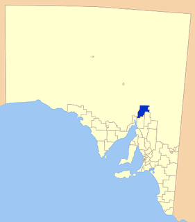
The County of Newcastle is one of the 49 counties of South Australia spanning the central Flinders Ranges. It was named in 1876 for Francis Pelham-Clinton-Hope, the eighth Duke of Newcastle. [1]

Lands administrative divisions of South Australia

The lands administrative divisions of South Australia are the cadastral units of counties and hundreds in South Australia. They are located only in the south-eastern part of the state, and do not cover the whole state. 49 counties have been proclaimed across the southern and southeastern areas of the state historically considered to be arable and thus in need of a cadastre. Within that area, a total of 540 hundreds have been proclaimed, although five were annulled in 1870, and, in some cases, the names reused elsewhere.

South Australia State of Australia

South Australia is a state in the southern central part of Australia. It covers some of the most arid parts of the country. With a total land area of 983,482 square kilometres (379,725 sq mi), it is the fourth-largest of Australia's states and territories by area, and fifth largest by population. It has a total of 1.7 million people, and its population is the second most highly centralised in Australia, after Western Australia, with more than 77 percent of South Australians living in the capital, Adelaide, or its environs. Other population centres in the state are relatively small; Mount Gambier, the second largest centre, has a population of 28,684.

Flinders Ranges mountain range in South Australia

The Flinders Ranges are the largest mountain range in South Australia, which starts about 200 km (125 mi) north of Adelaide. The discontinuous ranges stretch for over 430 km (265 mi) from Port Pirie to Lake Callabonna.

Contents

Local government

Local government was initiated within the county in 1883 with the establishment of the Corporate Town of Quorn in the Hundred of Pichi Richi in the central south the county. In 1888 the councils of Davenport (later called Woolundunga) and Kanyaka were established, bringing the whole county under local governance.

Corporate Town of Quorn Local government area in South Australia

The Corporate Town of Quorn was a local government area in South Australia from 1883 to 1969, centred on the town of Quorn.

Hundred of Pichi Richi Cadastral in South Australia

The Hundred of Pichi Richi is a cadastral hundred of the County of Newcastle in South Australia, located at 32.195°S 138.215°E and 293 m (961 ft) above sea level. Spanning the eastern slopes of Dutchman Range and centered on the township of Quorn.

District Council of Kanyaka Local government area in South Australia

The District Council of Kanyaka was a local government area in South Australia that existed from 1888 to 1969.

Local government for the western third of the county (west of Dutchmans Range and Middle Range ridge line, that is, the Hundred of Crozier, the west half of the Hundred of Yarrah, the western majority of the Hundred of Wyacca and the western flank of the Hundred of Pichi Richi) was ceded to the state prior to the abolition of the Woolundunga council in the early 1900s.

In 1969 Kanyaka and Quorn councils amalgamated, uniting the remaining incorporated eastern two thirds of the county under one local government body, the District Council of Kanyaka-Quorn. In 1997, Kanyaka-Quorn amalgamated with the District Council of Hawker to the north to form the much larger Flinders Ranges Council.

The District Council of Kanyaka-Quorn was a local government area in South Australia that existed from 1969 to 1997.

District Council of Hawker Local government area in South Australia

The District Council of Hawker was a local government area in South Australia from 1888 to 1997, centred on the town of Hawker. At its creation it was the northernmost local government area in the state.

Flinders Ranges Council Local government area in South Australia

Flinders Ranges Council is a local government area (LGA) located in the Flinders Ranges of South Australia.

Hundreds

The county is divided into the following 9 hundreds:

Yadlamalka, South Australia South Australia

Yadlamalka is a rural locality in the Far North region of South Australia. Yadlamalka lies at the southern tip of Lake Torrens within the Pastoral Unincorporated Area, 60 kilometres north of Port Augusta.

Kanyaka, South Australia Town in South Australia

Kanyaka is a rural locality in the Far North region of South Australia, situated in the Flinders Ranges Council.

The Hundred of Cudlamudla is a cadastral hundred of the County of Newcastle in South Australia, that is located at 32.195°S 138.215°E. The traditional owners of the area are the Ngadjuri peoples/ and the first European explorer to the area was Thomas Burr in September 1842.

Related Research Articles

Quorn, South Australia Town in South Australia

Quorn is a township and railhead in the Flinders Ranges in the north of South Australia, 39 km northeast of Port Augusta. At the 2016 census, the locality had a population of 1,230 of which 1,131 lived in its town centre.

District Council of Woolundunga Local government area in South Australia

The District Council of Woolundunga was a local government area in South Australia from 1888 until 1933.

District Council of Wilmington Local government area in South Australia

The District Council of Wilmington was a local government area in South Australia, centred on the town of Wilmington from 1888 to 1980.

Hammond, South Australia Town in South Australia

Hammond is a town and locality in the Australian state of South Australia located in the southern Flinders Ranges.

Yarrah, South Australia Town in South Australia

Yarrah is a rural locality in the Far North region of South Australia. The eastern section of Yarrah lies within the Flinders Ranges Council, while the western section lies in the Pastoral Unincorporated Area.

Emeroo, South Australia Suburb of Pastoral Unincorporated Area, South Australia

Emeroo is a locality in the Australian state of South Australia about 295 kilometres north of the state capital Adelaide and about 18 kilometres northeast of Port Augusta in the state’s Far North region.

Hundred of Boolcunda Cadastral in South Australia

The Hundred of Boolcunda is a cadastral hundred of the County of Newcastle in South Australia. It was proclaimed by Governor Anthony Musgrave in 1876.

Saltia, South Australia Town in South Australia

Saltia is a locality in the Australian state of South Australia located on the western side of the Flinders Ranges about 279 kilometres (173 mi) north of the state capital of Adelaide and about 19 kilometres (12 mi) east of the city of Port Augusta.

County of Frome Cadastral in South Australia

The County of Frome is one of the 49 cadastral counties of South Australia in straddling the Mid North and Flinders Ranges regions. It was proclaimed in 1851 by Governor Henry Young and was named for the former Surveyor-General of South Australia, Edward Charles Frome. The iconic Mount Remarkable in the Hundred of Gregory is at the centre of the county.

Moockra, South Australia Suburb of Flinders Ranges , South Australia

Moockra is a locality in the Australian state of South Australia located on the eastern side of the Flinders Ranges about 274 kilometres (170 mi) north of the state capital of Adelaide and about 47 kilometres (29 mi) north-east and 36 kilometres (22 mi) south-east respectively of the municipal seats of Melrose and Quorn.

County of Granville Cadastral in South Australia

The County of Granville is one of the 49 counties of South Australia located in the Flinders Ranges region. It was proclaimed in 1876 by Governor Anthony Musgrave and was named for the Granville Leveson-Gower, the second Earl of Granville and the Secretary of State for the Colonies until a few years prior.

County of Hanson Cadastral in South Australia

County of Hanson is a cadastral unit located in the Australian state of South Australia that covers land in the Flinders Ranges immediately east of the town of Hawker. It was proclaimed on 20 July 1877 and is named after Sir Richard Davies Hanson who served as Premier, Administrator and Chief Justice of South Australia. It has been partially divided in the following sub-units of hundreds – Adams, Arkaba, French, Moralana and Warcowie.

References

  1. "Placename Details: County of Newcastle". Property Location Browser. Government of South Australia. 24 June 2009. SA0049569. Retrieved 24 July 2017. Derivation of Name: Duke of Newcastle; Other Details: Area 1221 square miles.