County of Le Hunte

Last updated

Le Hunte
South Australia
Home and Store, Kyancutta (22700699351).jpg
Railway crossing, Kyancutta
Australia South Australia location map.svg
Red pog.svg
Le Hunte
Coordinates 33°03′38″S135°35′01″E / 33.060480°S 135.583650°E / -33.060480; 135.583650 Coordinates: 33°03′38″S135°35′01″E / 33.060480°S 135.583650°E / -33.060480; 135.583650
Established1908 [1]
LGA(s) District Council of Kimba (part)
Wudinna District Council (part)
Pastoral Unincorporated Area [2]
Region Far North [3] [2]
Eyre Western [4] [2]
Lands administrative divisions around Le Hunte:
Robinson Bosanquet Hore-Ruthven
Robinson Le Hunte Buxton
Musgrave Musgrave
Jervois
Jervois
FootnotesCoordinates [2]
Adjoining counties [5]
Map all coordinates using: OpenStreetMap  
Download coordinates as: KML  ·  GPX

County of Le Hunte is a cadastral unit located in the Australian state of South Australia that covers land located in the centre of Eyre Peninsula. It was proclaimed in 1908 and named after George Le Hunte who was the Governor of South Australia from July 1903 to February 1909.

Contents

Description

The County of Le Hunte covers a part of South Australia associated with the western side of the centre of Eyre Peninsula located south of the Gawler Ranges. [2] It is bounded to the west by the County of Robinson, to the south by the counties of Musgrave and Jervois, and to the east by the County of Buxton and to the north by County of Bosanquet. [2] [6] [5] [1]

The county is served by the following major roads - Eyre Highway which passes through the county from east to west and the Tod Highway which passes from the south and which meets the Eyre Highway at Kyancutta. [2] [7]

Settlements include Minnipa, Yaninee, Pygery, Wudinna and Kyancutta which are located (from west to east) along the Eyre Highway and Warramboo being located on the Tod Highway. [2]

The Port Lincoln to Wudinna line of the Eyre Peninsula Railway passes through the county from the south to the west following the alignment of the Tod Highway and then the alignment of the Eyre Highway west of Kyancutta. [2]

Land use within the county includes primary industrial activity such as “cereal and legume cropping, pastures, and grazing of sheep and cattle,” and mining. The following protected areas are located in the county - Cocata Conservation Park in the south-east corner while the Pinkawillinie Conservation Park occupies most of the county's northern-eastern corner. [2] [8] [9] [10]

Its extent includes parts of the local government areas of the Wudinna District Council on its western side and the District Council of Kimba on its eastern side with parts of the state's Pastoral Unincorporated Area located on its northern and eastern sides. [2]

History

The County of Le Hunte was proclaimed on 4 November 1908. [1]

The naming of the county after Governor Le Hunte who was the Governor of South Australia from July 1903 to February 1909, by the South Australian government follows “a precedent which was established in 1842’ when a county was named after Governor Gawler. [11] [2]

The following hundreds have been proclaimed within the county - Kappakoola, Mamblin, Minnipa, Palabie, Pygery, Wannamana, Warramboo, Wudinna and Yaninee in 1913, Pinbong in 1922, Pordia in 1925, Cootra and Koongawa in 1926, Hill in 1927, Cocata in 1928, and Corrobinnie and Peella in 1957. [12]

Constituent hundreds

Location of constituent hundreds

The hundreds are laid out in four rows in the west–east direction as follows: [5]

  1. Cocata, Kappakoola, Warramboo and Cootra from west to east along the county's eastern boundary.
  2. Pordia, Palabie, Wannamana, Mamblin and Koongawa
  3. Yaninee, Pygery, Wudinna, Hill and Peella, and
  4. The most northerly row of hundreds consists of the Hundreds of Minnipa and Pinbong in the north-west corner of the county and Corrobinnie in the north-east corner of the county separated by an area of land that has not been proclaimed as one or more hundreds.

Hundred of Cocata

The Hundred of Cocata ( 33°15′44″S135°14′39″E / 33.262180°S 135.244210°E / -33.262180; 135.244210 (Hundred of Cocata) ) was proclaimed on 9 August 1928. It covers an area of 307.6 square kilometres (118.75 sq mi) and is named after Cocata Hill, a hill located within the extent of the hundred. It is mostly located within the gazetted locality of Cocata, with a section in Mount Damper. [13]

Hundred of Cootra

The Hundred of Cootra ( 33°16′06″S135°53′29″E / 33.268440°S 135.891450°E / -33.268440; 135.891450 (Hundred of Cootra) ) was proclaimed on 4 November 1926. It covers an area of 310 square kilometres (119.5 sq mi) and is derived from the aboriginal name for “a rockhole in vicinity.” It includes the gazetted locality of Cootra, the southern section of Koongawa and a small section of Warramboo. [14]

Hundred of Corrobinnie

The Hundred of Corrobinnie ( 32°50′05″S135°54′54″E / 32.834660°S 135.914920°E / -32.834660; 135.914920 (Hundred of Corrobinnie) ) was proclaimed on 7 February 1957. It is divided between the gazetted localities of Buckleboo and Pinkawillinie. [15]

Hundred of Hill

The Hundred of Hill ( 32°59′07″S135°44′22″E / 32.985290°S 135.739310°E / -32.985290; 135.739310 (Hundred of Hill) ) was proclaimed on 24 November 1927. It covers an area of 260 square kilometres (100 sq mi) and is named after Lionel Hill, a former member of the South Australian Parliament and a former Premier of South Australia. It is located entirely within the broader gazetted locality of Pinkawillinie. [16]

Hundred of Kappakoola

The Hundred of Kappakoola ( 33°15′57″S135°27′34″E / 33.265770°S 135.4594°E / -33.265770; 135.4594 (Hundred of Kappakoola) ) was proclaimed on 31 July 1913. It covers an area of 307 square kilometres (118.5 sq mi) and is derived from Kappakoola Hill, a hill located within the hundred. It is nearly entirely located within the broader gazetted locality of Warramboo, with a small section in Cocata. [17]

Hundred of Koongawa

The Hundred of Koongawa ( 33°07′26″S135°54′48″E / 33.123930°S 135.913270°E / -33.123930; 135.913270 (Hundred of Koongawa) ) was proclaimed on 4 November 1926. It covers an area of 247 square kilometres (95.5 sq mi) and is derived from an aboriginal word for “good.” The northern section is located within the gazetted locality of Pinkawillinie, while the southern section is located in Koongawa. [18]

Hundred of Mamblin

The Hundred of Mamblin ( 33°07′11″S135°44′23″E / 33.119640°S 135.739620°E / -33.119640; 135.739620 (Hundred of Mamblin) ) was proclaimed on 31 July 1913. It covers an area of 260 square kilometres (100 sq mi) and is derived from Mamblin Hill, a hill located within the hundred. More than half of the hundred is located in the gazetted locality of Kyancutta, with a smaller section in Koongawa and a very small section in Warramboo. [19]

Hundred of Minnipa

The Hundred of Minnipa ( 2°50′23″S135°13′30″E / 2.839740°S 135.224960°E / -2.839740; 135.224960 (Hundred of Minnipa) ) was proclaimed on 31 July 1913 and covers an area of 260 square kilometres (100 sq mi). A majority of the hundred is contained in the broader gazetted locality of Minnipa, while the eastern and south-eastern section is contained in Yaninee. [20]

Hundred of Palabie

The Hundred of Palabie ( 33°07′42″S135°23′53″E / 33.128260°S 135.397990°E / -33.128260; 135.397990 (Hundred of Palabie) ) was proclaimed on 31 July 1913. It covers an area of 260 square kilometres (100 sq mi) and is derived from an aboriginal name. The hundred contains the south-western half of the broader gazetted locality of Wudinna, while a small section in the south-west corner of the hundred forms part of Cocata. [21]

Hundred of Peella

The Hundred of Peella ( 32°56′57″S135°54′58″E / 32.949210°S 135.9161°E / -32.949210; 135.9161 (Hundred of Peella) ) was proclaimed on 7 February 1957. Most of the hundred is contained in the broader gazetted locality of Pinkawillinie, while the north-eastern corner lies in Buckleboo. [22]

Hundred of Pinbong

The Hundred of Pinbong ( 32°49′58″S135°23′10″E / 32.8329°S 135.386020°E / -32.8329; 135.386020 (Hundred of Pinbong) ) was proclaimed on 26 October 1922. It covers an area of 260 square kilometres (100 sq mi) and is derived from the aboriginal name for “a rockhole in the area.” The hundred is divided between three gazetted localities, containing the northern section of Pygery, part of the north-eastern section of Yaninee and a small southern section of Gawler Ranges. [23]

Hundred of Pordia

The Hundred of Pordia ( 33°07′49″S135°13′54″E / 33.130380°S 135.231660°E / -33.130380; 135.231660 (Hundred of Pordia) ) was proclaimed on 13 August 1925. It covers an area of 260 square kilometres (100 sq mi) and is derived from Kappakoola Hill, a hill located within the hundred. The majority of the locality lies within the gazetted locality of Mount Damper, with a section of Cocata in the south of the hundred and Wudinna in the east. [24]

Hundred of Pygery

The Hundred of Pygery ( 32°59′21″S135°23′40″E / 32.989190°S 135.394310°E / -32.989190; 135.394310 (Hundred of Pygery) ) was proclaimed on 31 July 1913. It covers an area of 260 square kilometres (100 sq mi) and is derived from the aboriginal name for “a a rockhole in the area.” It includes the southern section of the gazetted locality of Pygery, with sections of Yaninee in the north-west and Wudinna in the south-east. [25]

Hundred of Wannamana

The Hundred of Wannamana ( 33°07′42″S135°34′00″E / 33.128350°S 135.566590°E / -33.128350; 135.566590 (Hundred of Wannamana) ) was proclaimed on 31 July 1913. It covers an area of 247 square kilometres (95.5 sq mi) and is derived from “a native name.” Most of the hundred is contained within the gazetted locality of Kyancutta, including Kyancutta township, with sections of Warramboo and Wudinna. [26]

Hundred of Warramboo

The Hundred of Warramboo ( 33°15′57″S135°40′38″E / 33.265970°S 135.6772°E / -33.265970; 135.6772 (Hundred of Warramboo) ) was proclaimed on 31 July 1913. It covers an area of 307 square kilometres (118.5 sq mi) and is derived from the aboriginal name for “a lake located in the vicinity.” Most of the hundred is contained within the gazetted locality of Warramboo, with small sections in Koongawa, Kyancutta. [27]

Hundred of Wudinna

The Hundred of Wudinna ( 32°59′11″S135°33′51″E / 32.986450°S 135.564280°E / -32.986450; 135.564280 (Hundred of Wudinna) ) was proclaimed on 31 July 1913. It covers an area of 260 square kilometres (100.5 sq mi) and is derived from the aboriginal name for a hill located within the hundred. Most of the hundred is contained within the broader gazetted locality of Wudinna, with small sections in Kyancutta and Pinkawillinie. [28]

Hundred of Yaninee

The Hundred of Yaninee ( 32°59′07″S135°13′35″E / 32.985190°S 135.226280°E / -32.985190; 135.226280 (Hundred of Yaninee) ) was proclaimed on 31 July 1913. It covers an area of 258 square kilometres (99.5 sq mi) and is derived from Lake Yaninee, a lake located within the hundred. Most of the hundred is located within the gazetted locality of Yaninee, with a small section in the north-west corner in Minnipa. [29]

See also

Related Research Articles

Wudinna District Council Local government area in South Australia

Wudinna District Council is a rural local government area on central Eyre Peninsula, South Australia. Its seat is Wudinna, on the Eyre Highway, 580 kilometres (360 mi) west of Adelaide. The district's economy is largely driven by agriculture, mainly cereal crops, with beef and sheep commonly farmed as well.

Warramboo, South Australia Town in South Australia

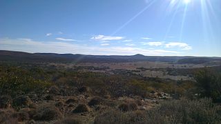
Warramboo (wɔrˑræmˑbʉː) is a locality in the Australian state of South Australia located on the Eyre Peninsula about 334 kilometres (208 mi) north-west of the state capital of Adelaide and about 26 kilometres (16 mi) south-east of the municipal seat of Wudinna. It is 189 kilometres (117 mi) north of Port Lincoln on the Tod Highway and is the north-western terminus of the wheat haulage lines radiating from Port Lincoln on the Eyre Peninsula Railway. The railway line was built from 1907–1915 to develop the cereal industry. The grain silos are a distinctive local landmark of the town.

County of Robinson Cadastral in South Australia

The County of Robinson is one of the 49 counties of South Australia. It was proclaimed in 1883 by Governor William Robinson who named it after himself. It lies on the north west coast of Eyre Peninsula stretching from Streaky Bay inland to include the Gawler Ranges Conservation Park at the southern cusp of the Gawler Ranges.

Gawler Ranges, South Australia Suburb of Pastoral Unincorporated Area, Wudinna District Council, South Australia

Gawler Ranges is a locality in the Australian state of South Australia located on Eyre Peninsula about 380 kilometres north-west of the Adelaide city centre and about 48 kilometres north of the town centre of Wudinna and which is associated with the protected area known as the Gawler Ranges National Park.

County of Fergusson Cadastral in South Australia

County of Fergusson is a cadastral unit located in the Australian state of South Australia which spans Yorke Peninsula south of Price. It was proclaimed in 1869 by Governor Fergusson after whom the county was named.

County of Hamley Cadastral in South Australia

The County of Hamley is a cadastral unit located in the Australian state of South Australia covers land located in the state's east north of the Murray River, bordering New South Wales and Victoria. It was proclaimed in 1869 by Governor Fergusson and named after Francis Hamley.

County of Burra Cadastral in South Australia

County of Burra is a cadastral unit located in the Australian state of South Australia which covers land located in the state’s east associated with the town of Burra. It was proclaimed in 1851 by Governor Young and named after the town of Burra.

County of Musgrave Cadastral in South Australia

The County of Musgrave is a cadastral unit in the Australian state of South Australia that covers land on the west coast of Eyre Peninsula. It was proclaimed on 22 June 1876 and named after Anthony Musgrave, the Governor of South Australia from 9 June 1876 to 29 January 1877.

County of Bosanquet Cadastral in South Australia

The County of Bosanquet is a cadastral unit in the Australian state of South Australia that covers land both in the north of the Eyre Peninsula and to the peninsula's north. It was proclaimed on 23 October 1913 and was named after Sir Day Hort Bosanquet, the Governor of South Australia from 1909 to 1914.

County of Manchester Cadastral in South Australia

County of Manchester is a cadastral unit located in the Australian state of South Australia that covers land both located in the north-east of Eyre Peninsula and to the peninsula's north. It was proclaimed in 1891 and named after George Montagu, 6th Duke of Manchester who was the father-in-law of the Rt Hon. Earl of Kintore GCMG, the Governor of South Australia at the time.

Conservation reserves of South Australia is a class of protected area used in the Australian state of South Australia where crown land under the control of the responsible minister has been dedicated for conservation purposes. This class of protected area has been in use as early as 1985 and as of 2016, there are fifteen conservation reserves that cover an area of 194.7 square kilometres or less than 1% of South Australia's land area.

Kulliparu Conservation Park Protected area in South Australia

Kulliparu Conservation Park is a protected area in the Australian state of South Australia located on the Eyre Peninsula in the gazetted localities of Colley, Karcultaby, Mount Cooper and Mount Damper about 59 kilometres (37 mi) west of the town centre in Kyancutta.

Cocata Conservation Park Protected area in South Australia

Cocata Conservation Park is a protected area in the Australian state of South Australia located on the Eyre Peninsula in the gazetted localities of Cocata and Warramboo about 26 kilometres (16 mi) south-west of the town centre in Kyancutta.

Corrobinnie Hill Conservation Park Protected area in South Australia

Corrobinnie Hill Conservation Park is a protected area in the Australian state of South Australia located on the Eyre Peninsula in the gazetted locality of Pinkawillinie about 24 kilometres (15 mi) west of the town centre in Kyancutta.

County of Jervois Cadastral in South Australia

The County of Jervois is a cadastral unit in the Australian state of South Australia that covers land on the east coast of the Eyre Peninsula. It was proclaimed on 24 January 1878 and named after William Jervois, the Governor of South Australia from October 1877 to January 1883.

County of Taunton Cadastral in South Australia

County of Taunton is a cadastral unit located in the Australian state of South Australia on land on the east coast of Lake Torrens about 160 kilometres (99 mi) from the city of Port Augusta. It was proclaimed in 1877 and named after Lord Taunton who was the Secretary for the Colonies from 1855 to 1858. It has been partially divided in the following sub-units of hundreds – Bunyeroo, Carr, Edeowie, Nilpena, Oratunga and Parachilna.

County of Blachford Cadastral in South Australia

County of Blachford is a cadastral unit located in the Australian state of South Australia that covers land between the east coast of Lake Torrens and the western side of the Flinders Ranges about 90 kilometres (56 mi) north-east of the city of Port Augusta. It was proclaimed in 1877 and named after Frederic Rogers, 1st Baron Blachford who was the Under Secretary of State for the Colonies from 1860 to 1871. It has been partially divided in the following sub-units of hundreds – Barndioota, Cotabena, Warrakimbo, Wonoka and Woolyana.

County of Herbert Cadastral in South Australia

County of Herbert is a cadastral unit located in the Australian state of South Australia that covers land to the east of the Flinders Ranges about 55 kilometres (34 mi) north-east of the town of Peterborough. It was proclaimed in 1877 and named after a prominent man of the time with either a title or a surname containing the name ‘Herbert’. It has been partially divided in the following sub-units of hundreds – Cavenagh, Coglin, Minburra, Nackara, Paratoo and Waroonee.

County of Kimberley Cadastral in South Australia

County of Kimberley is a cadastral unit located in the Australian state of South Australia that covers land to the east of the Flinders Ranges about 45 kilometres (28 mi) east of the town of Peterborough. It was proclaimed in 1871 and named after John Wodehouse, 1st Earl of Kimberley, a British Secretary of State for the Colonies. It has been partially divided in the following sub-units of hundreds – Gumbowie, Hardy, Ketchowla, Parnaroo, Terowie and Wonna.

County of Hanson Cadastral in South Australia

County of Hanson is a cadastral unit located in the Australian state of South Australia that covers land in the Flinders Ranges immediately east of the town of Hawker. It was proclaimed on 20 July 1877 and is named after Sir Richard Davies Hanson who served as Premier, Administrator and Chief Justice of South Australia. It has been partially divided in the following sub-units of hundreds – Adams, Arkaba, French, Moralana and Warcowie.

References

  1. 1 2 3 Kirkpatrick, A.A. (5 November 1908). "NEW COUNTY" (PDF). The South Australian Government Gazette. Government of South Australia. 1908: 894. Retrieved 7 January 2017.
  2. 1 2 3 4 5 6 7 8 9 10 11 12
  3. "Far North SA Government region" (PDF). The Government of South Australia. Retrieved 11 December 2016.
  4. "Eyre Western SA Government region" (PDF). The Government of South Australia. Retrieved 12 December 2016.
  5. 1 2 3 "HUNDRED MAP Series Index Map" (PDF). Department of Environment and Heritage, Government of South Australia. December 2008. Retrieved 16 November 2015.
  6. "Search result for "Eyre Peninsula (Peninsula)" (Record no SA0023359) with the following datasets selected - "Counties"". Government of South Australia. 2011. Archived from the original on 12 October 2016. Retrieved 5 October 2015.
  7. "Naming of State Rural Roads, Eyre Peninsula" (PDF). Government of South Australia. 2011. Rack Plan 997. Archived from the original (PDF) on 9 September 2014. Retrieved 17 December 2016.
  8. "Development Plan, Kimba Council, Consolidated – 25 October 2012" (PDF). Government of South Australia. 2012. pp. 114 and 143–147. Retrieved 25 December 2016.
  9. "Land Not Within a Council Area Eyre, Far North, Riverland and Whyalla, Consolidated – 18 October 2012" (PDF). Government of South Australia. 2012. pp. 13, 110–112 and 161–167. Archived from the original (PDF) on 8 April 2016. Retrieved 4 September 2015.
  10. "Development Plan, Wudinna District Council, Consolidated – 25 October 2012" (PDF). Government of South Australia. 2012. pp. 114 and 145–149. Retrieved 27 July 2016.
  11. "STATE GOVERNORS COMMEMORATED, Counties Throughout S.A. Named After Them". The Advertiser (Adelaide) . South Australia. 4 January 1934. p. 11. Retrieved 19 January 2017 via National Library of Australia.
  12. Leadbeater, Maureen (2014). "Counties & Hundreds of South Australia". FamilyHistorySA. Retrieved 20 November 2016.
  13. "Search result for " Hundred of Cocata (HD)" (Record no SA0014570) with the following layers selected - "Suburbs and Localities", "Counties" and "Hundreds"". Property Location Browser. Government of South Australia. Archived from the original on 12 October 2016. Retrieved 16 January 2017.
  14. "Search result for " Hundred of Cootra (HD)" (Record no SA0015990) with the following layers selected - "Suburbs and Localities", "Counties" and "Hundreds"". Property Location Browser. Government of South Australia. Archived from the original on 12 October 2016. Retrieved 16 January 2017.
  15. "Search result for " Hundred of Corrobinnie (HD)" (Record no SA0016338) with the following layers selected - "Suburbs and Localities", "Counties" and "Hundreds"". Property Location Browser. Government of South Australia. Archived from the original on 12 October 2016. Retrieved 17 January 2017.
  16. "Search result for " Hundred of Hill (HD)" (Record no SA0030418) with the following layers selected - "Suburbs and Localities", "Counties" and "Hundreds"". Property Location Browser. Government of South Australia. Archived from the original on 12 October 2016. Retrieved 17 January 2017.
  17. "Search result for " Hundred of Kappakoola (HD)" (Record no SA0034082) with the following layers selected - "Suburbs and Localities", "Counties" and "Hundreds"". Property Location Browser. Government of South Australia. Archived from the original on 12 October 2016. Retrieved 17 January 2017.
  18. "Search result for " Hundred of Koongawa (HD)" (Record no SA0037548) with the following layers selected - "Suburbs and Localities", "Counties" and "Hundreds"". Property Location Browser. Government of South Australia. Archived from the original on 12 October 2016. Retrieved 17 January 2017.
  19. "Search result for " Hundred of Mamblin (HD)" (Record no SA0042368) with the following layers selected - "Suburbs and Localities", "Counties" and "Hundreds"". Property Location Browser. Government of South Australia. Archived from the original on 12 October 2016. Retrieved 17 January 2017.
  20. "Search result for " Hundred of Minnipa (HD)" (Record no SA0045218) with the following layers selected - "Suburbs and Localities", "Counties" and "Hundreds"". Property Location Browser. Government of South Australia. Archived from the original on 12 October 2016. Retrieved 17 January 2017.
  21. "Search result for " Hundred of Palabie (HD)" (Record no SA0052982) with the following layers selected - "Suburbs and Localities", "Counties" and "Hundreds"". Property Location Browser. Government of South Australia. Archived from the original on 12 October 2016. Retrieved 17 January 2017.
  22. "Search result for " Hundred of Peella (HD)" (Record no SA0054180) with the following layers selected - "Suburbs and Localities", "Counties" and "Hundreds"". Property Location Browser. Government of South Australia. Archived from the original on 12 October 2016. Retrieved 17 January 2017.
  23. "Search result for " Hundred of Pinbong (HD)" (Record no SA0055151) with the following layers selected - "Suburbs and Localities", "Counties" and "Hundreds"". Property Location Browser. Government of South Australia. Archived from the original on 12 October 2016. Retrieved 17 January 2017.
  24. "Search result for " Hundred of Pordia (HD)" (Record no SA0056490) with the following layers selected - "Suburbs and Localities", "Counties" and "Hundreds"". Property Location Browser. Government of South Australia. Archived from the original on 12 October 2016. Retrieved 17 January 2017.
  25. "Search result for " Hundred of Pygery (HD)" (Record no SA0057282) with the following layers selected - "Suburbs and Localities", "Counties" and "Hundreds"". Property Location Browser. Government of South Australia. Archived from the original on 12 October 2016. Retrieved 17 January 2017.
  26. "Search result for "Hundred of Wannamana (HD)" (Record no SA0014425) with the following layers selected - "Suburbs and Localities", "Counties" and "Hundreds"". Property Location Browser. Government of South Australia. Archived from the original on 12 October 2016. Retrieved 17 January 2017.
  27. "Search result for "Hundred of Warramboo (HD)" (Record no SA0018012) with the following layers selected - "Suburbs and Localities", "Counties" and "Hundreds"". Property Location Browser. Government of South Australia. Archived from the original on 12 October 2016. Retrieved 17 January 2017.
  28. "Search result for " Hundred of Wudinna (HD)" (Record no SA0028344) with the following layers selected - "Suburbs and Localities", "Counties" and "Hundreds"". Property Location Browser. Government of South Australia. Archived from the original on 12 October 2016. Retrieved 17 January 2017.
  29. "Search result for " Hundred of Yaninee (HD)" (Record no SA0029833) with the following layers selected - "Suburbs and Localities", "Counties" and "Hundreds"". Property Location Browser. Government of South Australia. Archived from the original on 12 October 2016. Retrieved 17 January 2017.