
Lincoln National Park is a protected area in the Australian state of South Australia located about 249 kilometres (155 mi) west of the state capital of Adelaide and about 9.5 kilometres (5.9 mi) south of the municipal seat of Port Lincoln. It consists of a mainland area on the Jussieu Peninsula on the south eastern tip of Eyre Peninsula and a number of nearby islands. The national park contains significant sites of natural, indigenous and early European heritage.

Port Lincoln is a town on the Lower Eyre Peninsula in the Australian state of South Australia. It is situated on the shore of Boston Bay, which opens eastward into Spencer Gulf. It is the largest city in the West Coast region, and is located approximately 280 km as the crow flies from the State's capital city of Adelaide. In June 2019 Port Lincoln had an estimated population of 16,418, having grown at an average annual rate of 0.55% year-on-year over the preceding five years. The city is reputed to have the most millionaires per capita in Australia, as well as claiming to be Australia's "Seafood Capital".
The Eyre Peninsula is a triangular peninsula in South Australia. It is bounded by the Spencer Gulf on the east, the Great Australian Bight on the west, and the Gawler Ranges on the north.

Buckleboo is a locality in the Australian state of South Australia on the Eyre Peninsula located about 313 kilometres (194 mi) northwest of the state capital of Adelaide and about 31 kilometres (19 mi) northwest of the municipal seat of Kimba.

Streaky Bay is a coastal town on the western side of the Eyre Peninsula, in South Australia just off the Flinders Highway, 303 km (188 mi) north-west of Port Lincoln and 727 km (452 mi) by road from Adelaide. At the 2016 census, Streaky Bay recorded a population of 1, 378.

Wudinna District Council is a rural local government area on central Eyre Peninsula, South Australia. Its seat is Wudinna, on the Eyre Highway, 580 kilometres (360 mi) west of Adelaide. The district's economy is largely driven by agriculture, mainly cereal crops, with beef and sheep commonly farmed as well.
Fowlers Bay, formerly known as Yalata, is a bay, town and locality in the Australian state of South Australia located about 658 kilometres (409 mi) north-west of the state capital, Adelaide. The town is located on Port Eyre, at the western end of the larger Fowlers Bay. It was named Yalata after Yalata station, established in the 1860s and stretching from the Nullarbor Plain across to near Streaky Bay on the Eyre Peninsula, whose homestead was located on the hill nearby. The name Yalata now belongs to a small Aboriginal community further west, which was also situated on station land.

Penong is a town and locality on the Nullarbor Plain, in the far west of the state of South Australia located about 616 kilometres (383 mi) north-west of the state capital of Adelaide. With no settlements between it and Border Village on the border with Western Australia, 400 km (250 mi) away on the Eyre Highway, it is a popular rest-stop for travellers.
Louth Bay is a town and locality in the Australian state of South Australia. It is named after the bay named by Matthew Flinders on 26 February 1802 which itself is derived from a place in Lincolnshire. At the 2006 census, Louth Bay had a population of 408.

The County of Robinson is one of the 49 counties of South Australia. It was proclaimed in 1883 by Governor William Robinson who named it after himself. It lies on the north west coast of Eyre Peninsula stretching from Streaky Bay inland to include the Gawler Ranges Conservation Park at the southern cusp of the Gawler Ranges.

Point Labatt is a headland located on the west coast of Eyre Peninsula in the Australian state of South Australia about 39 kilometres south by east of Streaky Bay. It is notable as one of the largest Australian mainland breeding sites for Australian sea lions. The land and the sea adjoining Point Labatt is part of three protected areas - the Point Labatt Conservation Park, the Point Labatt Aquatic Reserve and the West Coast Bays Marine Park.
Calca is a small township around 20 kilometres (12 mi) south-east of Streaky Bay, on the southern border of the Calpatanna Waterhole Conservation Park, Eyre Peninsula.
John O'Connor was an Australian politician who represented the South Australian House of Assembly multi-member seat of Flinders from 1924 to 1927 for the Labor Party.
Mortana is a rural locality in South Australia, located on the Eyre Peninsula. It is traversed by the Flinders Highway. The boundaries for the locality were established in April 2001 in respect of the long established local name.

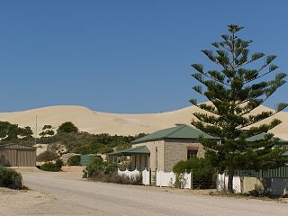
Sleaford is a locality in the Australian state of South Australia located at the southern tip of the Eyre Peninsula overlooking the Great Australian Bight about 260 kilometres west of the state capital of Adelaide and about 17 kilometres west of the municipal seat of Port Lincoln.
County of Manchester is a cadastral unit located in the Australian state of South Australia that covers land both located in the north-east of Eyre Peninsula and to the peninsula's north. It was proclaimed in 1891 and named after George Montagu, 6th Duke of Manchester who was the father-in-law of the Earl of Kintore GCMG, the Governor of South Australia at the time.
Pureba is a locality in the Australian state of South Australia located on the west coast of Eyre Peninsula and on land to the immediate north of the peninsula about 528 kilometres north-west of the state capital of Adelaide and about 52 kilometres north-east and 90 kilometres north respectively of the municipal seats of Ceduna and Streaky Bay.

The County of Jervois is a cadastral unit in the Australian state of South Australia that covers land on the east coast of the Eyre Peninsula. It was proclaimed on 24 January 1878 and named after William Jervois, the Governor of South Australia from October 1877 to January 1883.
The West Coast Sentinel is a weekly newspaper published Thursdays in Ceduna, South Australia. It was founded in mid-1912, and has been published continuously since then. It was later sold to Rural Press, previously owned by Fairfax Media, but now an Australian media company trading as Australian Community Media.
The Port Lincoln Times is a newspaper published weekly in Port Lincoln, South Australia. It was first printed in August 1927, and has been published continuously ever since. It was later sold to Rural Press, previously owned by Fairfax Media, but now an Australian media company trading as Australian Community Media.

