
Tintinara is a town located in the Murray and Mallee region of the South East of South Australia.

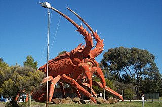
Coonalpyn is a town and a locality in the Australian state of South Australia located about 143 kilometres (89 mi) south-east of the state capital of Adelaide and about 61 kilometres (38 mi) south-east of the municipal seat in Tailem Bend. It is situated in the local government area of the Coorong District Council and is in the State electoratal district of MacKillop and the Federal division of Barker.

Coorong is a locality in the Australian state of South Australia which is associated with the lagoon known as the Coorong in the south-east of the state and which overlooks the continental coastline from the mouth of the Murray River about 80 kilometres south-east of the state capital of Adelaide to the immediate north of the town of Kingston SE extending for a distance of at least 140 kilometres (87 mi).

Coorong District Council is a local government area in South Australia located between the River Murray and the Limestone Coast region. The district covers mostly rural areas with small townships, as well as part of the Coorong National Park.
Culburra is a town and locality in the Australian state of South Australia. It is located on the Dukes Highway and Melbourne–Adelaide railway. , about 158 kilometres (98 mi) south-east of the state capital of Adelaide and about 77 kilometres (48 mi) south-east of the municipal seat of Tailem Bend.

Gum Lagoon Conservation Park is an 8765 ha protected area about 40 km south-west of Keith in the Limestone Coast region of South Australia. It lies about 20 km inland from the southern end of the Coorong. It contains an isolated block of mallee woodland important for malleefowl conservation.

The County of Grey is one of the 49 cadastral counties of South Australia. It was proclaimed in 1846 by Governor Frederick Robe and named for former Governor George Grey. It covers the extreme south-east of the state from Penola and Lake George southwards. This includes the following contemporary local government areas of the state:

The County of Russell is one of the 49 cadastral counties in South Australia. It was proclaimed in 1842 by Governor George Grey and named for Lord John Russell, who was involved in the early development of the (British) South Australian colony when he was Secretary of State for War and the Colonies. It covers a portion of the state bounded to the west by the eastern half of Lake Alexandrina and the section of the Murray River extending to Bowhill in the north and bounded to the south by the coastline adjoining the Coorong coastal lagoon and fully surrounds Lake Albert which is excluded from its extent. This includes the north western quarter of the contemporary local government area of Coorong District Council.

The County of Buckingham is one of the 49 cadastral counties of South Australia. It was proclaimed by Governor James Fergusson in 1869 and named for the third Duke of Buckingham and Chandos, Richard Temple-Nugent-Brydges-Chandos-Grenville who was appointed Secretary of State for the Colonies in 1867. It is located adjacent to the Victorian border in the state's upper south east. This includes most of the contemporary local government area of Tatiara District Council and a small east portion of Coorong District Council.
The County of MacDonnell is one of the 49 cadastral counties of South Australia. It was proclaimed in 1857 and named for the South Australian Governor at the time of proclamation, Richard Graves MacDonnell. It is located in the upper south-east of the state from the Limestone Coast at Kingston to the Victorian border. This includes the following contemporary local government areas of the state:
The Hundred of Colebatch is a Hundred of the County of Cardwell centred on Colebatch, South Australia
The Hundred of Coombe is a Hundred of the County of Cardwell centred on the bounded rural locality of Colebatch, South Australia near the town of Tintinara, South Australia in the Murray Mallee region of South Australia.
The Hundred of Petherick is a Hundred of the County of Cardwell centred on Petherick, South Australia. It is in the Limestone Coast region southeast of Adelaide.
Laffer is a locality in the Australian state of South Australia located in the state’s south-east about 199 kilometres (124 mi) south-east of the state capital of Adelaide and about 57 kilometres (35 mi) west of the municipal seat in Bordertown.
Colebatch is a locality in the Australian state of South Australia located in the state’s south-east about 162 kilometres (101 mi) south-east of the state capital of Adelaide and about 81 kilometres (50 mi) south-east of the municipal seat in Tailem Bend.

The County of Granville is one of the 49 counties of South Australia located in the Flinders Ranges region. It was proclaimed in 1876 by Governor Anthony Musgrave and was named for the Granville Leveson-Gower, the second Earl of Granville and the Secretary of State for the Colonies until a few years prior.

County of Kimberley is a cadastral unit located in the Australian state of South Australia that covers land to the east of the Flinders Ranges about 45 kilometres (28 mi) east of the town of Peterborough. It was proclaimed in 1871 and named after John Wodehouse, 1st Earl of Kimberley, a British Secretary of State for the Colonies. It has been partially divided in the following sub-units of hundreds – Gumbowie, Hardy, Ketchowla, Parnaroo, Terowie and Wonna.

The District Council of Coonalpyn Downs was a local government area in the Australian state of South Australia that existed from 1957 to 1997 on land in the state’s south-east.
Coombe is a locality in the Australian state of South Australia located about 186 kilometres (116 mi) south-east of the state capital of Adelaide and about 105 kilometres (65 mi) south-east of the municipal seat in Tailem Bend.
The District Council of Meningie was a local government area in the colony and then the Australian state of South Australia that existed from 1888 to 1997 on land in the state’s south-east.

