Related Research Articles
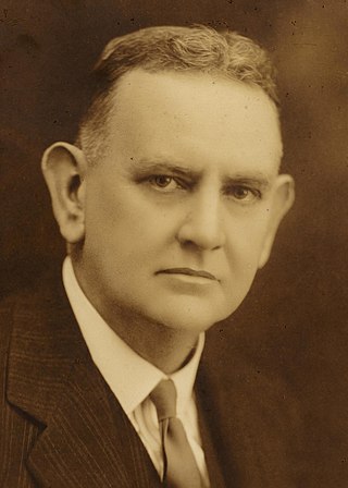
Sir Harry Pateshall Colebatch was a long-serving figure in Western Australian politics. He was a member of the Western Australian Legislative Council for nearly 20 years, the twelfth Premier of Western Australia for a month in 1919, agent-general in London for five years, and a senator for four years. He was known for supporting free trade, federalism and Western Australian secessionism, and for opposing communism, socialism and fascism. Born in England, his family migrated to South Australia when Colebatch was four years old. He left school aged 11 and worked for several newspapers in South Australia before moving to Broken Hill in New South Wales in 1888 to work as a reporter for the Silver Age. In 1894, he moved to the Western Australian Goldfields following the gold rush there, working for the Golden Age in Coolgardie and the Kalgoorlie Miner in Kalgoorlie. Two years later, he moved to Perth to join the Morning Herald, but after that newspaper collapsed, he moved to Northam where he started The Northam Advertiser. He also became friends with local bank manager James Mitchell and convinced Mitchell to run for state parliament. Colebatch was the mayor of Northam between 1909 and 1912.
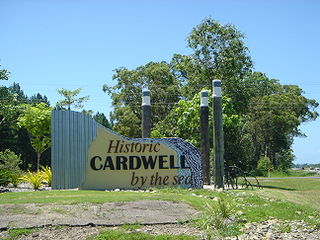
Cardwell is a coastal town and rural locality in the Cassowary Coast Region, Queensland, Australia. In the 2016 census, the locality of Cardwell had a population of 1,309 people.
Hal Gibson Pateshall Colebatch was a West Australian author, poet, lecturer, journalist, editor, and lawyer.
Colebatch may refer to:

Coorong is a locality in the Australian state of South Australia which is associated with the lagoon known as the Coorong in the south-east of the state and which overlooks the continental coastline from the mouth of the Murray River about 80 kilometres south-east of the state capital of Adelaide to the immediate north of the town of Kingston SE extending for a distance of at least 140 kilometres (87 mi).

The Shire of Cardwell was a local government area of Queensland. It was located on the Coral Sea coast about halfway between the cities of Cairns and Townsville. The shire, administered from the town of Tully, covered an area of 3,062.2 square kilometres (1,182.3 sq mi), and existed as a local government entity from 1884 until 2008, when it amalgamated with the Shire of Johnstone to form the Cassowary Coast Region.
This is a list of members of the Western Australian Legislative Assembly between the 1917 election and the 1921 election, together known as the 10th Parliament.
Culburra is a town and locality in the Australian state of South Australia. It is located on the Dukes Highway and Melbourne–Adelaide railway. , about 158 kilometres (98 mi) south-east of the state capital of Adelaide and about 77 kilometres (48 mi) south-east of the municipal seat of Tailem Bend.

Cardwell Bush Telegraph is a heritage-listed former post office and now heritage centre at 53 Victoria Street, Cardwell, Cassowary Coast Region, Queensland, Australia. The Telegraph and Post Office at Cardwell was designed by Colonial Architect's Office and built in 1870 by George McCallum, making it one of the oldest buildings in North Queensland.

The County of Cardwell is one of the 49 cadastral counties of South Australia. It was proclaimed by Governor Dominick Daly in 1864 and named for Edward Cardwell, 1st Viscount Cardwell, who was appointed Secretary of State for the Colonies in the same year. It is located south east of Lake Albert abutting the coastline along the southern portion of the Coorong coastal lagoon. This includes the southern half of the contemporary local government area of the Coorong District Council and smaller parts of the Tatiara District and Kingston District council areas.
The Hundred of Field is a cadastral hundred of the County of Cardwell, centred on the rural localities of Field and Colebatch, South Australia. It was proclaimed by Governor Winston Dugan in 1938 and named for Edgar John Field, a local government administrator of the day.
The Hundred of Coombe is a Hundred of the County of Cardwell centred on the bounded rural locality of Colebatch, South Australia near the town of Tintinara, South Australia in the Murray Mallee region of South Australia.
The Hundred of Santo is a cadastral hundred of the County of Cardwell, centred on the rural locality of Salt Creek, South Australia. It was proclaimed by Governor Dominick Daly in 1864 and named for Philip Santo, a member of the South Australian parliament in the 1860s and 1870s.
The Hundred of Laffer is a Hundred of the County of Cardwell centered on Laffer, South Australia. It is in the Limestone Coast region south east of Adelaide, South Australia.
The Hundred of Petherick is a Hundred of the County of Cardwell centred on Petherick, South Australia. It is in the Limestone Coast region southeast of Adelaide.
Colebatch is a locality in the Australian state of South Australia located in the state’s south-east about 162 kilometres (101 mi) south-east of the state capital of Adelaide and about 81 kilometres (50 mi) south-east of the municipal seat in Tailem Bend.
Messent Conservation Park, formerly the Messent National Park and the Messent Wildlife Reserve, is a protected area in the Australian state of South Australia located in the state’s south-east in the gazetted localities of Colebatch and Deepwater about 164 kilometres (102 mi) south-east of the state capital of Adelaide and about 6 kilometres (3.7 mi) north-east of the town centre in Salt Creek.

The District Council of Coonalpyn Downs was a local government area in the Australian state of South Australia that existed from 1957 to 1997 on land in the state’s south-east.
The District Council of Meningie was a local government area in the colony and then the Australian state of South Australia that existed from 1888 to 1997 on land in the state’s south-east.
Mount Boothby Conservation Park, formerly the Mount Boothby National Park, is a protected area in the Australian state of South Australia located in the locality of Field about 147 kilometres (91 mi) south-east of the state capital of Adelaide and about 14 kilometres (8.7 mi) west of the Culburra town centre on the Dukes Highway.
References
- ↑ "Search for 'County of Cardwell, CNTY' (ID SA0012368)". Government of South Australia. Archived from the original on 7 December 2015. Retrieved 19 July 2016.
| | This South Australia geography article is a stub. You can help Wikipedia by expanding it. |