Related Research Articles

Dunklin County is located in the Bootheel of the U.S. state of Missouri. As of the 2020 census, the population was 28,283. The largest city and county seat is Kennett. The county was officially organized on February 14, 1845, and is named in honor of Daniel Dunklin, a Governor of Missouri who died the year before the county was organized.
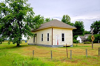
Cardwell is a city in southwest Dunklin County, Missouri, United States. The population was 713 at the 2010 census. The current Mayor of Cardwell is Brandon Cupp and the current aldermen are Harvey Beasley, Mike Clark, and Chuck Walls.

Stella is a village in southern Newton County, Missouri, United States. The population was 158 at the 2010 census. It is part of the Joplin, Missouri Metropolitan Statistical Area. The village of Stella is located 17 miles southeast of Neosho.

Tatiara District Council is a local government area located in south-eastern South Australia. The name Tatiara is said to mean "the good country", a phrase which dates back to the area's first inhabitants, the Bodaruwitj people. It is one of the largest local government areas in South Australia at 6,476 km2 (2,500 sq mi). The district's economy is based primarily on agriculture, with cereal crops such as wheat, barley and oats and with livestock such as sheep, cattle and pigs prominent.
Petherick may refer to:
Vernon Gordon Petherick was an Australian politician who represented the South Australian House of Assembly seat of Victoria from 1918 to 1924, 1932 to 1938 and 1941 to 1945 for the Liberal Union, Liberal Federation and Liberal and Country League.

The District Council of Wirrega was a short-lived local government area in South Australia in existence from 1884 to 1888.

The County of Cardwell is one of the 49 cadastral counties of South Australia. It was proclaimed by Governor Dominick Daly in 1864 and named for Edward Cardwell, 1st Viscount Cardwell, who was appointed Secretary of State for the Colonies in the same year. It is located south east of Lake Albert abutting the coastline along the southern portion of the Coorong coastal lagoon. This includes the southern half of the contemporary local government area of the Coorong District Council and smaller parts of the Tatiara District and Kingston District council areas.

The County of Hamley is a cadastral unit located in the Australian state of South Australia covers land located in the state's east north of the Murray River, bordering New South Wales and Victoria. It was proclaimed in 1869 by Governor Fergusson and named after Francis Hamley.

County of Young is a cadastral unit located in the Australian state of South Australia covers land located in the state’s east on the north side of the Murray River. It was proclaimed in 1860 by Governor MacDonnell and named after his predecessor, Governor Young. It has been partially divided in the following sub-units of hundreds – Markaranka, Parcoola, Pooginook and Stuart.
Conservation reserves of South Australia is a class of protected area used in the Australian state of South Australia where crown land under the control of the responsible minister has been dedicated for conservation purposes. This class of protected area has been in use as early as 1985. In 2016 there were 15 conservation reserves that covered an area of 194.7 square kilometres. As of March 2022 the number had increased to 16 conservation reserves covering 193.6 square kilometres or less than 1% of South Australia's land area.

County of Buxton is a cadastral unit located in the Australian state of South Australia that covers land located in the centre of Eyre Peninsula. It was proclaimed in 1896 and named after Thomas Buxton who was the Governor of South Australia from 29 October 1895 to 29 March 1899. It has been divided into thirteen sub-divisions known as hundreds, with the most recent being created in 1928.
The Hundred of Colebatch is a Hundred of the County of Cardwell centred on Colebatch, South Australia
The Hundred of Coombe is a Hundred of the County of Cardwell centred on the bounded rural locality of Colebatch, South Australia near the town of Tintinara, South Australia in the Murray Mallee region of South Australia.
The Hundred of Santo is a cadastral hundred of the County of Cardwell, centred on the rural locality of Salt Creek, South Australia. It was proclaimed by Governor Dominick Daly in 1864 and named for Philip Santo, a member of the South Australian parliament in the 1860s and 1870s.
The Hundred of Laffer is a Hundred of the County of Cardwell centered on Laffer, South Australia. It is in the Limestone Coast region south east of Adelaide, South Australia.

The Hundred of Bowaka, is a hundred in the County of Robe, within the Limestone Coast region of South Australia. The hundred is located at 36°55′38″S 140°1′33″E.
Didicoolum is a homestead located in the gazetted locality of Petherick in the Australian state of South Australia.
Petherick is a locality in the Australian state of South Australia located in the state’s south-east about 211 kilometres (131 mi) south-east of the state capital of Adelaide and about 55 kilometres (34 mi) west of the municipal seat in Bordertown.
The District Council of Meningie was a local government area in the colony and then the Australian state of South Australia that existed from 1888 to 1997 on land in the state’s south-east.
References
- ↑ Search for 'County of Cardwell, CNTY' (ID SA0012368) Archived 7 December 2015 at the Wayback Machine , Government of South Australia access date 19 July 2016
36°21′07″S140°08′36″E / 36.3518767°S 140.1431986°E Coordinates: 36°21′07″S140°08′36″E / 36.3518767°S 140.1431986°E
| | This South Australia geography article is a stub. You can help Wikipedia by expanding it. |