
The Flinders Ranges are the largest mountain ranges in South Australia, which starts about 200 km (125 mi) north of Adelaide. The ranges stretch for over 430 km (265 mi) from Port Pirie to Lake Callabonna.

Flinders Ranges Council is a local government area (LGA) located in the Flinders Ranges of South Australia.

Kanyaka Station was a cattle and sheep station in the Flinders Ranges of South Australia located at Kanyaka, approximately 40 km (25 mi) north-north-east of Quorn, South Australia. along Hawker-Stirling North Road (B83)
The Willochra Plain is a wide plain situated east of Port Augusta, South Australia. The area falls in the view from Mount Brown Lookout and from walking trails in The Dutchmans Stern Conservation Park.

Simmonston was a former town in South Australia which was abandoned before completion in the early 1880s. The town was originally intended to be on the new railway extending north from Quorn, but the final route passed through Gordon instead. Today, the stone ruins of a hotel and its cellars are still visible. The town is reported as being "named after Sir Lintorn Simmons, Field Marshal and Commandant of the Royal Engineers" by William Jervois, the 10th Governor of South Australia. The creation of the town was announced in April 1880 as follows: "Portions of Crown Lands in the Hundred of Kanyaka have been reserved as a site for the new town of Simmonston." Plans to build the hotel were announced three weeks later in May 1880 by a D. McFie. The site of the former town is currently located in the gazetted locality of Kanyaka and within the local government area of the Flinders Ranges Council.
The District Council of Wilmington was a local government area in South Australia, centred on the town of Wilmington from 1888 to 1980.

The District Council of Kanyaka was a local government area in South Australia that existed from 1888 to 1969.
The District Council of Kanyaka-Quorn was a local government area in South Australia that existed from 1969 to 1997.
The District Council of Hawker was a local government area in South Australia from 1888 to 1997, centred on the town of Hawker. At its creation it was the northernmost local government area in the state.
The Corporate Town of Quorn was a local government area in South Australia from 1883 to 1969, centred on the town of Quorn.

Kanyaka is a rural locality in the Far North region of South Australia, situated in the Flinders Ranges Council.
The County of Newcastle is one of the 49 counties of South Australia spanning the central Flinders Ranges. It was named in 1876 for Francis Pelham-Clinton-Hope, the eighth Duke of Newcastle.
The Hundred of Cudlamudla is a cadastral hundred of the County of Newcastle in South Australia, that is located at 32.195°S 138.215°E. The traditional owners of the area are the Ngadjuri peoples/ and the first European explorer to the area was Thomas Burr in September 1842.
The Hundred of Palmer is a cadastral hundred of the County of Newcastle in South Australia. It is located near 32.195°S, 138.215°E east of the township of Quorn, and south of the former town of Willochra which, although surveyed in 1860, never properly developed and was abandoned during the drought in the 1860s.
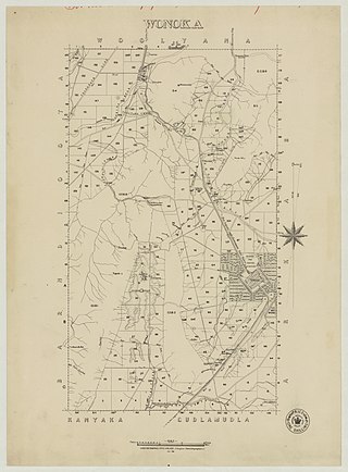
The Hundred of Wonoka is a cadastral unit of hundred in the County of Blachford, South Australia.

The Hundred of Yednalue is a cadastral unit of hundred in the County of Granville, South Australia.

The Hundred of Wirreanda is a cadastral unit of hundred in the County of Granville, South Australia. The township of Cradock is at the hundred's centre.

The County of Frome is one of the 49 cadastral counties of South Australia in straddling the Mid North and Flinders Ranges regions. It was proclaimed in 1851 by Governor Henry Young and was named for the former Surveyor-General of South Australia, Edward Charles Frome. The iconic Mount Remarkable in the Hundred of Gregory is at the centre of the county.
Moockra is a locality in the Australian state of South Australia located on the eastern side of the Flinders Ranges about 274 kilometres (170 mi) north of the state capital of Adelaide and about 47 kilometres (29 mi) north-east and 36 kilometres (22 mi) south-east respectively of the municipal seats of Melrose and Quorn.

The County of Granville is one of the 49 counties of South Australia located in the Flinders Ranges region. It was proclaimed in 1876 by Governor Anthony Musgrave and was named for the Granville Leveson-Gower, the second Earl of Granville and the Secretary of State for the Colonies until a few years prior.
