Wattle Range Council is a local government area in the Limestone Coast region of South Australia. It stretches from the coast at Beachport east to the Victorian border. It had a population of over 11,000 as at the 2016 Census.

Tantanoola is a town in regional South Australia. The name is derived from the aboriginal word tentunola, which means boxwood / brushwood hill or camp. Tantanoola was originally named 'Lucieton' by Governor Jervois after his daughter Lucy Caroline, on 10 July 1879. It was changed by Governor Robinson to 'Tantanoola' on 4 October 1888. At the 2006 census, Tantanoola had a population of 255.

Millicent is a town in the Australian state of South Australia located about 399 kilometres (248 mi) south-east of the state capital of Adelaide and about 50 kilometres (31 mi) north of the regional centre of Mount Gambier. In the 2021 census, the population was 4,760.
Glencoe is a town in South Australia, Australia, located 27 kilometres (17 mi) north-west of Mount Gambier.

Southend is a town and locality in the Australian state of South Australia located in the south-east of the state on the southern shore of Rivoli Bay about 324 kilometres (201 mi) south-east of the state capital of Adelaide.

The Hundred of Balaklava is a cadastral unit of hundred located on the northern Adelaide Plains in South Australia immediately south of the Wakefield River. It is one of the eight hundreds of the County of Gawler. It was named in 1856 by Governor Dominick Daly after the Crimean War Battle of Balaklava. The township of Balaklava is at the extreme north east corner of the hundred.

The Hundred of Port Adelaide is a cadastral hundred covering the vicinity of Port Adelaide, Lefevre Peninsula and the coast of the central Adelaide Plains south of Gawler River and west of Port Wakefield Road. It is one of the eleven hundreds of the County of Adelaide and was named in 1846 by Governor Frederick Robe.
The District Councils Act 1887 was an act of the Parliament of South Australia. It received assent on 9 December 1887, and its provisions came into effect when proclaimed by Governor William C. F. Robinson on 5 January 1888.

The County of Hindmarsh is one of the 49 cadastral counties of South Australia. It was proclaimed by Governor George Grey in 1842 and named for Governor John Hindmarsh.

The County of Grey is one of the 49 cadastral counties of South Australia. It was proclaimed in 1846 by Governor Frederick Robe and named for former Governor George Grey. It covers the extreme south-east of the state from Penola and Lake George southwards. This includes the following contemporary local government areas of the state:

The Hundred of Willunga is a cadastral unit of hundred covering the extreme south suburbs of the Adelaide metropolitan area. It is one of the eleven hundreds of the County of Adelaide. It was named in 1846 by Governor Frederick Robe probably deriving from a Kaurna/Ngarrindjeri place label willannga, meaning place of green trees.

The Hundred of Barossa is a cadastral unit of hundred in South Australia in the northern Adelaide Hills. It lies west of the Barossa Range at the south end of the Barossa Valley and is bounded on the north and south by the North Para and South Para rivers, respectively. It is the most northern of the eleven hundreds of the County of Adelaide and was named in 1846 by Governor Frederick Robe after the Barossa Range.
The Hundred of Mount Muirhead is a cadastral division of the County of Grey in southeastern South Australia. It was named on 15 July 1869 for the geographical feature of the same name which, in turn, was named by Charles Bonney for one of his stockmen.
The Hundred of Mayurra is a cadastral division of the County of Grey in southeastern South Australia. It was named on 15 July 1869 for an Aboriginal word meaning fern straws.
Gower Conservation Park is a protected area located in the Australian state of South Australia in the locality of Tantanoola about 353 kilometres (219 mi) south-east of the state capital of Adelaide and about 25 kilometres (16 mi) north west of the regional city of Mount Gambier.
Kangaroo Inn is a locality in the Australian state of South Australia located in the state's south-east within the Limestone Coast region about 306 kilometres (190 mi) south-east of the state capital of Adelaide, and about 30 kilometres (19 mi) south-east and about 46 kilometres (29 mi) north-west respectively of the municipal seats of Robe and Millicent.
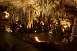
The District Council of Tantanoola was a local government area seated at Tantanoola in South Australia from 1888 to circa 1960.
The District Council of Millicent was a local government area in South Australia seated at Millicent.
The District Council of Mount Muirhead was a local government area in South Australia from 1888 to 1914.