
Wakefield Regional Council is a local government area in the Yorke and Mid North region of South Australia. The council seat is at Balaklava.
Yorketown is a town and a locality in the Australian state of South Australia located in the southern Yorke Peninsula about 91 kilometres (57 mi) west of the state capital of Adelaide and about 70 kilometres (43 mi) south of the municipal seat of Maitland. At the 2016 census, the locality had a population of 969 of which 642 lived in its town centre.

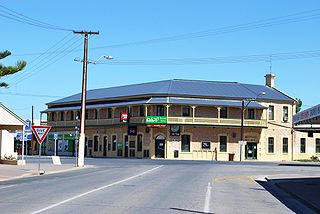
Port Wakefield was the first government town to be established north of the capital, Adelaide, in South Australia.

The Clare and Gilbert Valleys Council is a local government area located in the Yorke and Mid North region of South Australia. The council was founded on 1 July 1997 with the amalgamation of the District Council of Clare, the District Council of Riverton and the District Council of Saddleworth and Auburn. The council seat is located at Clare; it also maintains branch offices at Riverton and Saddleworth.
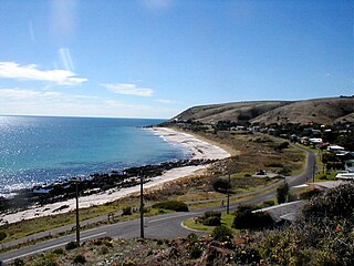
Carrickalinga is a small coastal town in South Australia about 60 km south of Adelaide on the Fleurieu Peninsula overlooking Gulf St Vincent. The town has no shops, with the nearest being in Normanville, one kilometre away.

Halbury is a former railway town in South Australia, west of the Clare Valley, halfway between Balaklava and Auburn. At the 2006 census, Halbury had a population of 363.
Suburbs and localities are the names of geographic subdivisions in Australia, used mainly for address purposes. The term locality is used in rural areas, while the term suburb is used in urban areas. Australian postcodes closely align with the boundaries of localities and suburbs.

Culburra is a settlement in South Australia on the Dukes Highway and Melbourne–Adelaide railway. "Culburra" is an indigenous name meaning "plenty of sand", and the settlement was previously called Dewson before the name was changed in the early 20th century.

Hansborough is a locality along the former Morgan railway line adjacent to the Thiele Highway, in South Australia's Mid North region. It is situated 9 kilometres south-west of Eudunda and 18 kilometres north-east of Kapunda. The Light River runs through the locality.
Overland Corner is a locality in the Australian state of South Australia located in the state’s east about 181 kilometres (112 mi) north-east of the state capital of Adelaide and about 30 kilometres (19 mi) west of the municipal seat in Berri.
Bagot Well is a locality around 6 km north-east of Kapunda, South Australia on the road to Eudunda and was named for Captain C. H. Bagot, who owned a great deal of property in the area.
Everard Central is a locality in South Australia's Mid North. The locality is situated in approximately the southern two thirds of the cadastral Hundred of Everard.
The Hundred of Blyth is a cadastral unit of hundred on the northern Adelaide Plains of South Australia centred on the township of Blyth. It is one of the 16 hundreds of the County of Stanley. It was named in 1860 by Governor Richard MacDonnell after Arthur Blyth who arrived in South Australia as a teenager in 1839 and went on to become a local businessman, parliamentarian and thrice the premier of South Australia.

Hilltown is a locality in the District Council of Clare and Gilbert Valleys of South Australia. The former town centre is located on Hilltown Road, which runs north-south between Andrews and Hill River, while the unsealed Harvey Highway connects the former town centre to RM Williams Way. It is about 4 km east of RM Williams Way, on the former Spalding railway line.
Whites Flat is a rural locality in the Eyre and Western region of South Australia, situated within the District Council of Lower Eyre Peninsula. The boundaries for the locality were formally established in October 2003 for the long established local name; this had originally been named after pastoralist Samuel White.
Mingbool is a locality in the Australian state of South Australia located about 372 kilometres (231 mi) south-east of the state capital of Adelaide adjoining the border with the state of Victoria and about 16 kilometres (9.9 mi) north-west of the municipal seat of Mount Gambier.
The District Council of Hall was a local government area in South Australia from 1878 to 1935.
Tilley Swamp is a locality in the Australian state of South Australia located in the state's south-east about 199 kilometres (124 mi) south-east of the state capital of Adelaide and about 55 kilometres (34 mi) north of the municipal seat of Kingston SE. The 2016 Australian census, which was conducted in August 2016, reports that the area had a population of 27 people.
Duck Ponds is a locality in the Australian state of South Australia located on the Eyre Peninsula in the state’s west about 258 kilometres (160 mi) west of the state capital of Adelaide, about 51 kilometres (32 mi) south of the municipal seat of Cummins and about 6 kilometres (3.7 mi) west of the city of Port Lincoln.
Kringin is a town and a locality in the Australian state of South Australia located in the state’s east about 199 kilometres (124 mi) east of the state capital of Adelaide and about 61 kilometres (38 mi) south of the municipal seat of Loxton.
Historically the place was known to locals as "Bumburnie" - see ref. notes at bottom RH corner of Page 32 of "Manning's Place names of South Australia" book


