Hill River (South Australia)

Last updated

Hill
Hill River at Andrews, South Australia. Upstream (southward) view..JPG
An upstream view of the Hill River
Australia South Australia relief location map.png
Red pog.svg
Location of the river mouth in South Australia
Etymology John Hill [1]
Location
Country Australia
State South Australia
Region Mid North
Physical characteristics
Source 
  locationnear Penwortham
  elevation341 m (1,119 ft)
Mouth confluence with the Broughton River
  coordinates
33°31′39″S138°37′34″E / 33.5274°S 138.626110°E / -33.5274; 138.626110
  elevation
296 m (971 ft)
Length37 km (23 mi)
Basin size230 km2 (89 sq mi)
Basin features
River system Broughton River
Waterhole Beetaloo Reservoir
[2]

The Hill River is an ephemeral river located in the Mid North region of the Australian state of South Australia.

Contents

Course and features

The Hill River rises about 3 kilometres (1.9 mi) east of Penwortham and then flows northward for about 37 kilometres (23 mi). Hill River runs roughly parallel to Hutt River, approximately 3 kilometres (1.9 mi) to the west. Near the town of Spalding Hill River becomes a tributary of the Broughton River shortly before the Hutt merges also.

The Hill River drains a catchment area of 230 square kilometres (89 sq mi). Flows which are intermittent, can result from either winter rains or local thunderstorms. The average annual observed flow in 2000–04 was 2,568 megalitres (90.7×10^6 cu ft). [3] Most of the catchment emanates from the Camels Hump Range and to a lesser degree from the Stony Range. Slab Hut Creek is amongst the more significant tributaries. The river has a low gradient which, combined with a broad and shallow catchment valley, renders it unsuitable as the site of any significant reservoir. In some areas the clearing of native vegetation has led to erosion and steep banks. The Hill River also gives its name to the locality of Hill River, which is within the District Council of Clare and Gilbert Valleys. [4]

History

For over 100 years the date of European discovery and name origin for the river was confused. In the absence of proper research, several false attributions became accepted. According to (incorrect) state government sources, the river was discovered by an obscure 'William' Hill in 1838 and named for Rowland Hill, the secretary of the South Australian Colonization Commission from 1833 until 1837. [4]

According to Edward John Eyre, he discovered the river in 1839 and named it after explorer John Hill because he was "the gentleman who discovered its twin river, the Hutt". [1] John Hill was the first European to explore the nearby Clare Valley. He sighted and named several important rivers of South Australia, including the adjacent Hutt River and Wakefield River. A 1908 news article conversely credits the obscure William Hill with naming Hill River after himself. [5]

The issue was finally resolved in 2015 with the publication of John Hill : South Australia's Discoverer of Rivers, which emphatically concludes that Eyre discovered the river on 5 June 1839 and named it after John Hill, the explorer who discovered the Clare Valley

See also

Related Research Articles

<span class="mw-page-title-main">Cooper Creek</span> River in Queensland, South Australia

The Cooper Creek is a river in the Australian states of Queensland and South Australia. It was the site of the death of the explorers Burke and Wills in 1861. It is sometimes known as the Barcoo River from one of its tributaries and is one of three major Queensland river systems that flow into the Lake Eyre basin. The flow of the creek depends on monsoonal rains falling months earlier and many hundreds of kilometres away in eastern Queensland. It is 1,300 kilometres (810 mi) in length.

John Baxter was an Irish convict who became an Australian pioneer, overlander, explorer, and offsider of explorer Edward John Eyre.

<span class="mw-page-title-main">Jacobs Creek (Australia)</span> Stream in South Australia

Jacob's Creek is a small creek located in Mid North region of the Australian state of South Australia.

<span class="mw-page-title-main">Onkaparinga River</span> River in South Australia

The Onkaparinga River, known as Ngangkiparri or Ngangkiparingga in the Kaurna language, is a river located in the Southern Adelaide region in the Australian state of South Australia. Rising in the Mount Lofty Ranges, the river's estuary extends from Old Noarlunga to the river's mouth between the suburbs of Port Noarlunga and Port Noarlunga South.

<span class="mw-page-title-main">Penwortham, South Australia</span> Town in South Australia

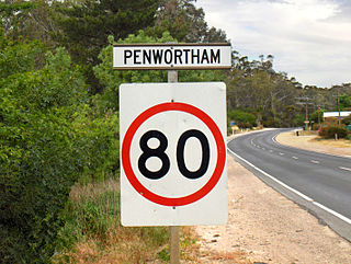
Penwortham is a small town in the Clare Valley, South Australia, along the Horrocks Highway, approximately 10 kilometres south of Clare and 14 kilometres north of Auburn.

<span class="mw-page-title-main">Auburn, South Australia</span> Town in South Australia

Auburn is a small town in the southern edge of the Clare Valley, in the Mid North of South Australia.

The Hutt River is a river located in the Mid North and Clare Valley regions of the Australian state of South Australia.

The following lists events that happened during 1839 in Australia.

Hill River is a river in the Wheatbelt region of Western Australia.

<span class="mw-page-title-main">Gilbert River (South Australia)</span> River in South Australia

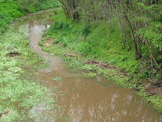
The Gilbert River is a river in the Mid North region of South Australia.

Hutt River is a river in the Mid West region of Western Australia.

<span class="mw-page-title-main">Robert Cock</span>

Robert Cock was one of the first European explorers of the Adelaide region of South Australia following the establishment of the colony in December 1836.

The Bowes River is a river in the Mid West region of Western Australia. It was named on 6 April 1839 by the explorer George Grey while on his second exploration expedition along the Western Australian coast. It was named for Mary Bowes, Dowager Countess of Strathmore, the wife of Sir William Hutt. Hutt was a British Liberal politician who was heavily involved in the colonization of New Zealand and South Australia, and the brother of John Hutt, the second governor of Western Australia. Sir William Hutt was a member of the 1836 select committee on Disposal of Lands in the British Colonies. Grey named the nearby Hutt River after Hutt.

<span class="mw-page-title-main">Wakefield River</span> River in South Australia, Australia

The Wakefield River is an ephemeral river that flows to an estuary in the Australian state of South Australia.

<span class="mw-page-title-main">Broughton River (South Australia)</span> River in South Australia, Australia

The Broughton River is a river in the Australian state of South Australia.

The Buller River is a river in the Mid West region of Western Australia, near Geraldton.

<span class="mw-page-title-main">John Jackson Oakden</span>

John Jackson Oakden, pastoralist, was an English explorer of South Australia, part of the European exploration of Australia, and a pioneer runholder of the Canterbury region of New Zealand.

John Hill was an English explorer of South Australia and part of the European exploration of Australia. Hill was the first European to see and traverse the Clare Valley.

<span class="mw-page-title-main">Clare Valley</span> Region in South Australia

The Clare Valley is a valley located in South Australia about 100 kilometres north of Adelaide in the Clare and Gilbert Valleys council area. It is the river valley formed by the Hutt River but is also strongly associated with the roughly parallel Hill River. The valley is traversed by the Horrocks Highway and the towns in the valley along that route from south to north are Auburn, Leasingham, Watervale, Penwortham, Sevenhill and Clare. The geographical feature has given rise to the Clare Valley wine region designation, a notable winegrowing region of Australia.

<span class="mw-page-title-main">Hill River, South Australia</span> Town in South Australia

Hill River is a locality in the Yorke and Mid North region of South Australia, about 127 kilometres north of the Adelaide city centre. It is bisected by the Hill River, an ephemeral stream from which it derives its name. Its boundaries were created in January 2001 for the “long established name.”

References

  1. 1 2 Eyre, Edward John (1984). Jill Waterhouse (ed.). Autobiographical Narrative, 1833–1839. Caliban Books. p. 205.
  2. "Map of Hill River, SA". Bonzle Digital Atlas of Australia. Retrieved 25 March 2017.
  3. Northern and Yorke Natural Resources Management Board (2009). Water Allocation Plan for the Clare Valley Prescribed Water Resources Area (PDF). Crystal Brook, South Australia: Northern and Yorke Natural Resources Management Board, Government of South Australia. p. 4. ISBN   978-0-9806143-1-2.
  4. 1 2 "Search result for "Hill River, STRM" (Record # SA0007485)". Department of Planning, Transport and Infrastructure, Government of South Australia. Archived from the original on 7 December 2015. Retrieved 12 November 2015. Derivation of Name: Rowland Hill; Other Details: Recorded as being discovered by William Hill in 1838. Rowland Hill was at that time Secretary to the SA Association. He later became famous for pastoral activities. Shown on Captain Frome's 1842 Plan as River Hill.
  5. "NOMENCLATURE OF SOUTH AUSTRALIA. THE ORIGIN OF NAME8. No. XIII: AN ALPHABETICAL REVIEW. An Early Plea for Closer Settlement". South Australian Register . 13 June 1908. p. 9. The Hutt and Hill Rivers were discovered and named by William Hill in 1839 — the one after Sir William Hutt, M.P. one of Lord Glenelg's nominees among the South Australian Colonization Commissioners, and the other after himself.