Gawler River (South Australia)

Last updated

Gawler
Metta Watte [1]
Gawler River at Angle Vale when dry.JPG
Australia South Australia relief location map.png
Red pog.svg
Location of the river mouth in South Australia
Location
Country Australia
State South Australia
Region Mid North
District Adelaide Plains
Towns Gawler, Angle Vale, Virginia
Physical characteristics
Source confluence South Para River and North Para River
  location Gawler
  elevation52 m (171 ft)
Mouth Gulf St Vincent
  location
between Port Gawler and Buckland Park
  coordinates
34°40′30″S138°28′25″E / 34.6750°S 138.4737°E / -34.6750; 138.4737 Coordinates: 34°40′30″S138°28′25″E / 34.6750°S 138.4737°E / -34.6750; 138.4737
  elevation
0 m (0 ft)
Length41 km (25 mi)
Basin size883 km2 (341 sq mi) [2]
Discharge 
  location Port Gawler
  average10.3 gigalitres per year (8,400 acre feet per year) [2]
Basin features
National park Adelaide International Bird Sanctuary
[3]

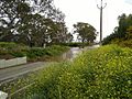
The Gawler River is a river located in the Adelaide Plains district of the Mid North region in the Australian state of South Australia.

Contents

The district surrounding the river produces cereal crops and sheep for both meat and wool, as well as market gardens, almond orchards and vineyards.

Course and features

Formed by the confluence of the North Para and South Para Rivers in the town of Gawler, the river flows generally west onto the Adelaide Plains. The mouth is in the Adelaide International Bird Sanctuary National Park—Winaityinaityi Pangkara, which consists primarily of mangroves in the tidal flats as the river empties into Gulf St Vincent. The outflow represents the boundary between the suburbs of Port Gawler on the northern bank and Buckland Park on the southern bank. The river descends 50 metres (160 ft) over its 41-kilometre (25 mi) course. [3]

Flooding

The Gawler is subject to periodic flood events and the cause of occasional flash flooding (during 1:10 to 1:50 year flood events). Major overtopping in large floods occurs along much of the river length. Significant flooding commences within Gawler township from both the North and South Para Rivers. [4]

Angle Vale

Baker Road ford, Virginia

September 2016 [5]

See also

Related Research Articles

Adelaide Capital of South Australia

Adelaide is the capital city of the state of South Australia, and the fifth-most populous city of Australia. The demonym Adelaidean is used to denote the city and the residents of Adelaide.

Protected areas of South Australia

Protected areas of South Australia consists of protected areas located within South Australia and its immediate onshore waters and which are managed by South Australian Government agencies. As of March 2018, South Australia contains 359 separate protected areas declared under the National Parks and Wildlife Act 1972, the Crown Land Management Act 2009 and the Wilderness Protection Act 1992 which have a total land area of 211,387.48 km2 (81,617.16 sq mi) or 21.5% of the state's area.

Macquarie River

Macquarie River a watercourse that is part of the Macquarie–Barwon catchment within the Murray–Darling basin, is one of the main inland rivers in New South Wales, Australia.

Sturt Highway

The Sturt Highway is an Australian national highway in New South Wales, Victoria, and South Australia. The Sturt Highway is an important road link for the transport of passengers and freight between Sydney and Adelaide and the regions situated adjacent to the route.

River Torrens River in Australia

The River Torrens, is the most significant river of the Adelaide Plains. It was one of the main reasons for the siting of the city of Adelaide, capital of South Australia. It flows 85 kilometres (53 mi) from its source in the Adelaide Hills near Mount Pleasant, across the Adelaide Plains, past the city centre and empties into Gulf St Vincent between Henley Beach South and West Beach. The upper stretches of the river and the reservoirs in its watershed supply a significant part of the city's water supply.

Port River River in Australia

The Port River is part of a tidal estuary located north of the Adelaide city centre in the Australian state of South Australia. It has been used as a shipping channel since the beginning of European settlement of South Australia in 1836, when Colonel Light selected the site to use as a port. Before colonisation, the Port River region and the estuary area were known as Yerta Bulti by the Kaurna people, and used extensively as a source of food and plant materials to fashion artefacts used in daily life.

Light Regional Council Local government area in South Australia

Light Regional Council is a local government area north of Adelaide in South Australia. It is based in the town of Kapunda, and includes the towns of Freeling, Greenock, Hansborough, Hewett, Roseworthy and Wasleys.

Riverland Region in South Australia

The Riverland is a region of South Australia. It covers an area of 9,386 square kilometres (3,624 sq mi) along the Murray River from where it flows into South Australia from New South Wales and Victoria downstream to Blanchetown. The major town centres are Renmark, Berri, Loxton, Waikerie, Barmera and Monash, along with many minor townships; the population is approximately 35,000 people.

Main North Road

Main North Road is the major north-south arterial route through the suburbs north of the Adelaide City Centre in the city of Adelaide, South Australia. It continues north through the settled areas of South Australia and is a total of 307 kilometres (191 mi) long, from North Adelaide to 21 kilometres (13 mi) out of Port Augusta. It follows the route established in the early years of the colony by explorer John Horrocks and was a major route for farmers and graziers to reach the capital, passing through rich farmland and the Clare Valley wine region. In 2011, the section of road between Gawler to Wilmington was renamed Horrocks Highway.

Outer Harbor railway line

The Outer Harbor railway line is a suburban branch line in Adelaide, South Australia. It runs from Adelaide station through the north western suburbs to Port Adelaide and Outer Harbor. It is 21.9 kilometres in length, and shares part of its run with the Grange line. It is operated by Adelaide Metro.

Blanchetown Town in South Australia

Blanchetown is a small township in South Australia, on the (west) bank of the Murray River, 130 kilometres (81 mi) northeast of Adelaide. The Blanchetown Bridge is the western-most of the four crossings of the Sturt Highway over the Murray River. During the nineteenth century it was an important transportation centre on the lower Murray. In the early 21st century, Blanchetown has been described as "a strange mixture of historic buildings and temporary shacks built by holidaymakers on the banks of the river". Blanchetown is widely regarded as the entrance to the Riverland district.

South Para River River in South Australia

The South Para River is a river located in the Mount Lofty Ranges northeast of Adelaide in the Australian state of South Australia.

Little Para River

The Little Para River is a seasonal creek running across the Adelaide Plains in the Australian state of South Australia, whose catchment fills reservoirs that supply some of the water needs of Adelaide’s northern suburbs.

Buckland Park, South Australia Suburb of Adelaide, South Australia

Buckland Park is a suburb on the northern rural outskirts of Adelaide, the capital city of South Australia. Port Wakefield Road, the main highway north from Adelaide, passes the eastern boundary. The northern boundary is the Gawler River, and the western side is Gulf St Vincent. Buckland Park is named after an early pioneer homestead in the area.

The Murraylands is a geographical region in South Australia; generally, the lower part of the Murray River basin, in South-Eastern South Australia. The area stretches from Blanchetown; roughly 130 kilometres north-east of Adelaide, right down to Wellington, which is situated at the beginning of Lake Alexandrina.

Munno Para, South Australia Suburb of Adelaide, South Australia

Munno Para is a northern suburb of Adelaide, South Australia. It is located in the City of Playford.

In South Australia, one of the states of Australia, there are many areas which are commonly known by regional names. Regions are areas that share similar characteristics. These characteristics may be natural such as the Murray River, the coastline, desert or mountains. Alternatively, the characteristics may be cultural, such as common land use. South Australia is divided by numerous sets of regional boundaries, based on different characteristics. In many cases boundaries defined by different agencies are coterminous.

Adelaide Dolphin Sanctuary Protected area in South Australia

Adelaide Dolphin Sanctuary is a marine protected area in the Australian state of South Australia located on the east coast of Gulf St Vincent in and adjoining the north-western part of the Adelaide metropolitan area and which was established in 2005 for the protection of a resident population of Indo-Pacific bottlenose dolphins .

Gawler Place, Adelaide

Gawler Place is a single-lane road in the city centre of Adelaide, the capital of South Australia. It runs north to south from North Terrace to Wakefield Street, parallel to and approximately midway between King William and Pulteney Streets.

Division of Spence Australian federal electoral division

The Division of Spence is an electoral district for the Australian House of Representatives. It is located in the outer northern suburbs of Adelaide in South Australia.

References

  1. "Placename Details: Mette Watte". Property Location Browser. Land Services, Government of South Australia. 4 January 2011. SA0000252. Retrieved 29 February 2016.
  2. 1 2 Pattiaratchi, Charitha; Jones, Rhys (July 2005). "Physical oceanographic studies of Adelaide coastal waters using high resolution modeling, in-situ observations and satellite techniques" (PDF). ACWS Technical Report No. 8 prepared for the Adelaide Coastal Waters Study Steering Committee. Centre for Water Research, University of Western Australia . Retrieved 5 June 2020.
  3. 1 2 "Map of Gawler River, SA". Bonzle Digital Atlas of Australia. Retrieved 25 March 2017.
  4. Australian Water Environments (15 September 2015). "Gawler River Floodplain Mapping Report" (PDF). Gawler River Floodplain Management Authority. Retrieved 25 March 2017.
  5. "SA weather: Gawler flooding in wake of severe storms as river levels peak". ABC News. abc.net.au. 30 September 2016. Retrieved 15 April 2017.