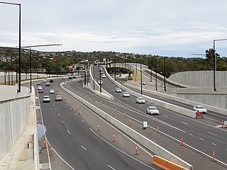
The Southern Expressway is an 18.5 km (11.5 mi) freeway in the southern suburbs of Adelaide, South Australia, between Bedford Park and Old Noarlunga. It is the southern part of the North–South Corridor which extends the full length of Adelaide and is being built to urban freeway standard.

The Mount Lofty Ranges are the range of mountains just to the east of Adelaide in the Australian state of South Australia.

The City of Onkaparinga is a local government area (LGA) located on the southern fringe of Adelaide, South Australia. It is named after the Onkaparinga River, whose name comes from Ngangkiparinga, a Kaurna word meaning women's river. It is the largest LGA in South Australia, with a population of over 170,000 people in both urban and rural communities and is also geographically expansive, encompassing an area of 518.3 km². The council is headquartered in the Noarlunga Centre with area offices situated in Aberfoyle Park, Woodcroft and Willunga.
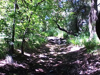
The Field River is an urban watercourse located in the southern suburbs of Adelaide in the Australian state of South Australia.

Clarendon is a small town in the Adelaide Hills, about 25–30 kilometres (16–19 mi) south of the Adelaide city centre and now regarded as an outer suburb of Adelaide. It lies within the City of Onkaparinga council area. The Clarendon Weir is located in the town area, on the Onkaparinga River.

The Onkaparinga River, known as Ngangkiparri in the Kaurna language, is a river located in the Southern Adelaide region in the Australian state of South Australia.

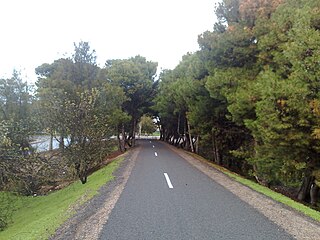
The Patrick Jonker Veloway is a sealed bikeway for the exclusive use of cyclists that runs continuously alongside the Southern Expressway for a distance of 7 km — from Marion/Main South Road to the Panalatinga Tunnel. South of the Panalatinga Tunnel, the bikeway becomes a shared track for the remaining 12 km of the Southern Expressway. It provides important links to other cycling facilities in the area, notably the Sturt River recreational trail at the Veloway's northern end, and the Coast to Vines rail trail at both Panalatinga Road and Southern end of the shared track. The Northern end of veloway links to the Sturt River shared path, providing an almost non-stop bicycle route between Glenelg and Willunga.

Woodcroft is a metropolitan suburb of Adelaide, South Australia, located 20 km south of the Central Business District of Adelaide. It is bordered to the north by Reynell Road, to the south by Bains Road, to the west by Panalatinga Road Road and by the Hills Face Zone to the east. The Panalatinga Creek also runs through the suburb.

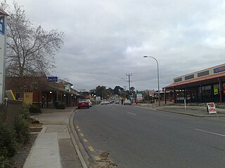
Reynella is a metropolitan suburb of Adelaide, South Australia.

John Reynell was an English-born emigrant to the colony of South Australian where he became established as a wheat farmer, a sheep and cattle breeder, and a vigneron and winemaker.
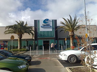
Noarlunga Centre is a suburb in the City of Onkaparinga in the southern suburbs of Adelaide, South Australia. The suburb is mostly commercial, being dominated by the Centro Colonnades shopping centre and the small 'Inspire Noarlunga' estate to the east of Goldsmith Road. The suburb is bordered by Beach Road to the north, Dyson Road to the west Goldsmith Road to the south and the Southern Expressway to the east. Burgess Drive, Seaman Road and David Witton Drive are the main thoroughfares inside the boundaries of the suburb.

Moana is an outer coastal suburb in the south of Adelaide, South Australia. The suburb is approximately 36.4 km from the Adelaide city centre. It lies within the City of Onkaparinga local government area, and neighbours the suburbs Seaford, Maslin Beach, Seaford Rise and Port Noarlunga
Old Reynella is a metropolitan suburb of Adelaide, South Australia. It is located 20 km south of the Adelaide city centre in the north of the City of Onkaparinga.
Reynella East is a metropolitan suburb of Adelaide, South Australia. It lies within the City of Onkaparinga and has postcode 5161. It is one of the smallest suburbs in South Australia.
Dorset Vale is a rural locality near Adelaide, South Australia. It straddles three local government areas adjacent to the Onkaparinga River, being within the Adelaide Hills, Mount Barker and the Onkaparinga council areas. The precise boundaries were set in April 1994 and extended in November 2003 for the long-established name. The first post office in the area was given the English name Dorset Vale circa 1850, but it was locally known as "Scotts Bottom" as it was downstream from Scott Creek. Scotts Bottom School opened in 1930, its name was changed to Dorset Vale in 1937 and it closed in 1944.
The Coast to Vines rail trail is a rail trail in the Australian state of South Australia following the course of the disused Willunga railway line in the southern suburbs of Adelaide. It is open to pedestrians and cyclists, and runs for 34 km from Marino to Willunga.
Southern Times Messenger is a weekly suburban newspaper in Adelaide, part of the Messenger Newspapers group. The Southern Times' area stretches from Lonsdale in the north, through to Sellicks Beach in the south, and covers the southern suburbs, accessible from the city via Main South Road and the more recently constructed Southern Expressway. The newspaper generally reports on events of interest in its distribution area, including the suburbs of Morphett Vale, Noarlunga, Reynella and Aldinga. It also covers the City of Onkaparinga council. It has a circulation of 57,690 and a readership of 95,000.

The Sturt River, also known as the Sturt Creek and Warri Parri in the Kaurna language, is a river located in the Adelaide region of the Australian state of South Australia.

Panalatinga Road is a north-south minor arterial road in the southern suburbs of Adelaide. It runs from the junction of Main South Road and the Southern Expressway in Reynella, and heads south past Wheatsheaf Road where it terminates soon after, continuing uphill as Coxs Hill Road into the Onkaparinga Hills. The original road reserve for the extension of Panalatinga Road carries on southwards as a “No Through Road” named St Vincent’s View terminating at several private gateways to adjacent acreage properties. The road reserve then continues across a creek gully to emerge on the other side of the gully as Kimbley Road at the junction of Spriggs Road. At least until the early 1960s it was possible to traverse this road reserve and cross the creek - by foot or by horseback but not by a vehicle - thus allowing travel along the full length of Panalatinga Road including its southern road reserve extension from Reynella in the north to Upper Penney’s Hill Road in the south at Hackam. The route was enhanced by partial clearing when a rough service vehicle track was created in the mid-1950s to assist with the laying out of high voltage power poles and lines, which now follow this road reserve for its full length. The current Panalatinga Road is a four lane dual carriageway for the 4.6 km length north of Wheatsheaf Road, and a two lane single carriageway for the 1 km to the south. The entire road has a speed limit of 80 km/h, and is used as an alternative to South Road and local road States Road. The majority of southbound traffic exits at Wheatsheaf Road, where the road reduces to a single lane, and the right southbound and left northbound lane are made for access to/from Wheatsheaf Road. The Panalatinga Creek runs under the road in the northern section, which gives this road its name. It is derived from the Kaurna name Pandlotinga, with the 'inga' suffix meaning 'path of water' which is often mispronounced as Panatalinga.
Keswick Creek and Glen Osmond Creek together form a watercourse flowing through the inner south-eastern, south-western and western suburbs of the Adelaide metropolitan area, in the Australian state of South Australia. The watercourse is part of the Patawalonga River catchment.
