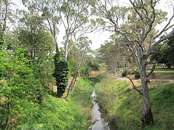
Brown Hill Creek, also known as Willawilla in the Kaurna language, is a watercourse flowing from the Adelaide Hills through in the inner south suburbs of the Adelaide metropolitan area, in the Australian state of South Australia. It is part of the Patawalonga River catchment.

Gawler is the oldest country town on the Australian mainland in the state of South Australia. It was named after the second Governor of the colony of South Australia, George Gawler. It is about 40–44 km (25–27 mi) north of the state capital, Adelaide, and is close to the major wine producing district of the Barossa Valley. Topographically, Gawler lies at the confluence of two tributaries of the Gawler River, the North and South Para rivers, where they emerge from a range of low hills.

The River Torrens is the most significant river of the Adelaide Plains. It was one of the main reasons for the siting of the city of Adelaide, capital of South Australia. It flows 85 kilometres (53 mi) from its source in the Adelaide Hills near Mount Pleasant, across the Adelaide Plains, past the city centre and empties into Gulf St Vincent between Henley Beach South and West Beach. The upper stretches of the river and the reservoirs in its watershed supply a significant part of the city's water supply.

The Eyre Peninsula is a triangular peninsula in South Australia. It is bounded by the Spencer Gulf on the east, the Great Australian Bight on the west, and the Gawler Ranges to the north.

The Mount Lofty Ranges are a range of mountains in the Australian state of South Australia which for a small part of its length borders the east of Adelaide. The part of the range in the vicinity of Adelaide is called the Adelaide Hills and defines the eastern border of the Adelaide Plains.

The Adelaide Plains is a plain in South Australia lying between the coast on the west and the Mount Lofty Ranges on the east. The southernmost tip of the plain is in the southern seaside suburbs of Adelaide around Brighton at the foot of the O'Halloran Hill escarpment with the south Hummocks Range and Wakefield River roughly approximating the northern boundary.

The Onkaparinga River, known as Ngangkiparri or Ngangkiparingga in the Kaurna language, is a river located in the Southern Adelaide region in the Australian state of South Australia. Rising in the Mount Lofty Ranges, the river's estuary extends from Old Noarlunga to the river's mouth between the suburbs of Port Noarlunga and Port Noarlunga South.

The North Para River is a river located in the Barossa Valley of the Australian state of South Australia.

Totness Recreation Park is a protected area in the Australian state of South Australia located within the localities of Mount Barker and Totness in the central Mount Lofty Ranges. Covering 41 hectares of land, the park is divided by the South Eastern Freeway and features a large dam. It was declared as a reserve in 1970 and re-designated as a recreation park in 1972. The park has no visitor facilities except for access tracks. It is the only park in the district, managed by the Department of Environment and Water, that is solely designated for recreation.

The Little Para River is a seasonal creek running across the Adelaide Plains in the Australian state of South Australia, whose catchment fills reservoirs that supply some of the water needs of Adelaide’s northern suburbs.

The County of Adelaide is one of the 49 cadastral counties of South Australia and contains the city of Adelaide. It was proclaimed on 2 June 1842 by Governor Grey. It is bounded by the Gawler River and North Para River in the north, the Mount Lofty Ranges in the east, and Gulf St Vincent in the west. The south border runs from Aldinga Bay to Willunga South and Mount Magnificent.

The Bremer River, part of the lower Murray-Darling catchment, is a river that is located in the Adelaide Hills region in the Australian state of South Australia.
Munno Para is a northern suburb of Adelaide, South Australia. It is located in the City of Playford.

South Australia is an Australian state, situated in the southern central part of the country, and featuring some low-lying mountain ranges, the most significant being the Mount Lofty Ranges, which extend into the state's capital city, Adelaide, which comprises most of the state's population. Adelaide is situated on the eastern shores of Gulf St Vincent, on the Adelaide Plains, north of the Fleurieu Peninsula, between Gulf St Vincent and the low-lying Mount Lofty Ranges. The state of South Australia, which stretches along the coast of the continent and has boundaries with every other state in Australia, with the exception of the Australian Capital Territory and Tasmania. The Western Australia border has a history with South Australia, involving the South Australian Government Astronomer, Dodwell and the Western Australian Government Astronomer, Curlewis in the 1920s to mark the border on the ground.

The Light River, commonly called the River Light, is a seasonal and significant river in the Mid North region of the Australian state of South Australia named for early surveyor William Light.

Barossa zone is a wine zone located in central South Australia west of the Murray River and which occupies the Barossa Valley, the Eden Valley and some adjoining land. The zone which is enclosed by the Mount Lofty Ranges zone on three sides and by the Lower Murray zone to its east, contains two wine regions which have received appellation as Australian Geographical Indications (AGI). These are the Barossa Valley and Eden Valley regions. The Barossa zone also includes a broader area around these two defined regions. The zone received AGI in 1996.
In South Australia, one of the states of Australia, there are many areas which are commonly known by regional names. Regions are areas that share similar characteristics. These characteristics may be natural such as the Murray River, the coastline, desert or mountains. Alternatively, the characteristics may be cultural, such as common land use. South Australia is divided by numerous sets of regional boundaries, based on different characteristics. In many cases boundaries defined by different agencies are coterminous.

NNeales Flat is a rural locality southeast of Eudunda in the Mid North region in South Australia. It is in the Regional Council of Goyder local government area, the South Australian House of Assembly electoral district of Stuart and the Australian House of Representatives Division of Grey.

The Hundred of Barossa is a cadastral unit of hundred in South Australia in the northern Adelaide Hills. It lies west of the Barossa Range at the south end of the Barossa Valley and is bounded on the north and south by the North Para and South Para rivers, respectively. It is the most northern of the eleven hundreds of the County of Adelaide and was named in 1846 by Governor Frederick Robe after the Barossa Range.
Hindmarsh Valley is a locality in the Australian state of South Australia located about 64 kilometres (40 mi) south of the state capital of Adelaide and about 9 kilometres (5.6 mi) north of the municipal seat in Victor Harbor.