Willochra Creek

Last updated

Willochra Creek
Willochra Creek Railway Bridge - showing men on and near the bridge(GN02204).jpg
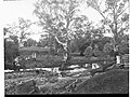
Willochra Creek Railway Bridge, 1917
Australia South Australia relief location map.png
Red pog.svg
Location
Country Australia
State South Australia
Region Far North
Physical characteristics
Source Mount Remarkable 5 kilometres (3.1 mi) east north east of Melrose
  coordinates 32°48′16″S138°08′20″E / 32.804460°S 138.139027°E / -32.804460; 138.139027
Mouth Lake Torrens
  location
61 km (38 mi) due west of Hawker
  coordinates
31°51′30″S137°46′56″E / 31.8582°S 137.78235°E / -31.8582; 137.78235 Coordinates: 31°51′30″S137°46′56″E / 31.8582°S 137.78235°E / -31.8582; 137.78235
Basin features
River system Lake Torrens

Willochra Creek is an ephemeral watercourse in the Far North region of South Australia. From Mount Remarkable, where it is also known as Mount Remarkable Creek, it flows generally eastwards to Melrose township at the foot of the mount. It thence flows generally northwards east of Mount Remarkable National Park across the eponymous Willochra Plain and through the locality of Bruce to the locality of Willochra itself at the heart of the plain. In Willochra locality the creek is also known as the Willochra Overflow and is joined by Boolcunda Creek. [1] Being assisted by flows from several other water courses north of Willochra locality, the flows ultimately end up crossing through a sharp gorge in the Flinders Ranges north of Mount Stephen and into the south end of Lake Torrens about 61 kilometres (38 mi) due west of Hawker.

See also

Related Research Articles

Brown Hill Creek river in South Australia, Australia

Brown Hill Creek, also known as Willawilla in the Kaurna language, is a watercourse flowing from the Adelaide Hills through in the inner south suburbs of the Adelaide metropolitan area, in the Australian state of South Australia. It is part of the Patawalonga River catchment.

The Wollemi Creek, a partly perennial stream of the Hawkesbury-Nepean catchment, is located in the Central Tablelands and Blue Mountains regions of New South Wales, Australia.

Mount Torrens, South Australia Town in South Australia

Mount Torrens is a town in the eastern Adelaide Hills region of South Australia, 46 kilometres east-north-east of the state capital, Adelaide and 8 km east of Lobethal. It is located in the Adelaide Hills Council and the Mid Murray Council local government areas. At the 2006 census, Mount Torrens had a population of 337.

Sturt River river in Australia

The Sturt River, also known as the Sturt Creek and Warri Parri in the Kaurna language, is a river located in the Adelaide region of the Australian state of South Australia.

Willochra may refer to:

Bruce, South Australia Town in South Australia

Bruce is a town and a locality in the Australian state of South Australia.

Mambray Creek, South Australia Suburb of District Council of Mount Remarkable, South Australia

Mambray Creek is a locality in the Australian state of South Australia located on the east coast of Spencer Gulf about 240 kilometres (150 mi) north of the state capital of Adelaide and about 40 kilometres (25 mi) north of the city of Port Pirie.

Dry Creek (South Australia) river in South Australia, Australia

Dry Creek or Dry Creek Drain is a seasonal stream in South Australia which passes through the Adelaide suburbs of Modbury, Walkley Heights and Pooraka. The nearby suburb of Dry Creek and Dry Creek railway station are named after the stream.

The Willochra Plain is a wide plain situated east of Port Augusta, South Australia. The area falls in view from Mount Brown Lookout and from walking trails in The Dutchmans Stern Conservation Park.

Willochra, South Australia Town in South Australia

Willochra is a rural locality and former town in the Flinders Ranges of South Australia, surveyed in 1860. It is at the heart of Willochra Plain which stretches approximately from Melrose to the Willochra locality, some distance northeast of Quorn, and is bisected by the Willochra Creek. The creek overflows across the plain within the locality of Willochra, being known as the 'Overflow of Willochra Creek'.

Light River (South Australia) river in Australia

The Light River, commonly called the River Light, is a seasonal and significant river in the Mid North region of the Australian state of South Australia named for early surveyor William Light.

Telowie Gorge Conservation Park Protected area in South Australia

Telowie Gorge Conservation Park is a protected area located in the Australian state of South Australia about 7.5 kilometres east of the town of Port Germein in the gazetted locality of Telowie.

Winninowie, South Australia Town in South Australia

Winninowie is a locality in the Mid North of South Australia. It is traversed by the Augusta Highway which is part of the Australian National Highway on Highway 1. It includes the intersection of Horrocks Pass Road, also known as Main North Road with the main highway. Winninowie is 21 kilometres (13 mi) southeast of Port Augusta, on the plain between Spencer Gulf on the west and the southern Flinders Ranges on the east.

County of Hindmarsh Cadastral in South Australia

The County of Hindmarsh is one of the 49 cadastral counties of South Australia. It was proclaimed by Governor George Grey in 1842 and named for Governor John Hindmarsh.

Baroota, South Australia Suburb of District Council of Mount Remarkable, South Australia

Baroota is a locality in the Australian state of South Australia located on the east coast of Spencer Gulf about 230 kilometres north of the state capital of Adelaide and about 29 kilometres (18 mi) north-east of the city of Port Pirie.

Mount Willoughby, South Australia Suburb of Pastoral Unincorporated Area, South Australia

Mount Willoughby is a locality in the Australian state of South Australia located about 837 kilometres north-west of the capital city of Adelaide and about 84 kilometres north-west of the town of Coober Pedy.

County of Frome Cadastral in South Australia

The County of Frome is one of the 49 cadastral counties of South Australia in straddling the Mid North and Flinders Ranges regions. It was proclaimed in 1851 by Governor Henry Young and was named for the former Surveyor-General of South Australia, Edward Charles Frome. The iconic Mount Remarkable in the Hundred of Gregory is at the centre of the county.

Burra Creek is a stream in South Australia rising in the northern Mount Lofty Ranges, flowing generally southwards and eastwards to join the River Murray at Morgan.

Moockra, South Australia Suburb of Flinders Ranges , South Australia

Moockra is a locality in the Australian state of South Australia located on the eastern side of the Flinders Ranges about 274 kilometres (170 mi) north of the state capital of Adelaide and about 47 kilometres (29 mi) north-east and 36 kilometres (22 mi) south-east respectively of the municipal seats of Melrose and Quorn.

Wirreanda Creek river in Australia

Wirreanda Creek is an ephemeral watercourse in the Far North region of South Australia. From the confluence of Pendowaga Creek and Cameron Creek, about 11 kilometres (6.8 mi) east of Cradock township, it flows generally westwards to join Kanyaka Creek, about 4 kilometres (2.5 mi) southwest of the historic Kanyaka Station homestead. The flows ultimately end up crossing through the Flinders Ranges into Lake Torrens via Willochra Creek.

References

  1. "Willochra Creek". Location SA Map Viewer. Government of South Australia. 17 January 2011. SA0025628. Retrieved 4 December 2019.