
The Spencer Gulf is the westernmost and larger of two large inlets on the southern coast of Australia, in the state of South Australia, facing the Great Australian Bight. It spans from the Cape Catastrophe and Eyre Peninsula in the west to Cape Spencer and Yorke Peninsula in the east.

Port Lincoln is a city on the Lower Eyre Peninsula in the Australian state of South Australia. It is situated on the shore of Boston Bay, which opens eastward into Spencer Gulf. It is the largest city in the West Coast region, and is located approximately 280 km as the crow flies from the State's capital city of Adelaide. In June 2019 Port Lincoln had an estimated population of 16,418, having grown at an average annual rate of 0.55% year-on-year over the preceding five years. The city is reputed to have the most millionaires per capita in Australia. The town claims to be the "Seafood Capital of Australia".

Port Augusta is a small city in South Australia. Formerly a seaport, it is now a road traffic and railway junction city mainly located on the east coast of the Spencer Gulf immediately south of the gulf's head and about 322 kilometres (200 mi) north of the state capital, Adelaide. The suburb of Port Augusta West is located on the west side of the gulf on the Eyre Peninsula. Other major industries included, up until the mid-2010s, electricity generation. At June 2018, the estimated urban population was 13,799, having declined at an average annual rate of -0.53% over the preceding five years.

The River Torrens, is the most significant river of the Adelaide Plains. It was one of the main reasons for the siting of the city of Adelaide, capital of South Australia. It flows 85 kilometres (53 mi) from its source in the Adelaide Hills near Mount Pleasant, across the Adelaide Plains, past the city centre and empties into Gulf St Vincent between Henley Beach South and West Beach. The upper stretches of the river and the reservoirs in its watershed supply a significant part of the city's water supply.

A body of water or waterbody is any significant accumulation of water, generally on a planet's surface. The term most often refers to oceans, seas, and lakes, but it includes smaller pools of water such as ponds, wetlands, or more rarely, puddles. A body of water does not have to be still or contained; rivers, streams, canals, and other geographical features where water moves from one place to another are also considered bodies of water.
Lake Torrens is a large ephemeral, normally endorheic salt lake in central South Australia. After sufficiently extreme rainfall events, the lake flows out through the Pirie-Torrens corridor to the Spencer Gulf.

The Eyre Peninsula is a triangular peninsula in South Australia. It is bounded on the east by Spencer Gulf, the west by the Great Australian Bight, and the north by the Gawler Ranges.

The Loddon River, an inland river of the north–central catchment, part of the Murray-Darling basin, is located in the lower Riverina bioregion and Central Highlands and Loddon Mallee regions of the Australian state of Victoria. The headwaters of the Loddon River rise on the northern slopes of the Great Dividing Range east of Daylesford and descend to flow north into the Little Murray River, near Swan Hill. The river is impounded by the Cairn Curran and Laanecoorie reservoirs. The Tullaroop Creek tributary which joins just above Laanecoorie Reservoir, is impounded by the Tullaroop Reservoir (72,950ML).
Goolwa is a historic river port on the Murray River near the Murray Mouth in South Australia, and joined by a bridge to Hindmarsh Island. The name "Goolwa" means "elbow" in Ngarrindjeri, the local Aboriginal language, and the area was known as "The Elbow" to the early settlers.

The Tambo River or Berrawan is a perennial river of the Mitchell River catchment, located in the East Gippsland region of the Australian state of Victoria. With a total length in excess of 186 kilometres (116 mi), the Tambo River is one of the longest rivers in the East Gippsland drainage basin, extending from the steep forested southern slopes of the Victorian Alps through forest and farmland to the Gippsland Lakes.

The Little Para River is a seasonal creek running across the Adelaide Plains in the Australian state of South Australia, whose catchment fills reservoirs that supply some of the water needs of Adelaide’s northern suburbs.

Investigator Strait is a body of water in South Australia lying between the Yorke Peninsula, on the Australian mainland, and Kangaroo Island. It was named by Matthew Flinders after his ship, HMS Investigator, on his voyage of 1801–1802. It is bordered by the Gulf St Vincent in the northeast.

The Glenelg River, a perennial river of the Glenelg Hopkins catchment, is located in the Australian states of Victoria and South Australia.
As Australia's supply of freshwater is increasingly vulnerable to droughts, possibly as a result of climate change, there is an emphasis on water conservation and various regions have imposed restrictions on the use of water.

The Broughton River is a river in the Australian state of South Australia.

The Hill River is an ephemeral river located in the Mid North region of the Australian state of South Australia.

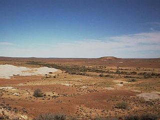
The Tod Reservoir is located on the Eyre Peninsula in South Australia, in the localities of Whites Flat and Koppio, 27 km north of Port Lincoln. It is situated on the Tod River, the only stream on Eyre Peninsula, South Australia providing reliable flows; the reservoir is supplied by concrete channels fed from weirs constructed across the Tod River and its major tributary, Pillaworta Creek. The river was named after Robert Tod who discovered it during explorations in 1839. The Tod River flows into Louth Bay in Spencer Gulf. The reservoir is listed on the South Australian Heritage Register.
Water Witch was a single-masted vessel rigged as a cutter built during 1835 in Van Diemen's Land and sunk in 1842 whilst moored in the River Murray at Moorundie, south of Blanchetown in South Australia (SA). Her wreck site was discovered in 1982 and received statutory protection as a historic shipwreck in 1983. The wreck site was the subject of an underwater survey in March 1984. She is notable for being the first European vessel to enter the River Murray via its mouth, her role in the charting of the lower reaches of the River Murray including Lake Alexandrina whilst under the command of William Pullen and her association with Edward John Eyre.
In South Australia, one of the states of Australia, there are many areas which are commonly known by regional names. Regions are areas that share similar characteristics. These characteristics may be natural such as the Murray River, the coastline, desert or mountains. Alternatively, the characteristics may be cultural, such as common land use. South Australia is divided by numerous sets of regional boundaries, based on different characteristics. In many cases boundaries defined by different agencies are coterminous.
Baroota is a locality in the Australian state of South Australia located on the east coast of Spencer Gulf about 230 kilometres north of the state capital of Adelaide and about 29 kilometres (18 mi) north-east of the city of Port Pirie.
