
Rear-Admiral Sir John Hindmarsh KH was a naval officer and the first Governor of South Australia, from December 28, 1836 to July 16, 1838.
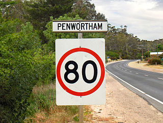
Penwortham is a small town in the Clare Valley, South Australia, along the Horrocks Highway, approximately 10 kilometres south of Clare and 14 kilometres north of Auburn.

Finniss is a single-member electoral district for the South Australian House of Assembly. It is named after B. T. Finniss, the first Premier of South Australia. It covers a 1,004 km2 (388 sq mi) regional area which includes the localities of Back Valley, Currency Creek, Encounter Bay, Finniss, Goolwa, Goolwa Beach, Goolwa North, Goolwa South, Hayborough, Hindmarsh Island, Hindmarsh Tiers, Hindmarsh Valley, Lower Inman Valley, McCracken, Middleton, Mosquito Hill, Mount Compass, Mount Observation, Mundoo Island, Nangkita, Port Elliot, Tooperang, and Victor Harbor; as well as parts of Inman Valley and Waitpinga.

The Bremer River, part of the lower Murray-Darling catchment, is a river that is located in the Adelaide Hills region in the Australian state of South Australia.
The City of Victor Harbor is a local government area of South Australia. It covers an area of 386.5 square kilometres (149.2 sq mi) along the coast, about 80 kilometres (50 mi) south of Adelaide, the capital of South Australia. The council is responsible for the town of Victor Harbor, which contains over 85% of its population, and the surrounding rural area to the north and west. The City of Victor Harbor had an estimated population of over 14,000 at the 2016 Census.
John Dallachy was a curator of Melbourne Botanic Gardens and a plant collector.

The Southern Argus is a newspaper first published from March 1866 in Port Elliot, South Australia, and then in Strathalbyn from 1868 to the present. It is published on Thursdays.
Hindmarsh was an electoral district of the House of Assembly in the Australian state of South Australia from 1938 to 1970. It was in the northwestern suburbs of Adelaide.

The County of Hindmarsh is one of the 49 cadastral counties of South Australia. It was proclaimed by Governor George Grey in 1842 and named for Governor John Hindmarsh.

The Hundred of Strathalbyn is a cadastral division of the County of Hindmarsh in South Australia. It lies west of the Adelaide Hills and east of Lake Alexandrina and includes at its southwestern extremity the town of Strathalbyn. Its name is derived from that used for a sub-division granted in 1841. No definitive derivation for the subdivision of Strathalbyn name is known but it is deemed probable that John Rankine or his brother William provided the name with the meaning given as "white valley" from the Scottish srath and albion. Mount Barker Creek forms much of the northern hundred boundary while the Bremer River forms the eastern border.
The District Council of Willunga, was a local government area in South Australia seated at Willunga from 1853 until 1997.
The District Council of Hindmarsh was a local government area in South Australia from 1853 to 1875, seated at the inner north west Adelaide suburb of Hindmarsh.

The Town of Hindmarsh was a local government area in South Australia from 1874 to 1993, encompassing on the inner north west Adelaide suburbs of Hindmarsh, Bowden and Brompton.
The Wotjobaluk are an Aboriginal Australian people of the state of Victoria. They are closely related to the Wergaia people.

The Hundred of Barossa is a cadastral unit of hundred in South Australia in the northern Adelaide Hills. It lies west of the Barossa Range at the south end of the Barossa Valley and is bounded on the north and south by the North Para and South Para rivers, respectively. It is the most northern of the eleven hundreds of the County of Adelaide and was named in 1846 by Governor Frederick Robe after the Barossa Range.

Spring Mount Conservation Park, formerly the Spring Mount Wild-Life Reserve, is a protected area in the Australian state of South Australia located in the localities of Hindmarsh Valley and Inman Valley about 57 kilometres (35 mi) south of the state capital of Adelaide.
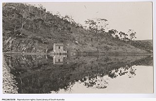
Hindmarsh Valley Reservoir is a reservoir in the Australian state of South Australia located in the gazetted locality of Hindmarsh Valley about 11 kilometres (7 mi) north of the municipal seat in Victor Harbor.
Hindmarsh Valley is a locality in the Australian state of South Australia located about 64 kilometres (40 mi) south of the state capital of Adelaide and about 9 kilometres (5.6 mi) north of the municipal seat in Victor Harbor.


