Gladesville Bridge is a heritage-listed concrete arch road bridge that carries Victoria Road over the Parramatta River, linking the Sydney suburbs of Huntleys Point and Drummoyne, in the local government areas of Canada Bay and Hunter's Hill, in New South Wales, Australia. Despite its name, the bridge is not in Gladesville.

Gawler is the oldest country town on the Australian mainland in the state of South Australia. It was named after the second Governor of the colony of South Australia, George Gawler. It is about 40–44 km (25–27 mi) north of the state capital, Adelaide, and is close to the major wine producing district of the Barossa Valley. Topographically, Gawler lies at the confluence of two tributaries of the Gawler River, the North and South Para rivers, where they emerge from a range of low hills.

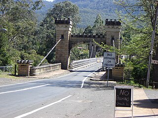
Hampden Bridge is a heritage-listed single-span suspension bridge that carries Moss Vale Road (B73) across the Kangaroo River, in Kangaroo Valley, in the City of Shoalhaven local government area of New South Wales, Australia. The bridge was designed by Ernest de Burgh and built by Loveridge and Hudson. The property is owned by Transport for NSW. It was added to the New South Wales State Heritage Register on 2 August 2019.

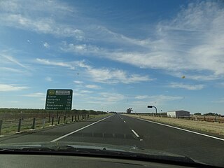
Northern Expressway, also known as the Fatchen Northern Expressway, is a 21 kilometre long controlled-access highway in Adelaide, South Australia. Since March 2020, the North–South Motorway continues west of Port Wakefield Highway and intersects the Port River Expressway to reach the harbour at Port Adelaide. These are the northernmost two parts of the North–South Corridor.

The Gawler River is a river located in the Adelaide Plains district of the Mid North region in the Australian state of South Australia.

The Denison Bridge is a heritage-listed footbridge over the Macquarie River in Bathurst, New South Wales, Australia. It is the fourth oldest metal truss bridge existing in Australia.
Hillier is a northern suburb of Adelaide, South Australia. It is located in the Town of Gawler.

Angle Vale is a semi-rural town on the Adelaide Plains between Gawler and Virginia in South Australia. It is steadily being surrounded by Adelaide's suburban sprawl. It is close to many vineyards and farms. The town includes Trinity College's Gawler River campus, Angle Vale Primary School and Riverbanks College. Some students travel to nearby towns or to Gawler.

The Nepean River railway bridge is a heritage-listed railway bridge that carries the Main Southern railway line across Menangle Road and the Nepean River located at the outer south-western Sydney settlement of Menangle in the Wollondilly Shire local government area of New South Wales, Australia. It was designed by John Whitton as the Engineer-in-Chief, of the New South Wales Government Railways and NSW Department of Public Works. The railway bridge was built in 1863 by Messers Peto, Brassey and Betts. It is also known as Menangle rail bridge over Nepean River and Menangle Railway Bridge. The property was added to the New South Wales State Heritage Register on 2 April 1999.

The Bethanga Bridge is a steel truss road bridge that carries the Riverina Highway across Lake Hume, an artificial lake on the Murray River in Australia. The dual heritage-listed bridge crosses the border between the Australian states of New South Wales and Victoria, linking the Victorian towns of Bellbridge and Bethanga with the regional New South Wales city of Albury.

Johnston Street Bridge is a concrete road bridge crossing the Yarra River between the Melbourne suburbs of Abbotsford and Kew.

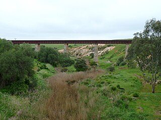
The Roseworthy–Peterborough railway line is a closed railway line in South Australia. It was first opened from a junction at Roseworthy on the Morgan railway line through Hamley Bridge, Riverton, initially to Tarlee, then extended in stages to Peterborough. The line was closed in sections in the 1980s with the final section from Gawler to Roseworthy being used in 2007.

The Hamley Bridge–Gladstone railway line was a railway line on the South Australian Railways network. It extended from a junction at Hamley Bridge on the Roseworthy-Peterborough line through Balaklava and Brinkworth to Gladstone.

The Macdonald River railway bridge is a heritage-listed railway bridge that carries the Main Northern Line across the Macdonald River located in Woolbrook, in the Walcha Shire, New South Wales, Australia. The railway bridge was designed by John Whitton as the Engineer-in-Chief for the New South Wales Government Railways and built during 1882 by J. S. Bennett, with iron work by J. & C. Brettell, Worcester, England. The railway bridge is also known as the Woolbrook rail bridge over the Macdonald River and the Woolbrook Lattice Railway Bridge. The bridge and adjacent infrastructure is owned by Transport Asset Holding Entity, an agency of the Government of New South Wales. The bridge was added to the New South Wales State Heritage Register on 2 April 1999 and was added to the Register of the National Estate on 18 April 1989.

The Macquarie River railway bridge is a heritage-listed disused railway bridge across the Macquarie River that was previously located on the Main Western line in Bathurst in the Bathurst Region local government area of New South Wales, Australia. It was built in 1876. It is also known as Bathurst Rail Bridge over Macquarie River and Bathurst – Kelso Railway Bridge. The property is owned by Transport Asset Holding Entity, an agency of the Government of New South Wales. The bridge was added to the New South Wales State Heritage Register on 2 April 1999 and was added to the Register of the National Estate on 18 April 1989.

The Dubbo rail bridge over Macquarie River – Wambuul is a heritage-listed railway bridge on the Main Western line across the Macquarie River, located west of the Dubbo central business district in New South Wales, Australia. It was designed by John Whitton as the Engineer-in-Chief for the New South Wales Government Railways. The bridge was built during 1884 by Benjamin Barnes, with ironwork by Cochrane & Co, Middlesborough, England. The railway bridge is also known as the Dubbo Lattice Railway Bridge. The property is owned by Transport Asset Holding Entity, an agency of the Government of New South Wales. The bridge was added to the New South Wales State Heritage Register on 2 April 1999 and was listed on the Register of the National Estate on 18 April 1989.

The Murray River road bridge is a heritage-listed road bridge that carries Swan Hill Road across the Murray River, on the border between New South Wales and Victoria, Australia. The bridge connects Murray Downs in New South Wales with McCallum Street in Swan Hill, Victoria. The bridge was built in 1896 and is owned by Transport for NSW. The bridge is also called the Swan Hill Bridge and the Swan Hill-Murray River Road Bridge. It was added to the New South Wales State Heritage Register on 20 June 2000.

The Murrumbidgee River railway bridge is a heritage-listed railway bridge across the Murrumbidgee River located on the Tumut railway line at Gundagai in the Cootamundra-Gundagai Regional Council local government area of New South Wales, Australia. It was built in 1903. It is also known as the Gundagai Rail Bridge over Murrumbidgee River and the Murrumbidgee River Railway Bridge. The property was added to the New South Wales State Heritage Register on 2 April 1999.

Murrumbidgee River railway bridge is a heritage-listed disused railway bridge on the Tocumwal railway line crossing from Narrandera to Gillenbah, both in Narrandera Shire, New South Wales, Australia. It was designed by John Whitton in his capacity as Engineer-in-Chief for Railways, and built in 1884–85 by Halliday & Owen with ironwork supplied by English firm Westwood, Baillie. It is also known as Narrandera Lattice Railway Bridge. The property was added to the New South Wales State Heritage Register on 2 April 1999 and was added to the Register of the National Estate on 15 May 1990.

The Chirk Viaduct is a Grade II* listed railway viaduct over the River Ceiriog between England and Wales. The viaduct carries the Shrewsbury–Chester line from the Welsh town of Chirk in historic Denbighshire from the north to the English village of Chirk Bank in Weston Rhyn, Shropshire to the south. To the east, the Chirk Aqueduct lies parallel to the railway viaduct.


