This article needs additional citations for verification .(November 2014) |
Adelaide Plains South Australia | |
---|---|
Coordinates | 34°56′21.69″S138°35′51.25″E / 34.9393583°S 138.5975694°E |
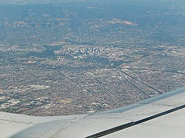
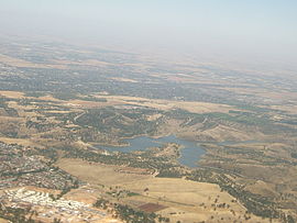
The Adelaide Plains (Kaurna name Tarndanya) is a plain in South Australia lying between the coast (Gulf St Vincent) on the west and the Mount Lofty Ranges on the east. [1] [2] The southernmost tip of the plain is in the southern seaside suburbs of Adelaide around Brighton at the foot of the O'Halloran Hill escarpment with the south Hummocks Range and Wakefield River roughly approximating the northern boundary.[ citation needed ]
Traditionally entirely occupied by the Kaurna (indigenous) people, the Adelaide Plains are crossed by a number of rivers and creeks, but several dry up during summer. [3] The rivers (from south to north) include: the Onkaparinga/Ngangki, Sturt/Warri Torrens/Karra Wirra, Little Para, Gawler, Light/Yarralinka and Wakefield/Undalya. The plains are generally fertile with annual rainfall of about 460 millimetres (18 in) per year.
The plain can be roughly divided into three parts. The southern area is now covered by the city of Adelaide, the capital of South Australia. The central area is considered the breadbasket of South Australia with many market gardens and wineries, particularly around the towns of Virginia and Angle Vale. The northern area is predominantly used for growing cereal grains such as wheat, barley, and canola, and farming sheep.
Usage of the term Adelaide Plains frequently refers to a central and non-metropolitan subset of the plain. This is evidenced by the local government area of Adelaide Plains Council, which occupies 932 square kilometres (360 sq mi) from the Gawler River in the south to Wild Horse Plains, Long Plains and Grace Plains north of Dublin and Mallala.
Adelaide is the capital city of South Australia, the state's largest city and the fifth-most populous city in Australia. "Adelaide" may refer to either Greater Adelaide or the Adelaide city centre. The demonym Adelaidean is used to denote the city and the residents of Adelaide. The Traditional Owners of the Adelaide region are the Kaurna people. The area of the city centre and surrounding Park Lands is called Tarndanya in the Kaurna language.
One Tree Hill is a town on the outskirts of Adelaide, South Australia. It is located in the City of Playford.
The Kaurna people are a group of Aboriginal people whose traditional lands include the Adelaide Plains of South Australia. They were known as the Adelaide tribe by the early settlers. Kaurna culture and language were almost completely destroyed within a few decades of the British colonisation of South Australia in 1836. However, extensive documentation by early missionaries and other researchers has enabled a modern revival of both language and culture. The phrase Kaurna meyunna means "Kaurna people".
Gawler is the oldest country town on the Australian mainland in the state of South Australia. It was named after the second Governor of the colony of South Australia, George Gawler. It is about 40–44 km (25–27 mi) north of the centre of the state capital, Adelaide, and is close to the major wine producing district of the Barossa Valley. Topographically, Gawler lies at the confluence of two tributaries of the Gawler River, the North and South Para rivers, where they emerge from a range of low hills.
Victoria Square, also known as Tarntanyangga, is the central square of five public squares in the Adelaide city centre, South Australia.
This article details the history of Adelaide from the first human activity in the region to the 20th century. Adelaide is a planned city founded in 1836 and the capital of South Australia.
The Mid North is a region of South Australia, north of the Adelaide Plains and south of the Far North and the outback. It is generally accepted to extend from Spencer Gulf east to the Barrier Highway, including the coastal plain, the southern part of the Flinders Ranges, and the northern part of the Mount Lofty Ranges. The Temperate Grassland of South Australia cover most of the area.
Bonython Park is a 17-hectare park in the north-west Park Lands of the South Australian capital of Adelaide. The park was opened in 1962 and named in honour of prominent South Australian politician and journalist, Sir John Langdon Bonython. It is situated on the north-western side of the River Torrens, bordered by Port Road. It is on the opposite side of the river to a golf course, and adjacent to the old Adelaide Gaol and the Police Barracks.
Main North Road is the major north-south arterial route through the suburbs north of the Adelaide City Centre in the city of Adelaide, South Australia. It continues north through the settled areas of South Australia and is a total of 307 kilometres (191 mi) long, from North Adelaide to 21 kilometres (13 mi) out of Port Augusta.
Aldinga is a suburb of Adelaide in South Australia located about 45 kilometres south of the Adelaide city centre in the City of Onkaparinga. It is a small suburb, about a kilometre east of the edge of the larger suburb of Aldinga Beach, and about 3 km (1.9 mi) from the beachfront.
Nunga is a term of self-identification for Aboriginal Australians, originally used by Aboriginal people in the southern settled areas of South Australia, and now used throughout Adelaide and surrounding towns. It is used by contrast with Gunya, which refers to non-Aboriginal persons. The use of "Nunga" by non-Aboriginal people is not always regarded as appropriate.
Bowmans is a locality in South Australia's Mid North. At the 2006 census, Bowmans had a population of 203. It is named after R and C Bowman who were "pastoralists in area."
The Adelaide Plains Council is a local government area in South Australia. It consists of a largely rural region along the Gulf St Vincent, covering a total area of approximately 926 km2. The council seat lies at Mallala, but it also maintains a service centre at Two Wells.
Yankalilla is an agriculturally based town situated on the Fleurieu Peninsula in South Australia, located 72 km south of the state's capital of Adelaide. The town is nestled in the Bungala River valley, overlooked by the southern Mount Lofty Ranges and acts as a service centre for the surrounding agricultural district.
Evanston South is a northern suburb of Adelaide, South Australia in the Town of Gawler. It is on the eastern side of Main North Road on the southern side of Gawler.
Aldinga Scrub Conservation Park is a protected area in the Australian state of South Australia located in the suburb of Aldinga Beach about 46 kilometres south by west of the state capital of Adelaide.
The Adelaide International Bird Sanctuary National Park—Winaityinaityi Pangkara is a protected area in South Australia established by the South Australian government on the northeast coast of Gulf St Vincent, between Parham in the north and the southern end of Barker Inlet in the south, for the purpose of rehabilitating land used as salt pans, protecting habitat for international migratory shorebirds, managing water quality in adjoining parts of Gulf St Vincent, creation of "green" space, development of niche tourism and creation of opportunities for Indigenous people.
In South Australia, one of the states of Australia, there are many areas which are commonly known by regional names. Regions are areas that share similar characteristics. These characteristics may be natural such as the Murray River, the coastline, desert or mountains. Alternatively, the characteristics may be cultural, such as common land use. South Australia is divided by numerous sets of regional boundaries, based on different characteristics. In many cases boundaries defined by different agencies are coterminous.
The Aboriginal South Australians are the Indigenous people who lived in South Australia prior to the British colonisation of South Australia, and their descendants and their ancestors. There are difficulties in identifying the names, territorial boundaries, and language groups of the Aboriginal peoples of South Australia, including poor record-keeping and deliberate obfuscation, so only a rough approximation can be given here.
The Hundred of Mudla Wirra is a cadastral unit of hundred located on the northern Adelaide Plains of South Australia, first proclaimed in 1847. The hundred is bounded on the north by the Light River and on the south by the Gawler River.