Undalya, South Australia

Last updated

Undalya
South Australia
Undalyabridge.jpg
Basket Bridge, Undalya, circa 2009
Australia South Australia location map.svg
Red pog.svg
Undalya
Coordinates 34°04′25″S138°41′33″E / 34.07361°S 138.69250°E / -34.07361; 138.69250 Coordinates: 34°04′25″S138°41′33″E / 34.07361°S 138.69250°E / -34.07361; 138.69250
Population29 (2016 census) [1]
Established1859
Postcode(s) 5451
Time zone ACST (UTC+9:30)
 • Summer (DST) ACDT (UTC+10:30)
LGA(s) District Council of Clare and Gilbert Valleys
State electorate(s) Frome
Federal Division(s) Grey
Localities around Undalya:
Hoyleton Auburn Manoora
Halbury Undalya Saddleworth
Woolshed Flat Rhynie Riverton

Undalya (Postcode: 5451) is a small rural town on the southern edge of the Clare Valley, in the mid north of the state of South Australia. It is located on the Horrocks Highway approximately halfway between the towns of Auburn and Rhynie, at the junction of the River Wakefield and Pine Creek. To the east lies the town of Saddleworth and to the south-west lies the town of Balaklava. The town was officially gazetted as Undalya in 1859.

Contents

Meaning

The name Undalya was given by the local Aborigines and means "water holes", while the surrounding district was known as Kercoonda meaning "camp near water". In the early years of the village, Aborigines were in great numbers in the district.

History and events

Recent
photo of the Bible Christian Church and School (now a private residence). Undalyachapel.jpg
Recent photo of the Bible Christian Church and School (now a private residence).

On one of his expeditions, explorer Edward John Eyre camped at Undalya and commented on the large amount of water in the River Wakefield as well as the availability of the local blue limestone.

The most notable feature of Undalya is the local bridge over the River Wakefield. Built in 1855, with various alterations, additions and repairs, the bridge is known locally by three names: Basket Bridge, Cradle Bridge or Coathanger Bridge. It has taken the full force of many floods and at one time was the biggest one-span bridge in South Australia. The bridge was bypassed with a new bridge slightly to the east of it in the 1950s and today only serves the local residents.

In 1859, a local farmer sold one quarter of an acre for a Bible Christian Church. The Church was built in 1859 and the next year a school was commenced inside it. Both were open for nearly 100 years. Today the building is part of a private residence.

In 1866, with a grant of money and land from another local farmer, the Roman Catholic Church of St. Patrick was built by the Jesuit Fathers of Sevenhill on the hill just south of the village. The church closed in 1915 and was later demolished. A graveyard was attached to the church, and is still operating as a cemetery today. People buried there include Patrick Michael Ryan, who discovered copper at Tiparra in 1861, which was the start of the famous Moonta mine, and the first wife of the father of Auburn poet C.J. Dennis.

One of the biggest local industries during the 19th century was that of wool-scouring, or wool-washing in the River Wakefield. One such example is that of George Henry Michell, who moved his family to Undalya in 1870, after living at Cudlee Creek, where he had acquired the art of wool-scouring. He persuaded some local farmers to sell their wool directly to him. The wool was processed in the river and packed off to Adelaide and then shipped to London and auctioned. His operation was hugely successful and in 1896 he was forced to move to Hindmarsh near Adelaide. Today, Michell is a large multi-national company, run by descendants of George Henry Michell. The company's factory is located on Main North Road at Salisbury South. The Michell homestead at Undalya still stands today and is used as an animal shelter.[ when? ]

In the mid-to-late 19th century, ancestors of Australian Football Hall of Fame footballer Neil Kerley lived at Undalya.[ citation needed ]

In the mid-19th century to the early 20th century, according to the newspapers of the time, Undalya was a thriving rural village with reports of ploughing matches, horse racing and even a shooting at the local hotel, where the owner shot a customer who, on being refused service, had jumped the counter to serve himself.

Today the village is nothing more than a collection of a few houses around a rarely used bridge.

Notable former residents include author, illustrator and naturalist, Mervinia Masterman.

Governance

Undalya is in the District Council of Clare and Gilbert Valleys, the State Electoral District of Frome, and the Australian House of Representatives Division of Grey.

Related Research Articles

Watervale, South Australia Town in South Australia

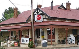
Watervale is a town on the Horrocks Highway in the Clare Valley, South Australia, approximately 9 kilometres north of Auburn and 15 kilometres south of Clare. It is surrounded by a number of small wineries and several B&Bs. The Riesling Trail runs past the town to the west, between the Highway and the Skilly Hills. The town has a number of 19th-century heritage buildings, including the former Stanley Grammar School, which now provides private bed and breakfast accommodation.

Penwortham, South Australia Town in South Australia

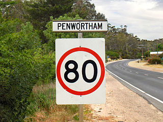
Penwortham is a small town in the Clare Valley, South Australia, along the Horrocks Highway, approximately 10 kilometres south of Clare and 14 kilometres north of Auburn.

Auburn, South Australia Town in South Australia

Auburn is a small town in the southern edge of the Clare Valley, in the Mid North of South Australia.

The Macdonald River is a perennial river located in the Hunter and Outer Metropolitan Sydney regions of New South Wales, Australia. It is a part of the Hawkesbury-Nepean catchment.

Balaklava, South Australia Town in South Australia

The town of Balaklava is located in South Australia, 92 kilometres north of Adelaide in the Mid North region. It is on the south bank of the Wakefield River, 25 kilometres east of Port Wakefield.

Clare and Gilbert Valleys Council Local government area in South Australia

The Clare and Gilbert Valleys Council is a local government area located in the Yorke and Mid North region of South Australia. The council was founded on 1 July 1997 with the amalgamation of the District Council of Clare, the District Council of Riverton and the District Council of Saddleworth and Auburn. The council seat is located at Clare; it also maintains branch offices at Riverton and Saddleworth.

Clare, South Australia Town in South Australia

The town of Clare is located in South Australia in the Mid North region, 136 km north of Adelaide. It gives its name to the Clare Valley wine and tourist region.

Skilly Hills

The Skilly Hills are a range of hills which make up part of the Mount Lofty Ranges in South Australia's Mid North region.

Mintaro, South Australia Town in South Australia

Mintaro is a historic town in the eastern Clare Valley, east of the Horrocks Highway, about 126 kilometres north of Adelaide, South Australia. The town lies at the south-eastern corner of the Hundred of Clare, within the Clare Valley wine region. Established in 1849, Mintaro is situated on land which was bought originally by Joseph and Henry Gilbert, which they sub-divided into 80 allotments.

Leasingham, South Australia Town in South Australia

Leasingham is the name of a hamlet on the southern edge of the Clare Valley, in the Mid North of South Australia. It is approximately 117 kilometres from the state's capital, Adelaide and 17 kilometres south of the town of Clare.

Halbury, South Australia Town in South Australia

Halbury is a former railway town in South Australia, west of the Clare Valley, halfway between Balaklava and Auburn. At the 2006 census, Halbury had a population of 363.

Ross, Tasmania Town in Tasmania, Australia

Ross is a historic town in the Midlands of the state of Tasmania in Australia. On the Macquarie River, Ross is located 78 km south of Launceston and 117 km north of Hobart. The town is listed on the Register of the National Estate and is noted for its historic bridge, original sandstone buildings and convict history.

Ginninderra

Ginninderra is the name of the former agricultural lands surrendered to urban development on the western and north-western fringes of Canberra, the capital of Australia. Ginninderra corresponds with the watershed of Ginninderra Creek, which is now in part occupied by the Canberra districts of Belconnen and Gungahlin.

Whitwarta, South Australia Town in South Australia

Whitwarta is a town in South Australia. The town is situated beside the Wakefield River about 100 km north of the state capital, Adelaide. The name Whitwarta means freshwater, a reference to the freshwater springs that exist along the pronounced bend in the river nearby. The constant availability of freshwater along an otherwise dry river meant that Whitwarta was a suitable place to establish a village. Approximately 20 people now live in the village.

Wakefield River

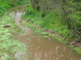
The Wakefield River is an ephemeral river that flows to an estuary in the Australian state of South Australia.

River Calder, West Yorkshire

The River Calder is in West Yorkshire, in Northern England.

G. H. Michell and Sons was an Australian wool processing and broking company based in Hindmarsh, South Australia, relocated to Salisbury, South Australia and with a change in company structure in the 1980s became Michell Australia Pty Ltd then the Michell Group of Companies.

Pine Creek, South Australia Town in South Australia

Pine Creek is a rural locality in the Mid North region of South Australia, situated in the Regional Council of Goyder. It was established in August 2000 when boundaries were formalised for the long established local name.

Hundred of Alma Cadastral in South Australia

The Hundred of Alma is a cadastral unit of hundred located on the northern Adelaide Plains of South Australia spanning the township of Alma and the Alma Plains. The hundred was proclaimed in 1856 in the County of Gawler and named by Governor Richard Graves MacDonnell for the River Alma on the Crimean Peninsula, the location of the Battle of the Alma, the first Allied victory in the Crimean War. The hundred is bounded on the north by the Wakefield River and on the south by the Light River

Corporation and District Council of Clare Local government area in South Australia

The Corporation and District Council of Clare were twin local government areas in South Australia centred on the town of Clare. The district council existed from 1853 until 1997, while the town corporation existed from 1868 until 1969.

References

  1. Australian Bureau of Statistics (27 June 2017). "Undalya". 2016 Census QuickStats. Retrieved 27 February 2020. OOjs UI icon edit-ltr-progressive.svg