
Hawker is a town and a locality in the Flinders Ranges area of South Australia, 365 kilometres (227 mi) north of Adelaide. It is in the Flinders Ranges Council, the state Electoral district of Stuart and the federal Division of Grey. At the 2016 census, the locality had a population of 341 of which 237 lived in its town centre.
Maude is a village on the north bank of the Murrumbidgee River in New South Wales, Australia. It is in between Hay and Balranald in Hay Shire. It is located 55 kilometres downstream from Hay and 25 kilometres upstream from the junction of the Lachlan River with the Murrumbidgee. At the 2006 census, Maude had a population of 161 people. Maude consists of a General Store, hotel, post office and caravan park. The town is surrounded by market gardens supplied with water from Maude Weir, a popular spot for anglers, looking for yellow belly, redfin and Murray cod.

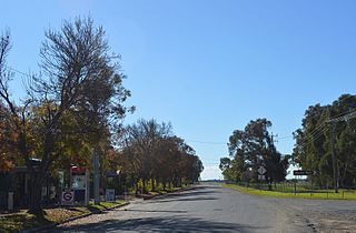
Booleroo Centre is a town in the southern Flinders Ranges region of South Australia. The town is located in the Mount Remarkable District Council local government area, 282 kilometres (175 mi) north of the state capital, Adelaide. At the 2006 census, Booleroo Centre had a population of 331.
Mount Victor Station is a pastoral lease currently operating as a sheep station located about 115 kilometres (71 mi) east of Hawker and 175 kilometres (109 mi) west of Broken Hill in the state of South Australia,
Pandie Pandie Station, most commonly known as Pandie Pandie, also often spelled as Pandi Pandi or Pandy Pandy, is a pastoral lease that operates as a cattle station in north east South Australia. It lies on the eastern edge of Karanguru territory.
Wilgena Station, commonly known as simply Wilgena, is a pastoral lease that operates as a sheep station in outback South Australia.
William Spence Peter was a pioneer pastoralist of South Australia and New Zealand, and a member of the New Zealand Legislative Council from 1868 to 1891.
Carriewerloo Station is a pastoral lease that operates as a sheep station in South Australia.
Yardea Station is a pastoral lease in the Australian state of South Australia that operates as a sheep station.
Eringa Station is a pastoral lease that operates as a cattle station in the outback of South Australia.
Muloorina is both a pastoral lease that operates as a cattle station and a formal bounded locality in South Australia. The name and boundaries of the locality were created on 26 April 2013 after the long-established local name.
Dulkaninna Station is a pastoral lease that once operated as a sheep station but now operates as a cattle station in outback South Australia.

Andrews is a rural locality in the Northern Areas Council of South Australia, located on the Hill River. Its boundaries were formalised in April 2001 for the long established name for the area. The district, which is primarily dedicated to primary production, mainly grain farming, is in the Spalding Ward of the council. The township has bulk grain handling and storage facilities as well as limited sporting and community facilities. The Hill River Road and the Hill River run north-south through the locality, while Andrews Road runs east-west, connecting the Goyder Highway with RM Williams Way. In the 2011 census, the population of Andrews was too low to separately report; it was included in that of adjacent Spalding.
Hart is a locality in the Mid North region of South Australia. The boundaries were formalised in January 2000 for the long established name for the area. There was a railway siding at Hart on the Gladstone railway line. The major industry in the area is cereal crop growing.

Greenmount is a rural locality in the Mackay Region, Queensland, Australia. In the 2016 census, Greenmount had a population of 473 people.

Hilltown is a locality in the District Council of Clare and Gilbert Valleys of South Australia. The former town centre is located on Hilltown Road, which runs north-south between Andrews and Hill River, while the unsealed Harvey Highway connects the former town centre to RM Williams Way. It is about 4 km east of RM Williams Way, on the former Spalding railway line.

Kanyaka is a rural locality in the Far North region of South Australia, situated in the Flinders Ranges Council.
Canowie is a locality in the Mid North region of South Australia. A town was surveyed in 1865, however little remains of the township today. The current boundaries of the locality were created in 2000. Its name is believed to be derived from Kanya-Owie, the Aboriginal name for a rock waterhole.

Flinders Ranges is a locality in the Australian state of South Australia located in the mountain range of the same name, about 380 kilometres north of the state capital of Adelaide, about 86 kilometres north-east of the municipal seat of Quorn and about 131 kilometres north-east of the centre of Port Augusta in the state’s Far North region.
The Hundred of Ninnes is a cadastral unit of hundred located in the Mid North of South Australia centred on the Ninnes Plain. It is one of the 16 hundreds of the County of Daly and was proclaimed by Governor Anthony Musgrave on the last day of 1874.
