
Eudunda is a rural town in South Australia, roughly 103 kilometres northeast of Adelaide, established in 1870 after settlers began moving into the area in the 1860s. As of the 2006 census, Eudunda had a population of 640.
The Regional Council of Goyder is a local government area located in the Mid North region of South Australia. The council area is reliant on agriculture as a mainstay of its economy, with manufacturing and tourism also becoming prominent. The council seat lies at Burra, with a branch office situated at Eudunda.

Bower is a town in South Australia, approximately halfway between Eudunda and Morgan on the Thiele Highway.
Point Pass is a small town in the Mid North of South Australia, 120 kilometres North of Adelaide which is the capital city of South Australia. The town is located 11 kilometres (6.8 mi) north of Eudunda, in the Regional Council of Goyder. At the 2006 census, Robertstown and the surrounding area had a population of 322.

Bundey is a locality in the Mid North region of South Australia. It is located on Goyder's Line, on the plains between Burra and Morgan in the Regional Council of Goyder. The bounded locality of Bundey corresponds to the boundaries of the cadastral Hundred of Bundey, except for the southwestern corner of the Hundred which is the northeastern corner of the locality of Geranium Plains. Bundey was named in 1878 for politician William Henry Bundey.

Geranium Plains is a small town in the Regional Council of Goyder in South Australia. The post office opened in 1894, but has since closed. There was a proposal to rename it to Iperta in 1916, but this did not go ahead.
Apoinga is a rural locality in the Mid North region of South Australia, situated in the Regional Council of Goyder.

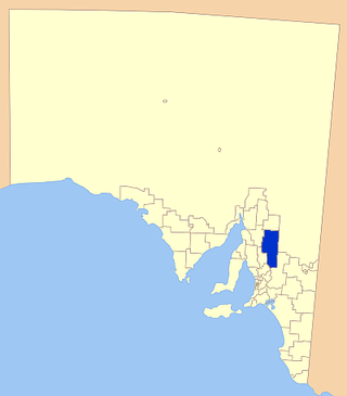
Neales Flat is a rural locality southeast of Eudunda in the Mid North region in South Australia. It is in the Regional Council of Goyder local government area, the South Australian House of Assembly electoral district of Stuart and the Australian House of Representatives Division of Grey.
The District Council of Robertstown was a local government area in South Australia from 1932 to 1997. The central town and council seat was Robertstown.

The County of Eyre is one of the 49 cadastral counties of South Australia. It was proclaimed by Governor George Grey in 1842 and named for the explorer Edward John Eyre. It covers a portion of the state between the Adelaide Hills in the west and the Murray River in the east from Robertstown and Mannum on the northern boundary to Sedan and Swan Reach on the southern boundary.
The District Council of Apoinga was a local government area in South Australia from 1873 to 1932.

County of Burra is a cadastral unit located in the Australian state of South Australia which covers land located in the state’s east associated with the town of Burra. It was proclaimed in 1851 by Governor Young and named after the town of Burra.
The District Council of English was a local government area in South Australia from 1878 to 1932.
Baldina is a rural locality in the Mid North region of South Australia, situated in the Regional Council of Goyder. It was established in August 2000, when boundaries were formalised for the "long established local name".
Emu Downs is a rural locality in the Mid North region of South Australia, situated in the Regional Council of Goyder.
Ngapala is a rural locality in the Mid North region of South Australia, situated in the Regional Council of Goyder. It was established in August 2000, when boundaries were formalised for the "long established local name". It is divided between the cadastral Hundreds of English and Julia Creek.
Bright is a rural locality in the Mid North region of South Australia, situated in the Regional Council of Goyder. It was established in August 2000, when boundaries were formalised for the "long established local name". It incorporates most of the cadastral Hundred of Bright, which was proclaimed on 17 June 1875 and named for politician Henry Edward Bright.
Koonoona is a rural locality in the Mid North region of South Australia, situated in the Regional Council of Goyder. It was established in August 2000, when boundaries were formalised for the "long established local name". It occupies the north-western corner of the cadastral Hundred of Apoinga.
Brady Creek is a rural locality in the Mid North region of South Australia, situated in the Regional Council of Goyder. It was established in August 2000, when boundaries were formalised for the "long established local name" for the creek which it is centred on and named after. It is divided between the cadastral Hundreds of Apoinga and English.
Peep Hill is a rural locality in the Mid North region of South Australia, situated in the Regional Council of Goyder. It was established in August 2000, when boundaries were formalised for the "long established local name". It is reported to be named for "a round hill in the last range towards the east".
