
The City of Playford is a local government area of South Australia in Adelaide's northern suburbs. It was named in recognition of Sir Thomas Playford, who played a part in the development of the area, and was South Australia's premier from 1938–1965. The city covers an area of 345 km2 (133 sq mi), and is home to over 90,000 residents. Playford was the fastest growing local government area in South Australia in the 2010s.
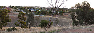
Uleybury is a rural locality near Adelaide, South Australia. It is located at the eastern side of the City of Playford local government area, just north of One Tree Hill along Gawler-One Tree Hill Road.
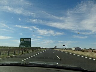
Northern Expressway, also known as the Fatchen Northern Expressway, is a 21 kilometre long controlled-access highway in Adelaide, South Australia. Since March 2020, the North–South Motorway continues west of Port Wakefield Highway and intersects the Port River Expressway to reach the harbour at Port Adelaide. These are the northernmost two parts of the North–South Corridor.
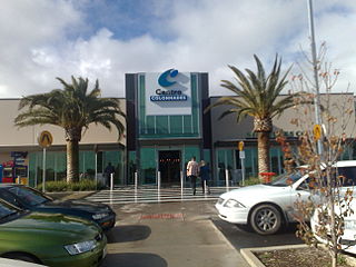
Noarlunga Centre is a suburb in the City of Onkaparinga in the southern suburbs of Adelaide, South Australia. The suburb is mostly commercial, being dominated by the Centro Colonnades shopping centre and the small 'Inspire Noarlunga' estate to the east of Goldsmith Road. The suburb is bordered by Beach Road to the north, Dyson Road to the west Goldsmith Road to the south and the Southern Expressway to the east. Burgess Drive, Seaman Road and David Witton Drive are the main thoroughfares inside the boundaries of the suburb.
Craigmore is a large suburb north of Adelaide, South Australia. It is in the City of Playford local government area, just east of Elizabeth and south of Gawler.
Elizabeth Grove is a suburb in the northern extent of Adelaide, South Australia, on the western side of Main North Road south of Elizabeth. It is bounded by Main North Road, Hogarth Road, Harvey Road and Ridley Road. It contains a local shopping centre, public and Catholic primary schools, and churches of several denominations.
Smithfield is a suburb in the northern outskirts of Adelaide, South Australia. It is in the City of Playford.

The City of Elizabeth was a local government area located in the northern suburbs of Adelaide and seated at Elizabeth from 1964 to 1997.
The City of Munno Para, formerly the District Council of Munno Para, was a local government area of South Australia from 6th November 1958 to 1997, seated at the township of Smithfield. In 1997 the City of Munno Para merged with the City of Elizabeth to form the new City of Playford.
Munno Para is a northern suburb of Adelaide, South Australia. It is located in the City of Playford.
Andrews Farm is a northern suburb of Adelaide, South Australia. It is located in the City of Playford.

Blakeview is a northern suburb of Adelaide, South Australia. It is located in the City of Playford. Blakeview is predominantly a residential suburb, but also has two commercial areas and two education areas.
MacDonald Park is a northern suburb of Adelaide, South Australia in the City of Playford. It is north and west of a bend in the Max Fatchen Expressway, bounded by Curtis Road and Heaslip Road on the north and west sides.
Munno Para Downs is a northern suburb of Adelaide, South Australia in the City of Playford.
Penfield is a northern suburb of Adelaide, South Australia, in the City of Playford.
Penfield Gardens is a northern suburb of Adelaide, South Australia in the City of Playford. It is in the urban fringe on the Adelaide Plains, with major industries including market gardening and harness racing horse training.
The District Council of Yatala was a local government area of South Australia established in 1853 and abolished in 1868.

The Hundred of Munno Para is a cadastral unit of hundred covering the outer northern suburbs of Adelaide north of the Little Para River and the flanking semi-rural areas in South Australia. It is one of the eleven hundreds of the County of Adelaide. It was named in 1846 by Governor Frederick Robe, Munno Para being a term from a local Kaurna Aboriginal people meaning golden wattle creek. This name refers to either the Gawler River or the Little Para River.
The District Council of Munno Para East was a local government area of South Australia from 1853 to 1958, seated at Uleybury.
The District Council of Munno Mara West was a local government area of South Australia on the central Adelaide Plains from 1854 to 1933.
