
Adelaide, is the capital city of South Australia, the state's largest city and the fifth-most populous city in Australia. "Adelaide" may refer to either Greater Adelaide or the Adelaide city centre. The demonym Adelaidean is used to denote the city and the residents of Adelaide. The Traditional Owners of the Adelaide region are the Kaurna people. The area of the city centre and surrounding parklands is called Tarndanya in the Kaurna language.

Elizabeth is an outer northern suburb of the Adelaide metropolitan area, South Australia, 24 km north of the Adelaide city centre. It is located in the City of Playford. At the 2016 census, Elizabeth had a population of 1,024.
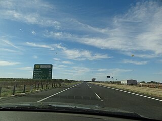
Port Wakefield Highway is an important South Australian highway, connecting Adelaide to the Yorke Peninsula, Port Augusta, northern and western South Australia, the Northern Territory and Western Australia. It is designated National Highway A1 and a part of the National Highway. It is named after Port Wakefield, the first government town north of Adelaide.

Mawson Lakes is a residential suburb in the City of Salisbury, Adelaide, Australia. Named in honor of Sir Douglas Mawson, it has a census area population of 10,872 people. The suburb is located in the northern suburbs of Adelaide around 12 km north of the Central business district. Much of the suburb was previously known as The Levels, and was a non-residential area, housing a campus of the University of South Australia and Technology Park Adelaide.

Enfield is a suburb in Adelaide, Australia. The suburb is about a 10-minute drive north from Adelaide city centre. The suburb is bordered by Gepps Cross to the north, Blair Athol to the west, Clearview to the east, and Prospect, Sefton Park and Broadview to the south.

Ferryden Park is a north-western suburb of Adelaide 6.3 km from the central business district, in the state of South Australia, Australia. Situated in the City of Port Adelaide Enfield local government area, it is adjacent to Kilkenny, Angle Park, Woodville Gardens, Croydon Park, and Regency Park. It is bounded to the north by Murray Street, west by Liberty Grove and Hassell Street, south by Regency Road and to the east by Days Road.

Athol Park is a north-western suburb of Adelaide, South Australia. It is located in the City of Charles Sturt.

Semaphore is a northwestern suburb of Adelaide in the Australian state of South Australia. It is located on the Gulf St Vincent coastline of the Lefevre Peninsula about 14 kilometres (8.7 mi) from the Adelaide city centre.
Ethelton is a north-western suburb of Adelaide 13 km (8.1 mi) from the CBD, on the Lefevre Peninsula, in the state of South Australia, Australia. It is a residential suburb within the local government area of City of Port Adelaide Enfield, adjacent to the suburbs of Semaphore, Semaphore South, Glanville and New Port. It is bounded to the north by Hart Street, to the south by Bower Road and in the west by Swan Terrace and in the east by Causeway Road.

Taylor is a single-member electoral district for the South Australian House of Assembly. This district is named after Doris Irene Taylor MBE, a leading force in the founding of Meals on Wheels, and Labor activist. Taylor is a 246.2 km2 semi-urban electorate in Adelaide's outer northern suburbs and market gardens on the Adelaide Northern plains. A large portion of the district lives in the western half of the City of Playford and it is regarded as a safe Labor seat. It now includes the suburbs and townships of Andrews Farm, Angle Vale, Bolivar, Buckland Park, Davoren Park, Edinburgh, Edinburgh North, Elizabeth North, Eyre, Macdonald Park, Munno Para West, Penfield, Penfield Gardens, Riverlea Park, Smithfield, Smithfield Plains, St Kilda, Virginia, and Waterloo Corner.
Grand Junction Road is the longest east–west thoroughfare in the Adelaide metropolitan area, traversing through Adelaide's northern suburbs approximately 8 kilometres north of the Adelaide city centre.
Northern Expressway, also known as the Fatchen Northern Expressway, is a 21 kilometre long controlled-access highway in Adelaide, South Australia. Since March 2020, the North–South Motorway continues west of Port Wakefield Highway and intersects the Port River Expressway to reach the harbour at Port Adelaide. These are the northernmost two parts of the North–South Corridor.
Port Noarlunga South is a suburb in the Australian state of South Australia located in the Adelaide metropolitan area on the coastline of Gulf St Vincent about 30 kilometres south of the state capital of Adelaide.
Devon Park is an inner northern suburb of Adelaide, South Australia. It is located in the cities of Port Adelaide Enfield and Charles Sturt beside the Gawler railway line near, but not meeting, the intersection of Torrens Road and Churchill Road.

Buckland Park is a suburb on the northern rural outskirts of Adelaide, the capital city of South Australia. Port Wakefield Road, the main highway north from Adelaide, passes the eastern boundary. The northern boundary is the Gawler River, and the western side is Gulf St Vincent. Buckland Park is named after an early pioneer homestead in the area.
Regency Road is a main east-west road forming a continuous connection between the inner northern suburbs of Adelaide, South Australia. Located approximately 6 kilometres (3.7 mi) north of the city centre, Regency Road carries a large amount of freight traffic, being located near Regency Park and the Churchill Road industrial area.
Globe Derby Park is a suburb of Adelaide, South Australia. It is located in the City of Salisbury.
Penfield is a northern suburb of Adelaide, South Australia, in the City of Playford.
New Port is a north-western suburb of Adelaide.

The Adelaide International Bird Sanctuary National Park—Winaityinaityi Pangkara is a protected area in South Australia established by the South Australian government on the northeast coast of Gulf St Vincent, between Parham in the north and the southern end of Barker Inlet in the south, for the purpose of rehabilitating land used as salt pans, protecting habitat for international migratory shorebirds, managing water quality in adjoining parts of Gulf St Vincent, creation of "green" space, development of niche tourism and creation of opportunities for Indigenous people.
