Local government areas of Western Australia

Last updated

Map of local government areas in Western Australia Western Australia Local Government Areas.svg
Map of local government areas in Western Australia

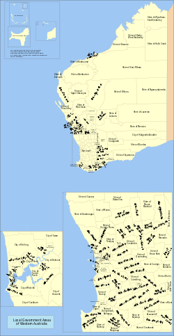
There are 137 local government areas (LGAs) in Western Australia, [1] which comprise 27 cities, 102 shires, and 8 towns that manage their own affairs to the extent permitted by the Local Government Act 1995 . [2] The Local Government Act 1995 also makes provision for regional local governments (referred to as "regional councils", established by two or more local governments for a particular purpose. [3]

Contents

There are three classifications of local government in Western Australia:

The Shire of Christmas Island and the Shire of Cocos (Keeling) Islands are federal external territories and covered by the Indian Ocean Territories Administration of Laws Act, which allows the Western Australian Local Government Act to apply "on-island" as though it were a Commonwealth act. Nonetheless, Christmas Island and the Cocos (Keeling) Islands are not parts of Western Australia.

The most recent local government elections were held in 2023.

History

Map of local government areas in 1933 Western Australia local government areas, 1933.jpg
Map of local government areas in 1933

Land was originally granted in the Swan River Colony under regulations which allowed for land commissioners to assess a tax on private allotments to fund the construction and maintenance of "roads, paths and plantations". [4] As the Colony began to develop, the first form of local government was established in some areas under the Towns Improvement Act of 1838. [5] These trusts were empowered to elect ratepayers as Trustees and assess and collect a property tax for the construction of roads. Many of these town trusts, including the Perth Town Trust, experienced severe administrative and financial difficulties, and in some cases barely functioned at all. The Guildford Town Trust lasted only a couple of years before ceasing to function until it was reconstituted in 1863. [6]

The District Roads Act and Municipal Institutions Act, both of 1871 improved matters by allowing for the establishment of Roads Boards and Municipal Corporations. [7] Municipal Corporations had the capacity to levy property taxes, pass municipal by-laws and undertake various local regulatory services previously carried out by colonial officials and other central bodies. Corporations could also establish civic institutions and facilities with the governors' consent, including libraries and botanical gardens. [6] Road Boards where strictly limited to the construction of roads, could not levy property taxes and depended on colonial government grants for any expenditures.

Women were permitted to be elected to Road Boards from 1911 and to Municipal Corporations from 1919. [8] The influence of town clerk W.E. Bold and the Greater Perth Movement around this time led to the amalgamation of inner city local governments to create a greatly expanded City of Perth until 1993, when the City was broken up once again.

The first local government department was established by the state in 1949 to guide local government authorities. [9] Following the war local governments increasingly expanded their services from property, health and local infrastructure (roads, drainage) to community and social services. This was termed the “New Order” at the time, and encompassed the development of community centres, infant health clinics and sporting facilities.

Only a few cities  Fremantle, Nedlands, Perth, South Perth, and Subiaco  existed prior to 1961. On 1 July 1961, all road districts became shires, and all municipalities became towns or cities.[ citation needed ] This structure has continued till the present day.

In the 1970s, the scope of local government services expanded to encompass the provision of nursing homes and other forms of aged care.

During the late 1980s, and early 1990s a bi-partisan reform process led to the Local Government Act 1995 , which amongst other changes, established for the first time a clear separation of responsibility between elected councillors and local government administration. Other key changes included a significant reduction in the number of decisions requiring ministerial approval which allowed for streamlined decision-making and greater local government autonomy.

Although successive state governments have periodically promoted municipal amalgamation, only a small number of local governments have merged over the course of Western Australia's history. Historically most local governments have strongly resisted forced amalgamations [10] and the total number of authorities has declined only marginally over the last century. The most recent state government led effort to encourage the voluntary amalgamation of 30 metropolitan local governments into 16 was abandoned by the Barnett government in 2014. [11]

In 2017, the McGowan government initiated a review process to reform the Local Government Act 1995. [12]

Metropolitan LGAs

The 30 metropolitan local government areas (LGAs) comprise 20 cities, 3 shires, and 7 towns.

Local government areaCouncil seat [13] Year est.Land area [14] Population density (km²)(2022)Population [15] Notes
km² sq mi 20212022
Armadale, City of Armadale 189456021618097,650100,737Armadale-Kelmscott until 1979
Bassendean, Town of Bassendean 19011041,60516,50516,601West Guildford until 1922
Bayswater, City of Morley 189735142,08471,79672,145
Belmont, City of Cloverdale 189840151,11143,87344,258
Cambridge, Town of Floreat 19942281,37229,83630,116Restructuring of Perth
Canning, City of Cannington 190765251,53499,35199,510Placed under control of a Commissioner in 2012
Claremont, Town of Claremont 1898522,36411,64511,715
Cockburn, City of Spearwood 187116865745122,211125,031Fremantle RD until 1959
Cottesloe, Town of Cottesloe 18953.922,1528,2468,297
East Fremantle, Town of East Fremantle 18973.112,5688,0658,060
Fremantle, City of Fremantle 18711971,74833,10933,711
Gosnells, City of Gosnells 1907127491,044131,381132,845
Joondalup, City of Joondalup 199899381,673165,075165,512Restructuring of Wanneroo
Kalamunda, City of Kalamunda 189732412518960,80361,229Governed by a Commissioner until 1961
Kwinana, City of Kwinana Town Centre 19541204641247,65849,457
Melville, City of Booragoon [16] 190053202,031106,845107,311
Mosman Park, Town of Mosman Park 18994.3222059,4829,585Split from Peppermint Grove RD. Buckland Hill RD 1899–1908, 1930–1937; Cottesloe Beach RD 1908–1930
Mundaring, Shire of Mundaring 19036432486140,54140,506Greenmount until 1932
Nedlands, City of Nedlands 18932081,17022,98422,977Claremont RD until 1932
Peppermint Grove, Shire of Peppermint Grove 18951.101,5401,6391,644
Perth, City of Perth 18561452,21129,66730,364
Rockingham, City of Rockingham 1897258100558140,595143,560
Serpentine–Jarrahdale, Shire of Mundijong 18949013483933,34634,770
South Perth, City of South Perth 189219.882,27744,98245,106
Stirling, City of Stirling 1871105412,252234,380235,845Shire of Perth until 1971
Subiaco, City of Subiaco 18965.623,19817,91417,967
Swan, City of Midland 18711,043403157158,691163,699
Victoria Park, Town of Victoria Park 19941872,15338,31238,361Restructuring of Perth
Vincent, City of Leederville 1994114369537,86538,433Restructuring of Perth
Wanneroo, City of Wanneroo 1902683.3264323216,450220,932

Non-metropolitan LGAs

The 107 non-metropolitan local government areas (LGAs) comprise 7 cities, 99 shires, and 1 town.

The Shire of Christmas Island and the Shire of Cocos (Keeling) Islands are also included for comparison purposes.

Local government areaCouncil seat [13] Region Year est.Land area [14] Population
[15]
WebsiteNotes
km² sq mi (2021)(2022)
Albany, City of Albany Great Southern 19984,308.51,66440,11540,434 albany.wa.gov.au Formerly:
Town of Albany (1871)
Shire of Albany (1871)
Ashburton, Shire of Tom Price Pilbara 1972100,81738,9267,7857,832 ashburton.wa.gov.au West Pilbara until 1987. Formerly:
Shire of Ashburton (1887)
Shire of Tableland (1896)
Augusta–Margaret River, Shire of Margaret River South West 18912,12281917,29817,889 amrsc.wa.gov.au Augusta until 1926
Beverley, Shire of Beverley Wheatbelt 18712,3719151,7351,738 beverley.wa.gov.au
Boddington, Shire of Boddington Peel 19031,9057361,7591,758 boddington.wa.gov.au Marradong until 1961
Boyup Brook, Shire of Boyup Brook South West 18962,8271,0921,8741,938 boyupbrook.wa.gov.au Upper Blackwood until 1969
Bridgetown–Greenbushes, Shire of Bridgetown South West 19701,3375165,3765,527 bridgetown.wa.gov.au Amalgamation of:
Nelson RD (1887–1917), Bridgetown RD (1917–1961), Shire of Bridgetown (1961–1970);
Greenbushes RD (1900–1961), Shire of Greenbushes (1961–1970)
Brookton, Shire of Brookton Wheatbelt 19061,601618961955 brookton.wa.gov.au
Broome, Shire of Broome Kimberley 191854,40221,00518,20918,361 broome.wa.gov.au
Broomehill–Tambellup, Shire of Tambellup Great Southern 20072,6101,0081,0891,093 shirebt.wa.gov.au Formerly:
Shire of Broomehill (1892)
Shire of Tambellup (1905)
Bruce Rock, Shire of Bruce Rock Wheatbelt 19132,7251,0521,0161,019 brucerock.wa.gov.au East Avon until 1918
Bunbury, City of Bunbury South West 1871642534,14834,396 bunbury.wa.gov.au City in 1979
Busselton, City of Busselton South West 19511,45456142,00642,888 busselton.wa.gov.au Amalgamation of Municipality and RD (both 1871)
City in 2012
Capel, Shire of Capel South West 189455821518,78019,021 capel.wa.gov.au Bunbury RD until 1907
Carnamah, Shire of Carnamah Mid West 19232,8711,108573572 carnamah.wa.gov.au Split from Irwin and Mingenew
Carnarvon, Shire of Carnarvon Gascoyne 191146,67518,0215,5265,531 carnarvon.wa.gov.au Formerly:
Town of Carnarvon (1891–1965)
Lower Gascoyne RD (1887–1911)
Minilya RD (1893–1911)
Gascoyne–Minilya RD and Shire (1911–1965)
Chapman Valley, Shire of Nabawa Mid West 19013,9811,5371,6131,649 chapmanvalley.wa.gov.au Upper Chapman until 1958
Chittering, Shire of Bindoon Wheatbelt 18961,2204716,1006,301 chittering.wa.gov.au
Christmas Island, Shire of Christmas Island AIOT 1992136531,7161,782 [17] shire.gov.cx Federal external territory.
Cocos (Keeling) Islands, Shire of Home Island AIOT 1992145602614 [17] shire.cc

Federal external territory.

Collie, Shire of Collie South West 19511,7106609,0889,147 collie.wa.gov.au Amalgamation of Municipality (1901) and RD (1900)
Coolgardie, Shire of Coolgardie Goldfields 192130,29811,6983,6383,642 coolgardie.wa.gov.au Amalgamation of Municipality (1894) and RD (1896)
Coorow, Shire of Coorow Mid West 19624,1901,6181,0911,091 coorow.wa.gov.au Split from Carnamah
Corrigin, Shire of Corrigin Wheatbelt 19132,6811,0351,0281,022 corrigin.wa.gov.au
Cranbrook, Shire of Cranbrook Great Southern 19263,2761,2651,1371,141 cranbrook.wa.gov.au
Cuballing, Shire of Cuballing Wheatbelt 19021,195461927931 cuballing.wa.gov.au
Cue, Shire of Cue Mid West 191213,5825,244228230 cue.wa.gov.au Amalgamation of Day Dawn M. (1894) and Cue RD (1895)
Cunderdin, Shire of Cunderdin Wheatbelt 18941,8627191,3421,342 cunderdin.wa.gov.au Split from Northam, named Meckering until 1944
Dalwallinu, Shire of Dalwallinu Wheatbelt 19167,2242,7891,4361,429 dalwallinu.wa.gov.au
Dandaragan, Shire of Jurien Bay Wheatbelt 18906,7122,5923,4733,559 dandaragan.wa.gov.au
Dardanup, Shire of Eaton South West 189452620315,19915,373 dardanup.wa.gov.au
Denmark, Shire of Denmark Great Southern 19111,8607186,4676,534 denmark.wa.gov.au
Derby–West Kimberley, Shire of Derby Kimberley 1884119,73146,2288,4148,411 sdwk.wa.gov.au West Kimberley until 1983
Donnybrook–Balingup, Shire of Donnybrook South West 19701,5606026,3126,400 donnybrook-balingup.wa.gov.au Formerly:
Shire of Donnybrook, Preston RD until 1961 (1896)
Shire of Balingup, Upper Capel RD until 1905 (1899)
Dowerin, Shire of Dowerin Wheatbelt 19111,863719733732 dowerin.wa.gov.au
Dumbleyung, Shire of Dumbleyung Wheatbelt 19092,539980699693 dumbleyung.wa.gov.au ]
Dundas, Shire of Norseman Goldfields 192992,88635,863699697 dundas.wa.gov.au
East Pilbara, Shire of Newman Pilbara 1972372,296143,74410,37710,307 eastpilbara.wa.gov.au Formerly:
Shire of Marble Bar (1896)
Shire of Nullagine (1898)
Esperance, Shire of Esperance Goldfields 189544,79817,29714,39814,500 esperance.wa.gov.au Absorbed municipality (1895–1908)
Exmouth, Shire of Exmouth Gascoyne 19646,4882,5053,2053,313 exmouth.wa.gov.au
Gingin, Shire of Gingin Wheatbelt 18933,2081,2395,7515,892 gingin.wa.gov.au Absorbed municipality (1893–1903)
Gnowangerup, Shire of Gnowangerup Great Southern 19124,2651,6471,2601,262 gnowangerup.wa.gov.au
Goomalling, Shire of Goomalling Wheatbelt 19271,835708985985 goomalling.wa.gov.au
Greater Geraldton, City of Geraldton Mid West 20119,9093,82641,19841,514 cgg.wa.gov.au Formerly:
City of Geraldton (1871–2007)
Shire of Greenough (1951–2007)
Shire of Mullewa (1911–2011)
Halls Creek, Shire of Halls Creek Kimberley 1887133,04651,3694,0414,102 hcshire.wa.gov.au Kimberley Goldfields until 1915
Harvey, Shire of Harvey South West 18941,72866729,63130,141 harvey.wa.gov.au
Irwin, Shire of Dongara Mid West 18712,3699153,7713,795 irwin.wa.gov.au
Jerramungup, Shire of Jerramungup Great Southern 19826,5112,5141,1961,196 jerramungup.wa.gov.au Split from Gnowangerup
Kalgoorlie–Boulder, City of Kalgoorlie Goldfields 198995,50036,87330,67430,697 kalbould.wa.gov.au Formerly:
Town of Kalgoorlie (1897–1989)
Shire of Boulder (1969–1989)
Karratha, City of Karratha Pilbara 188715,2385,88323,42123,778 karratha.wa.gov.au Absorbed Roebourne and Cossack municipalities in 1910, was known as Shire of Roebourne until 2014
Katanning, Shire of Katanning Great Southern 18921,5185864,2264,233 katanning.wa.gov.au
Kellerberrin, Shire of Kellerberrin Wheatbelt 19081,9157391,1781,178 kellerberrin.wa.gov.au
Kent, Shire of Nyabing Great Southern 19225,6252,172506506 kent.wa.gov.au Nyabing–Pingrup 1955–1972
Kojonup, Shire of Kojonup Great Southern 18712,9311,1321,9651,972 kojonup.wa.gov.au
Kondinin, Shire of Kondinin Wheatbelt 19257,4412,873872866 kondinin.wa.gov.au
Koorda, Shire of Koorda Wheatbelt 19272,8321,093373373 koorda.wa.gov.au
Kulin, Shire of Kulin Wheatbelt 19184,7191,822791784 kulin.wa.gov.au Roe until 1926
Lake Grace, Shire of Lake Grace Wheatbelt 192211,8864,5891,3001,290 lakegrace.wa.gov.au
Laverton, Shire of Laverton Goldfields 1906179,99469,4961,4321,433 laverton.wa.gov.au Mount Margaret until 1950, absorbed Mount Morgans M (1900–1913)
Leonora, Shire of Leonora Goldfields 191231,91512,3221,7171,720 leonora.wa.gov.au
Mandurah, City of Mandurah Peel 19491756893,41495,509 mandurah.wa.gov.au City in 1990
Manjimup, Shire of Manjimup South West 19087,0302,7149,3519,416 manjimup.wa.gov.au Warren until 1925
Meekatharra, Shire of Meekatharra Mid West 1909100,18938,6831,2871,293 meekashire.wa.gov.au
Menzies, Shire of Menzies Goldfields 1912124,11547,921569570 menzies.wa.gov.au
Merredin, Shire of Merredin Wheatbelt 19213,2941,2723,2213,228 merredin.wa.gov.au
Mingenew, Shire of Mingenew Mid West 19011,935747423423 mingenew.wa.gov.au Upper Irwin until 1919
Moora, Shire of Moora Wheatbelt 19083,7631,4532,3842,371 moora.wa.gov.au Split from Victoria Plains
Morawa, Shire of Morawa Mid West 19283,5111,356669668 morawa.wa.gov.au Split from Perenjori–Morawa RD
Mount Magnet, Shire of Mount Magnet Mid West 190113,8585,351698701 mtmagnet.wa.gov.au Absorbed municipality (1896–1901)
Mount Marshall, Shire of Bencubbin Wheatbelt 192310,1853,932467463 mtmarshall.wa.gov.au
Mukinbudin, Shire of Mukinbudin Wheatbelt 19333,4271,323593587 mukinbudin.wa.gov.au
Murchison, Shire of Murchison Mid West 187545,04617,392108108 murchison.wa.gov.au
Murray, Shire of Pinjarra Peel 18871,70665918,64119,104 murray.wa.gov.au
Nannup, Shire of Nannup South West 18903,0541,1791,5741,586 nannup.wa.gov.au Lower Blackwood until 1925
Narembeen, Shire of Narembeen Wheatbelt 19253,8091,471820821 narembeen.wa.gov.au
Narrogin, Shire of Narrogin Wheatbelt 18921,6316304,9374,953 narrogin.wa.gov.au Absorbed Town of Narrogin (1906–2016)
Ngaanyatjarraku, Shire of Warburton Goldfields 1993159,81661,7051,4761,478 ngaanyatjarraku.wa.gov.au
Northam, Shire of Northam Wheatbelt 18711,43155311,81011,940 northam.wa.gov.au Absorbed Town of Northam (1879–2007)
Northampton, Shire of Northampton Mid West 187112,5444,8433,3353,332 northampton.wa.gov.au Mines RD until 1887
Nungarin, Shire of Nungarin Wheatbelt 19211,166450263261 nungarin.wa.gov.au
Perenjori, Shire of Perenjori Mid West 19168,3013,205652651 perenjori.wa.gov.au Perenjori–Morawa until 1928
Pingelly, Shire of Pingelly Wheatbelt 18911,2955001,0721,067 pingelly.wa.gov.au Moorumbine until 1913
Plantagenet, Shire of Mount Barker Great Southern 18714,8771,8835,5345,590 plantagenet.wa.gov.au
Port Hedland, Town of Port Hedland Pilbara 189118,4177,11116,66016,987 porthedland.wa.gov.au Pilbara until 1904. Town 1989
Quairading, Shire of Quairading Wheatbelt 19132,017779982983 quairading.wa.gov.au Avon until 1922
Ravensthorpe, Shire of Ravensthorpe Great Southern 19009,8423,8002,1572,190 ravensthorpe.wa.gov.au Phillips River until 1961
Sandstone, Shire of Sandstone Mid West 189732,60512,589117117 sandstone.wa.gov.au Black Range until 1961
Shark Bay, Shire of Denham Gascoyne 190424,2019,3441,0691,076 sharkbay.wa.gov.au
Tammin, Shire of Tammin Wheatbelt 19481,102425401402 tammin.wa.gov.au Split from Cunderdin
Three Springs, Shire of Three Springs Mid West 19282,6571,026587587 threesprings.wa.gov.au
Toodyay, Shire of Toodyay Wheatbelt 19121,6926534,7134,812 toodyay.wa.gov.au Amalgamation of Newcastle M (1877) and Toodyay RD (1871)
Trayning, Shire of Trayning Wheatbelt 19111,651637307304 trayning.wa.gov.au
Upper Gascoyne, Shire of Gascoyne Junction Gascoyne 188757,81022,321180187 uppergascoyne.wa.gov.au
Victoria Plains, Shire of Calingiri Wheatbelt 18712,551985832827 victoriaplains.wa.gov.au
Wagin, Shire of Wagin Wheatbelt 18871,9467511,8021,811 wagin.wa.gov.au Arthur until 1905. Absorbed municipality (1906–1961)
Wandering, Shire of Wandering Wheatbelt 18741,904735551548 wandering.wa.gov.au
Waroona, Shire of Waroona Peel 18988323214,3574,405 waroona.wa.gov.au Drakesbrook until 1961
West Arthur, Shire of Darkan Wheatbelt 18962,8321,093795799 westarthur.wa.gov.au
Westonia, Shire of Westonia Wheatbelt 19163,3191,281255252 westonia.wa.gov.au
Wickepin, Shire of Wickepin Wheatbelt 19092,041788712706 wickepin.wa.gov.au
Williams, Shire of Williams Wheatbelt 18712,3058901,0501,055 williams.wa.gov.au
Wiluna, Shire of Wiluna Goldfields 1909181,29769,999570572 wiluna.wa.gov.au
Wongan–Ballidu, Shire of Wongan Hills Wheatbelt 18873,3651,2991,3381,339 wongan.wa.gov.au Melbourne until 1926
Woodanilling, Shire of Woodanilling Great Southern 19061,129436468469 woodanilling.wa.gov.au
Wyalkatchem, Shire of Wyalkatchem Wheatbelt 19201,595616484484 wyalkatchem.wa.gov.au
Wyndham East Kimberley, Shire of Kununurra Kimberley 1887112,06643,2698,0538,058 swek.wa.gov.au East Kimberley until 1896, Wyndham until 1961
Yalgoo, Shire of Yalgoo Mid West 190727,95010,792364365 yalgoo.wa.gov.au Upper Murchison until 1912
Yilgarn, Shire of Southern Cross Wheatbelt 189130,42911,7491,2061,196 yilgarn.wa.gov.au Absorbed Southern Cross M (1892–1918)
York, Shire of York Wheatbelt 18712,1328233,5533,565 york.wa.gov.au Absorbed Town of York (1871–1965)

Regional councils

Currently, Western Australia has ten regional councils. Each regional council comprises two or more local government areas (LGAs).

Metropolitan regional councils

Non-metropolitan regional councils

References

  1. "An introduction to local government". Department of Local Government, Sport and Cultural Industries, Government of Western Australia. 16 June 2022. Retrieved 15 December 2022.
  2. "Local Government Act 1995" . Retrieved 26 July 2011.
  3. Refer Part 3 Division 4 of the "Local Government Act 1995" . Retrieved 26 July 2011.
  4. Stannage, C.T. (1979). The people of Perth: A social history of Western Australia's capital city. Perth: Perth City Council. p. 55. ISBN   0909994862.
  5. Berry, Christopher (2009). "Local Government". In Gregory, Jenny; Gothard, Janice (eds.). Historical Encyclopedia of Western Australia (PDF). Crawley: UWA Publishing. pp. 540–542. ISBN   978-1-921401-15-2. OCLC   405500003. OL   45266821M. Wikidata   Q5773872.
  6. 1 2 Johns, J. R. H. (1949). "The Development of Local Government in Western Australia". The Australian Journal of Public Administration: 172–179.
  7. District Roads Act 1871.
  8. "History". Western Australia Local Government Association. Retrieved 7 October 2020.
  9. Committee for Perth (September 2009) ‘ Successful’ Metropolitan Local Government Models: Potential Lessons for Perth
  10. Consolidation in Local Government: A Fresh Look (May 2011), p16
  11. Foster, Brendan; Riddell, Alex (8 February 2015). "Council mergers scrapped after ratepayer polls". WA Today.
  12. "Local Government Act Review". Department of Local Government, Sport and Cultural Industries . 25 June 2019.
  13. 1 2 Department of Health. "Local Government contacts" . Retrieved 26 July 2009.
  14. 1 2 "3218.0 – Regional Population Growth, Australia, 2017-18: Population Estimates by Local Government Area (ASGS 2018), 2017 to 2018". Australian Bureau of Statistics. Australian Bureau of Statistics. 27 March 2019. Retrieved 25 October 2019. Estimated resident population, 30 June 2018.
  15. 1 2 "Regional population, 2021-22 financial year | Australian Bureau of Statistics". www.abs.gov.au. 31 August 2023. Retrieved 21 June 2024.
  16. Contact Us – City of Melville
  17. 1 2 "ERP by SA2 and above (ASGS 2016), 2001 onwards". ABS.Stat. Australian Bureau of Statistics. 27 March 2019. Retrieved 7 December 2019.
  18. "Eastern Metropolitan Regional Council" . Retrieved 19 April 2016.
  19. "Mindarie Regional Council" . Retrieved 19 April 2016.
  20. "Rivers Regional Council" . Retrieved 19 April 2016.
  21. "Southern Metropolitan Regional Council" . Retrieved 19 April 2016.
  22. "Tamala Park Regional Council" . Retrieved 19 April 2016.
  23. "Western Metropolitan Regional Council" . Retrieved 19 April 2016.
  24. "Bunbury Harvey Regional Council" . Retrieved 19 April 2016.
  25. "Murchison Regional Vermin Council" . Retrieved 3 August 2017.
  26. "Pilbara Regional Council" . Retrieved 19 April 2016.
  27. "Warren Blackwood Alliance of Councils" . Retrieved 20 September 2022.