| Shire of Tambellup Western Australia | |||||||||||||||
|---|---|---|---|---|---|---|---|---|---|---|---|---|---|---|---|
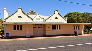
Tambellup Shire Hall (2018) | |||||||||||||||
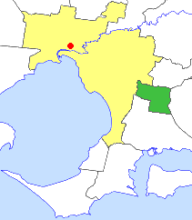
Location in Western Australia | |||||||||||||||
| Population | 659 (2006) [1] | ||||||||||||||
| • Density | 0.4588/km2 (1.1883/sq mi) | ||||||||||||||
| Established | 1905 | ||||||||||||||
| Area | 1,436.3 km2 (554.6 sq mi) | ||||||||||||||
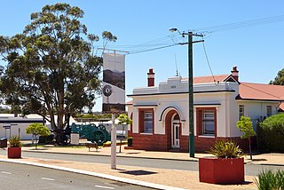
| Council seat | Tambellup | ||||||||||||||
| Region | Great Southern | ||||||||||||||
| Website | Shire of Tambellup | ||||||||||||||
| |||||||||||||||


The Shire of Tambellup was a local government area in the Great Southern region of Western Australia, about 40 kilometres (25 mi) south of Katanning and about 330 kilometres (205 mi) south-southeast of the state capital, Perth. The Shire covered an area of 1,436 square kilometres (554 sq mi), and its seat of government was the town of Tambellup.

The local government areas (LGAs) in the Australian state of Western Australia describes the 139 institutions and processes by which towns and districts can manage their own affairs to the extent permitted by the Local Government Act 1995. The Local Government Act 1995 also makes provision for regional local governments, established by two or more local governments for a particular purpose.

The Great Southern Region is one of the nine regions of Western Australia, as defined by the Regional Development Commissions Act 1993, for the purposes of economic development. It is a section of the larger South Coast of Western Australia and neighbouring agricultural regions.

Western Australia is a state occupying the entire western third of Australia. It is bounded by the Indian Ocean to the north and west, and the Southern Ocean to the south, the Northern Territory to the north-east and South Australia to the south-east. Western Australia is Australia's largest state, with a total land area of 2,529,875 square kilometres, and the second-largest country subdivision in the world, surpassed only by Russia's Sakha Republic. The state has about 2.6 million inhabitants – around 11 percent of the national total – of whom the vast majority live in the south-west corner, 79 per cent of the population living in the Perth area, leaving the remainder of the state sparsely populated.
Contents
The Tambellup Road Board was gazetted in 1905. On 1 July 1961, it became a shire council following changes to the Local Government Act. [2] On 1 July 2008, after 10 months of planning and preparation, it merged with the neighbouring Shire of Broomehill to form the Shire of Broomehill-Tambellup.
The Shire of Broomehill was a local government area in the Great Southern region of Western Australia, about 20 kilometres (12 mi) south of Katanning and about 310 kilometres (193 mi) south-southeast of the state capital, Perth. The Shire covered an area of 1,173 square kilometres (453 sq mi), and its seat of government was the town of Broomehill.
The Shire of Broomehill-Tambellup is a local government area in the Great Southern region of Western Australia, 320 kilometres (200 mi) south-southeast of the state capital, Perth. The Shire covers an area of 2,609.1 square kilometres (1,007.4 sq mi), and its seat of government is the town of Tambellup. It came into existence in 2008 through the amalgamation of the former Shire of Broomehill and Shire of Tambellup.