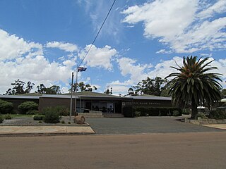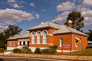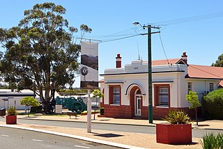
The Shire of Chittering is a local government area in the Wheatbelt region of Western Australia, covering an area of about 1,200 square kilometres (460 sq mi) just beyond the northeastern fringe of the Perth metropolitan area, generally along and east of the Great Northern Highway. Its seat of government is the town of Bindoon.

The Shire of Serpentine-Jarrahdale is a local government area in the outer southeastern metropolitan area of Perth, the capital of Western Australia, and has an area of 905 square kilometres (349 sq mi) and a population of almost 27,000 as at the 2016 Census. The Shire's seat of government is the town of Mundijong.

The Shire of Victoria Plains is a local government area in the Wheatbelt region of Western Australia, about 160 kilometres (100 mi) north of the state capital, Perth. It covers an area of 2,569 square kilometres (992 sq mi), and its seat of government is the town of Calingiri.

The Shire of Upper Gascoyne is a local government area in the Gascoyne region of Western Australia, inland from Carnarvon and about 1,000 kilometres (620 mi) north of the state capital, Perth. The Shire has an area of 57,939 square kilometres (22,370 sq mi), much of which is uninhabited land or sparsely vegetated sheep station country, and its seat of government is the small town of Gascoyne Junction. It has a population of 170, 56% of whom identify as Aboriginal.

The Shire of Dowerin is a local government area in the Wheatbelt region of Western Australia, about 160 kilometres (100 mi) northeast of Perth, the state capital. The Shire covers an area of 1,847 square kilometres (713 sq mi) and its seat of government is the town of Dowerin.

The Shire of Harvey is a local government area of Western Australia. Harvey is located in the state's South West region, approximately 140 km south of Perth, and includes some of Bunbury's northern suburbs. The shire covers an area of 1,728 km² and had a population of approximately 26,500 as at the 2016 Census. Around 12% of the population are of Southern or Eastern European origin.

The Shire of Waroona is a local government area in the Peel region of Western Australia between Mandurah and Harvey and about 110 kilometres (68 mi) south of Perth, the state capital. The Shire covers an area of about 835 km² (322 mi²) and its seat of government is the town of Waroona.

The Shire of Nannup is a local government area in the South West region of Western Australia, approximately 280 kilometres (174 mi) south of the state capital, Perth and 60 kilometres (37 mi) southeast of the coastal resort town of Busselton. Its seat of government is the town of Nannup, where about half of the Shire's population reside.

The Town of Bassendean is a local government area in the northeastern suburbs of the Western Australian capital city of Perth, 6 kilometres (4 mi) west of the industrial centre of Midland and about 12 kilometres (7 mi) northeast of Perth's central business district. The Town covers an area of 10.4 square kilometres (4.0 sq mi), maintains 97 km of roads and had a population of approximately 15,000 as at the 2016 Census. The Town of Bassendean is a member of the Eastern Metropolitan Regional Council.

The Shire of Toodyay is a local government area in the Wheatbelt region of Western Australia, beyond the north-eastern limits of the Perth metropolitan area. The Shire covers an area of 1,694 square kilometres (654 sq mi), and its seat of government is the town of Toodyay.

The Shire of Murchison covers a large area of the Murchison sub-region of the central part of Western Australia, 300 kilometres (186 mi) northeast of Geraldton. The shire and the older 'Murchison' region and goldfield are now part of the designated Mid West region. It is Australia's second least populated local government area and the only one without a town.

The Shire of Dandaragan is a local government area located in the Wheatbelt region of Western Australia, about 200 kilometres (124 mi) north of the state capital, Perth. The Shire covers an area of 6,716 square kilometres (2,593 sq mi) and its seat of government is the town of Jurien Bay.

The Shire of Gnowangerup is a local government area in the Great Southern region of Western Australia, about 120 kilometres (75 mi) north of Albany and about 370 kilometres (230 mi) southeast of the capital, Perth. The Shire covers an area of 4,268 square kilometres (1,648 sq mi), and its seat of government is the town of Gnowangerup.

The Shire of Capel is a local government area in the South West region of Western Australia, taking in the land between the cities of Bunbury and Busselton about 200 kilometres (124 mi) south of the state capital, Perth. The Shire covers an area of 557.6 square kilometres (215.3 sq mi), and its seat of government is the town of Capel.

The Shire of Dardanup is a local government area in the South West region of Western Australia, immediately to the east and southeast of the City of Bunbury and about 180 kilometres (112 mi) south of the state capital, Perth. The Shire covers an area of 526.6 square kilometres (203.3 sq mi), and its seat of government is in Eaton in Bunbury's eastern suburbs.

The Shire of Goomalling is a local government area in the Wheatbelt region of Western Australia, about 240 kilometres (149 mi) northeast of Perth, the state capital. The Shire covers an area of 2,836 square kilometres (1,095 sq mi) and its seat of government is the town of Goomalling.

The Shire of Mingenew is a local government area in the Mid West region of Western Australia, about 110 kilometres (68 mi) southeast of the city of Geraldton and about 370 kilometres (230 mi) north of the state capital, Perth. The Shire covers an area of 1,939 square kilometres (749 sq mi), and its seat of government is the town of Mingenew.

The Shire of Three Springs is a local government area in the Mid West region of Western Australia, about 310 kilometres (193 mi) north of the state capital Perth. The Shire covers an area of 2,657 square kilometres (1,026 sq mi), and its seat of government is the town of Three Springs.

The Shire of Woodanilling is a local government area in the Great Southern region of Western Australia, about 30 kilometres (19 mi) south of Wagin and about 260 kilometres (162 mi) south-southeast of the state capital, Perth. The Shire covers an area of 1,129 square kilometres (436 sq mi), and its seat of government is the town of Woodanilling.

The Shire of Yalgoo is a local government area in the Mid West region of Western Australia, about 500 kilometres (311 mi) north of the state capital, Perth. The Shire covers an area of 28,215 square kilometres (10,894 sq mi), and its seat of government is the town of Yalgoo.


