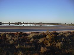
Location of the Wheatbelt within Western AustraliaGrain receival and storage facility at YealeringLand degradation caused by excessive clearing with resulting salinity, near BabakinBencubbin–Kellerberrin Road
The Wheatbelt is one of nine regions of Western Australia defined as administrative areas for the state's regional development, and a vernacular term for the area converted to agriculture during colonisation.[a] It partially surrounds the Perth metropolitan area, extending north from Perth to the Mid West region, and east to the Goldfields–Esperance region. It is bordered to the south by the South West and Great Southern regions, and to the west by the Indian Ocean, the Perth metropolitan area, and the Peel region. Altogether, it has an area of 154,862 square kilometres (59,793sqmi) (including islands).
The region has 42 local government authorities, with an estimated population of 75,000 residents. The Wheatbelt accounts for approximately three per cent of Western Australia's population.[3]
Ecosystems
The area, once a diverse ecosystem, reduced when clearing began in the 1890s with the removal of plant species such as eucalypt woodlands and mallee, is now home to around 11% of Australia's critically endangered plants.[4]
A number of nationally threatened birds reside in the Wheatbelt, including the endangered Carnaby's black cockatoo and the vulnerable malleefowl.[5]
The Wheatbelt encompasses a range of ecosystems and, as a result, there are a range of industries operating in the region.[clarification needed]
Near the coast, the region receives relatively high rainfall and mild temperatures, and its 150 kilometres (93mi) of coastline is a significant tourist area. In contrast, the eastern fringe is very arid, and is mainly used for pastoral farming of sheep. Mining of gold, nickel and iron ore also occurs. The remainder of the region is highly suited to agriculture, and is the source of nearly two thirds of the state's wheat production, half of its wool production, and the majority of its lamb and mutton, oranges, honey, cut flowers and a range of other agricultural and pastoral products.
Change
With a range of climate and economic changes in the region, considerable effort is made by government at all levels to cope with the decline of some communities, and create opportunities for ventures that keep population in the region.[6] Cultural change with population changes in many localities has been identified by local museums and historical societies, including online documentation.[7]
Bruce Rock
Corrigin
Cunderdin
Dowerin
Goomalling
Hyden
Kellerberrin
Koorda
Kulin
Lake Grace
Meckering
Merredin
Narrembeen
Newdegate
Nungarin
Southern Cross
Westonia
Wyalkatchem
Yelbeni
Also the literary tradition of writers including the wheatbelt in their writing included:[8]
The Wheatbelt once had an extensive railway system, which transported bulk wheat grain. It has been reduced in part, while the main lines are being supported. Grain is transported on those lines to ports for export from the CBH grain receival points (grain silos), which are primarily located in the Wheatbelt region.
The following list is the shires listed in the Wheatbelt as designated by the Wheatbelt Development Commission.[12] Some shires in adjoining regions are traditionally considered part of the Wheatbelt – there are shires in the Great Southern, Goldfields-Esperance and Mid West regions that are dominantly grain growing areas.
Most of the Wheatbelt is included in the larger Australia's Golden Outback.[14][15][16]
Due to their proximity to Perth, however, the following shires are instead promoted as part of the Destination Perth region. The tourist precincts are included:[17]
Finally, the northwestern Shire of Dandaragan is promoted as part of Australia's Coral Coast region due to the presence of the larger seaside towns of Cervantes and Jurien Bay, which developed independently of wheat-growing.[19]
Other regional designations
The Wheatbelt is separated into other designations at various times as well:
↑ Hughes-d'Aeth, Tony; ProQuest (Firm) (2017), Like nothing on this earth: [a literary history of the wheatbelt], UWA Publishing, ISBN978-1-76080-163-2
↑ Main Roads Western Australia (28 February 2011). "Wheatbelt Network"(PDF) (Map). Intergrated Service Arrangement. 1:2,040,816. Government of Western Australia. Archived from the original(PDF) on 3 August 2013. Retrieved 5 October 2013.
↑ Main Roads Western Australia (13 August 2013). Wheatbelt North Region map(PDF) (Map). 1:721,154. Version 1.0. Government of Western Australia. Archived(PDF) from the original on 29 August 2013. Retrieved 5 October 2013.
↑ Main Roads Western Australia (13 August 2013). Wheatbelt South Region map(PDF) (Map). 1:590,551. Version 1.0. Government of Western Australia. Archived(PDF) from the original on 29 August 2013. Retrieved 5 October 2013.
↑ Wooller, Susan J; Moore, Susan A; Australian Heritage Commission; Western Australian Natural Environment Evaluation Panel (2000), Regional assessment of the wheatbelt of Western Australia: Central Wheatbelt, Murdoch University, ISBN978-0-86905-746-9
↑ Promaco Geodraft (2013), The Open Wheatbelt (5th edition, January 2013ed.), [Mount Hawthorn, Western Australia] Promaco Geodraft, retrieved 11 February 2019
Further reading
Hughes-d'Aeth, Tony (2017). Like Nothing on this Earth: A Literary History of the Wheatbelt. Crawley, WA: UWA Publishing. ISBN9781742589244.
Places in bold are the council seat for the local government area
Places in italics are either former settlements or settlements that do not have an official postcode
This page is based on this Wikipedia article Text is available under the CC BY-SA 4.0 license; additional terms may apply. Images, videos and audio are available under their respective licenses.
 Wheat growing north-east of Northam