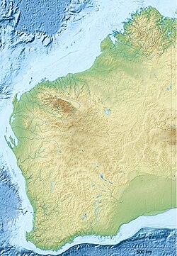
Wongamine

Last updated

Wongamine
Western Australia
Australia Western Australia location map.svg
Red pog.svg
Wongamine
Wongamine
Coordinates 31°29′S116°37′E / 31.483°S 116.617°E / -31.483; 116.617 Coordinates: 31°29′S116°37′E / 31.483°S 116.617°E / -31.483; 116.617
Population39 (SAL 2016) [1] [2]
LGA(s) Shire of Goomalling

Wongamine is a locality in the Wheatbelt region of Western Australia.

Contents

Located approximately 30 km from the nearby town of Goomalling and 19 km from Toodyay along Toodyay Road. The region comes under the jurisdiction of the Shire of Goomalling [3]

Education

The locality had a primary school from 1876 until it shut down in 1945. William Perrin taught at Buckland Primary School from 1871 to 1876 then Wongamine Primary School to 1900. He was one of many ex-convict teachers.

Notable people

Notable people from or who have lived in Wongamine include:

Related Research Articles

Piawaning, Western Australia Town in Western Australia

The townsite of Piawaning is located in the northern agricultural region, 160 km north-east of Perth and 28 km north-east of New Norcia. At the 2006 census, Piawaning had a population of 309.

<span class="mw-page-title-main">Goomalling, Western Australia</span> Town in Western Australia

Goomalling is a townsite in the Wheatbelt region of Western Australia, 45 kilometres north-north-east of Northam, Western Australia.

Yerecoin is a small town located in the Wheatbelt region of Western Australia, in the Shire of Victoria Plains,156 kilometres (97 mi) north-northeast of the state capital, Perth.

Ballidu, Western Australia Town in the Wheatbelt region of Western Australia

Ballidu is a town in the Central Midlands division of the Wheatbelt region of Western Australia, about 217 kilometres (135 mi) north of Perth. Ballidu is also 34 kilometres (21 mi) north of the town of Wongan Hills which, along with a few other small towns such as Cadoux and Bindi Bindi make up the Shire of Wongan-Ballidu.

<span class="mw-page-title-main">Woodbridge, Tasmania</span> Locality in Tasmania, Australia

Woodbridge is a semi-rural locality in the local government area (LGA) of Kingborough in the Hobart LGA region of Tasmania. The locality is about 26 kilometres (16 mi) south of the town of Kingston. The 2016 census has a population of 503 for the state suburb of Woodbridge. It is located 38 kilometres (24 mi) south of the state capital, Hobart.

Gidgegannup, Western Australia Suburb of City of Swan, Western Australia

Gidgegannup is a township 40 kilometres (25 mi) northeast of Perth, the capital city of Western Australia. The name Gidgegannup comes from a Noongar word meaning "Place where spears are made", and was first recorded by passing surveyors in 1852.

Chevallum is a rural locality in the Sunshine Coast Region, Queensland, Australia. In the 2016 census, Chevallum had a population of 441 people.

Camballin is a small town in the West Kimberley district of Western Australia. The town is located on the Camballin Station about 110 km (68 mi) south of Derby and between Derby and Fitzroy Crossing, with the homestead being situated in the town. The town was established in the 1950s by the Public Works Department of Western Australia to service the Camballin Irrigation Scheme.

Nebo, Queensland Town in Queensland, Australia

Nebo is a rural town and locality in the Isaac Region, Queensland, Australia. In the 2016 census the locality of Nebo had a population of 753 people.

The Dawn is a rural residential locality in the Gympie Region, Queensland, Australia. In the 2016 census The Dawn had a population of 545 people.

Bellmere is a rural locality in the Moreton Bay Region, Queensland, Australia. In the 2016 census, Bellmere had a population of 5,863 people.

Beremboke is a locality in western central Victoria, Australia. The locality is centred in the northern Brisbane Ranges and in the Moorabool Shire local government area, 94 km (58 mi) west of the state capital, Melbourne. At the 2016 census, Beremboke had a population of 149.

Gunalda Town in Queensland, Australia

Gunalda is a rural town in the Gympie Region and a locality split between Gympie Region and Fraser Coast Region in Queensland, Australia. In the 2016 census, the locality of Gunalda had a population of 392 people.

Wilsonton is an urban locality in the Toowoomba Region, Queensland, Australia. In the 2016 census, Wilsonton had a population of 5,955 people.

Taranganba Town in Queensland, Australia

Taranganba is a town and locality in the Livingstone Shire, Queensland, Australia. In the 2016 census, the locality of Taranganba had a population of 2,276 people.

Moodlu, Queensland Suburb of Moreton Bay Region, Queensland, Australia

Moodlu is a rural locality in the Moreton Bay Region, Queensland, Australia. In the 2016 census, Moodlu had a population of 318 people.

Lower Tenthill, Queensland Suburb of Lockyer Valley Region, Queensland, Australia

Lower Tenthill is a rural locality in the Lockyer Valley Region, Queensland, Australia. In the 2016 census, Lower Tenthill had a population of 252 people.

Winwill, Queensland Suburb of Lockyer Valley Region, Queensland, Australia

Winwill is a rural locality in the Lockyer Valley Region, Queensland, Australia. In the 2016 census, Winwill had a population of 149 people.

Hannans is a residential suburb of Kalgoorlie-Boulder, a city in the Eastern Goldfields region of Western Australia. At the 2016 census it had a population of 2,546 people, up from 2,483 in 2011. Hannans is named after Paddy Hannan, the prospector whose discovery of gold in 1893 led to the initial rush. The name Hannans originally referred to the Kalgoorlie townsite, and it was only much later in the city's history that it was applied to the current suburb.

Orion is a locality in the Central Highlands Region, Queensland, Australia. In the 2016 census, Orion had a population of 87 people.

References

  1. Australian Bureau of Statistics (27 June 2017). "Wongamine (Suburb and Locality)". Australian Census 2016.  OOjs UI icon edit-ltr-progressive.svg
  2. Australian Bureau of Statistics (27 June 2017). "Wongamine (Suburb and Locality)". Australian Census 2016 QuickStats. Retrieved 28 June 2022.  OOjs UI icon edit-ltr-progressive.svg
  3. "Google Maps". Google.