
Kalannie is a small town in the Shire of Dalwallinu, in the Wheatbelt region of Western Australia, approximately 259 kilometres (161 mi) north-east of the state capital, Perth.

Tammin is a town in the central agricultural region of Western Australia, 184 kilometres (114 mi) east of Perth and midway between the towns of Cunderdin and Kellerberrin on the Great Eastern Highway.
Yerecoin is a small town located in the Wheatbelt region of Western Australia, in the Shire of Victoria Plains,156 kilometres (97 mi) north-northeast of the state capital, Perth.

Doodlakine is a town 220 km (140 mi) east of Perth, Western Australia. It is within the Shire of Kellerberrin along the Great Eastern Highway. The town has a crossing loop for trains on the Perth-to-Kalgoorlie railway and serves as a stop on the MerredinLink rural train service.

Meckering is a town 130 kilometres (80.8 mi) east of Perth, Western Australia along the Great Eastern Highway. Meckering is located within the Shire of Cunderdin.
Grass Valley is a small townsite 13 kilometres (8 mi) east of Northam, Western Australia in the Avon Valley area.
Jennacubbine is a small town located in the Wheatbelt region of Western Australia, to the east of Perth, Western Australia between the towns of Northam and Goomalling.
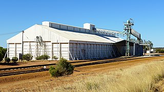
Marchagee is a small townsite located 243 km north of Perth in the Mid West region of Western Australia.

Hines Hill is a town located 240 km (150 mi) east of Perth, between the towns of Merredin and Doodlakine in Western Australia. The town is situated on the Great Eastern Highway and also on the edge of Lake Baandee. The town has one of the first privately owned weighbridges in Western Australia is located close to the town.

The Shire of Wongan–Ballidu is a local government area in the Wheatbelt region of Western Australia, about 180 kilometres (112 mi) NNE of Perth, the state capital. The Shire covers an area of 3,369 square kilometres (1,301 sq mi) and its seat of government is the town of Wongan Hills. The shire includes the Wongan Hills, after which the town is named.

Yornaning is a small town located in the Wheatbelt region of Western Australia, on Great Southern Highway, between Pingelly and Narrogin.
Grass Patch is a small town in the Goldfields-Esperance region of Western Australia, located 79 km north of Esperance on the Coolgardie-Esperance Highway. The town was named after a nearby farm of the same name that had been settled around 1896 and was renowned for bountiful crops and good grass. The town is part of the Shire of Esperance, and services the local farming community.
Kulja is a small town in the Wheatbelt region of Western Australia. The town is situated along the Bonnie Rock to Burakin Road.
Manmanning is a small Wheatbelt town in Western Australia.
Pingaring is a small town in the Wheatbelt region of Western Australia.

Pithara is a small town in the wheatbelt region of Western Australia. It is located about 240 km north of Perth, in the Shire of Dalwallinu. At the 2011 census, Pithara had a population of 257, a 25% fall from the previous 2006 census.

Kununoppin is a small town in the Wheatbelt region of Western Australia. The town is located on the Nungarin–Wyalkatchem Road and in the Shire of Trayning local government area, 257 kilometres (160 mi) north east of the state capital, Perth, Western Australia. At the 2006 census, Kununoppin had a population of 151.
Binnu is a town on the North West Coastal Highway in the Mid West region of Western Australia.

Yoting is a small town located between Quairading and Bruce Rock in the Wheatbelt region of Western Australia.
Pintharuka is an abandoned townsite in the Mid West region of Western Australia. The town is located between the towns of Morawa and Mullewa on the Mullewa-Wubin Road

