Southern Cross is a town in Western Australia, 371 kilometres east of state capital Perth on the Great Eastern Highway. It was founded by gold prospectors in 1888, and gazetted in 1890. It is the major town and administrative centre of the Shire of Yilgarn. At the 2016 census, Southern Cross had a population of 680.

Rhizanthella gardneri, commonly known as western underground orchid, is a species of flowering plant in the orchid family and is endemic to the southwest of Western Australia. It is a herb that spends its entire life cycle, including flowering, at or below the soil surface. A head of up to 100 small reddish to cream-coloured, inward facing flowers surrounded by large, cream-coloured bracts with a horizontal rhizome is produced between May and July.

Burracoppin is a townsite on the Great Eastern Highway, east of Merredin in the Wheatbelt region of Western Australia.
Carrabin is a small town located about 43 kilometres (27 mi) east-north-east of Merredin, on the railway line between Merredin and Southern Cross in Western Australia.
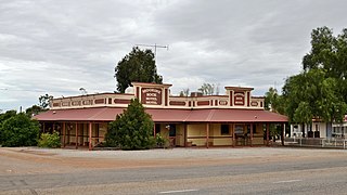
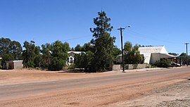
Moorine Rock is located in the eastern agricultural region of Western Australia, 347 km east of Perth and 22 km west south west of Southern Cross.

Bruce Rock is a town in the eastern Wheatbelt region of Western Australia, approximately 243 kilometres (151 mi) east of Perth and 48 kilometres (30 mi) southwest of Merredin. It is the main town in the Shire of Bruce Rock.

Kulin is a town in the eastern Wheatbelt region of Western Australia, approximately 280 km from Perth. It is the main town in the Shire of Kulin.

Bencubbin is a town in Western Australia in the north eastern Wheatbelt, 275 km north-east of Perth. The town lies within the Shire of Mount Marshall and is home to approximately 294 people as of 2011. Surveyor General John Septimus Roe first surveyed the region in 1836 and he was followed by sandalwood cutters and stockmen, but it was not until 1908 that the first permanent settlers arrived.

The Shire of Bruce Rock is a local government area in the Wheatbelt region of Western Australia, about 50 kilometres (31 mi) south of Merredin and about 250 kilometres (155 mi) east of the state capital, Perth. The Shire covers an area of 2,727 square kilometres (1,053 sq mi), and its seat of government is the town of Bruce Rock.

Ardath is a small town in the Wheatbelt region of Western Australia 20 kilometres (12 mi) south of the town of Bruce Rock.

Miling is a small town in the Shire of Moora, 200 kilometres (124 mi) north of Perth, Western Australia. At the 2021 census, it had a population of 101.

Quairading is a Western Australian town located in the Wheatbelt region. It is the seat of government for the Shire of Quairading.
Yuna is a small town in the Mid West region of Western Australia, in the Shire of Chapman Valley, 62 kilometres (39 mi) northeast of the city of Geraldton.
Koolanooka is a small town in the MidWest region of Western Australia. It is situated between Morawa and Perenjori just off the Mullewa-Wubin road. At the 2006 census, Koolanooka had a population of 46.
Badjaling is a small town in the Wheatbelt region of Western Australia located close to the Salt River, and is approximately 155 kilometres (96 mi) west of Perth.
Bilbarin is a small town in the Shire of Corrigin in the Wheatbelt region of Western Australia.
Kulja is a small town in the Wheatbelt region of Western Australia. The town is situated along the Bonnie Rock to Burakin Road.

Pithara is a small town in the wheatbelt region of Western Australia. It is located about 240 km north of Perth, in the Shire of Dalwallinu. At the 2011 census, Pithara had a population of 257, a 25% fall from the previous 2006 census.

Yelbeni is a small town 222 km east-northeast of Perth, Western Australia along the Nungarin-Wyalkatchem Road situated in the Wheatbelt region of Western Australia. At the 2006 census, Yelbeni had a population of 118.

Rhizanthella johnstonii, commonly known as south coast underground orchid, is a species of flowering plant in the orchid family and is endemic to the southwest of Western Australia. It is a subterranean herb that has a horizontal rhizome and a head of up to sixty small white flowers with a pink tinge, surrounded by relatively large, cream-coloured to pale pinkish cream bracts.