
Wellington is a township in South Australia, Australia on the Murray River just upstream of where it empties into Lake Alexandrina. Its postcode is 5259. Wellington is in the Rural City of Murray Bridge. At the 2006 census, Wellington had a population of 295.
Medowie is a suburb of the Port Stephens local government area in the Hunter Region of New South Wales, Australia. It is located approximately 34 km (21 mi) by road north of Newcastle, not far from RAAF Base Williamtown and is home to many of the personnel stationed there. The Worimi people are the traditional owners of the Port Stephens area.

Bridgetown is a town in the South West region of Western Australia, approximately 270 kilometres (168 mi) south of Perth on the Blackwood River at the intersection of South Western Highway with Brockman Highway to Nannup and Augusta.

The suburbs of Canberra are organised into a hierarchy of districts, town centres, group centres, local suburbs and other industrial areas and villages. While these divisions have no formal role in the governance or administration of the city, they formed a basis for the planning and development of the city and are significant to the city's commercial and social activities.

Bullsbrook is a suburb of Perth, Western Australia in the outer metropolitan area. It is located in the City of Swan. The original Bullsbrook townsite is located slightly west of the current town, on the 17 km mark of the Midland Railway. Bullsbrook is also home to the RAAF Pearce airbase, a major training facility for the Royal Australian Air Force. The suburb is situated on the Great Northern Highway, 25 kilometres north of the Midland Strategic Regional Centre. It is well serviced by several major transport networks including the Great Northern Highway, Railway Parade and the Brand Highway to the north, Chittering Road to the east and Neaves Road to the west. Bullsbrook is also adjacent to the State rail network, providing an opportunity for the development of an intermodal freight transport hub. The site is further strengthened by linkage to the planned Perth-Darwin National Highway via Stock Road.

Canning Vale is a southern suburb of Perth, 16 km (9.9 mi) from the central business district. Its local government areas are the City of Canning and the City of Gosnells.

Aubin Grove is a suburb of Perth, Western Australia in the City of Cockburn. The suburb was approved in 2003.

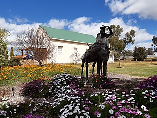
Boddington is a town and shire in the Peel region of Western Australia, located 120 kilometres (75 mi) south-east of Perth. The town sits on the road from Pinjarra to Williams on the Hotham River. The population of the town was 1,844 at the 2016 Census.

Woodvale is a suburb of Perth, Western Australia, located within the City of Joondalup and the City of Wanneroo. At the 2016 census Woodvale had a population of 9,276.
Bailup is a Western Australian locality and rural residential estate located 62 kilometres (39 mi) north-east of the state capital, Perth, along Toodyay Road. The population recorded at the 2021 census was 54. The area is split between the Shire of Toodyay and Shire of Mundaring, the latter of which contains most of the land area.
Muchea is a town in the Shire of Chittering, located 43 km (27 mi) north north-east of Perth. Its postcode is 6501. The town's name comes from the Aboriginal word "Muchela" which means in Nyoongar 'water hole', referring to the abundance of water in Muchea.
Stake Hill is a northeastern rural residential suburb of Mandurah, Western Australia. Its local government area is the Shire of Murray. At the 2011 census, Stake Hill had a population of 494.
Wandering is a town located in the Wheatbelt region of Western Australia, approximately 120 kilometres (75 mi) from the state capital, Perth, just off the Albany Highway. It is the main town in the Shire of Wandering. At the 2016 census, Wandering had a population of 294.
Lockridge is a suburb of Perth, in the Bassendean division of Western Australia, and the City of Swan local government area.
Chittering is a town and rural district approximately 70 km NNE of Perth, Western Australia. It is located along the Brockman River within the Shire of Chittering. It lies between the towns of Gingin and Toodyay, in the Wheatbelt region.
Moresby is a locality northeast of Geraldton, Western Australia, on the north bank of the Chapman River. Its local government area is the City of Greater Geraldton.

Woodridge is a town and rural residential estate located 75 kilometres (47 mi) north of the Perth central business district, the capital city of Western Australia, on the western side of Wanneroo Road near the Moore River. It is separated from Perth's residential area by a 13-kilometre (8 mi) wide area of State Forest at Wilbinga. In the 2016 census, it had a population of 645, up from the population of 584 at the 2011 Census, up from 565 at the 2006 Census, and 541 and 485 at the 2001 and 1996 censuses respectively.
Osterley is a small rural suburb of the Port Stephens local government area in the Hunter Region of New South Wales, Australia. Most of the small population lives in the elevated part of the suburb along Hinton Road, east of Barties Creek which is a tributary of the Hunter River. The area to the west of Barties creek is low-lying and subject to periodic flooding. .In 2016 117 people live there with a median age of 46.

Manoora is a settlement in the Mid North region of South Australia on the Barrier Highway and upper reaches of the Gilbert River. It was also on the Peterborough railway line serving Burra until the line was closed. At the 2006 census, Manoora had a population of 277.

Winwill is a rural locality in the Lockyer Valley Region, Queensland, Australia. In the 2016 census, Winwill had a population of 149 people.

