
Burakin is a small town near Kalannie in the eastern Wheatbelt region of Western Australia.
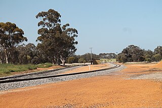
Ejanding is a townsite in the central Wheatbelt region of Western Australia. It is located about 20 kilometres (12 mi) north-northeast of Dowerin. It was originally a siding on the Ejanding Northward railway, a line built between the town now known as Amery, and Kalannie, around 1927. Amery was originally named Ejanding in 1910, but was changed to Amery in 1928. Ejanding was gazetted as a townsite in 1930. Its name is Aboriginal in origin, derived from "Hejanding Well", a name first recorded by the surveyor/explorer Augustus Gregory in 1846. Ejanding used to have a primary school. It operated from 1926 until 2000, closing due to low numbers. Currently Ejanding has a few houses, a wheatbin and railway siding, and is the location of the Dowerin Go Kart Club.

Goomalling is a townsite in the Wheatbelt region of Western Australia, 45 kilometres north-north-east of Northam, Western Australia.

Tammin is a town in the central agricultural region of Western Australia, 184 kilometres (114 mi) east of Perth and midway between the towns of Cunderdin and Kellerberrin on the Great Eastern Highway.

Wubin is a small town located in the northern Wheatbelt region of Western Australia, 272 kilometres (169 mi) north-northeast of Perth and 21 kilometres (13 mi) north of Dalwallinu.

Doodlakine is a town 220 km (140 mi) east of Perth, Western Australia. It is within the Shire of Kellerberrin along the Great Eastern Highway. The town has a crossing loop for trains on the Perth-to-Kalgoorlie railway and serves as a stop on the MerredinLink rural train service.

Meckering is a town 130 kilometres (80.8 mi) east of Perth, Western Australia along the Great Eastern Highway. Meckering is located within the Shire of Cunderdin.

Bruce Rock is a town in the eastern Wheatbelt region of Western Australia, approximately 243 kilometres (151 mi) east of Perth and 48 kilometres (30 mi) southwest of Merredin. It is the main town in the Shire of Bruce Rock.
Yilliminning is a small town located in the southern Wheatbelt region of Western Australia, 212 kilometres (132 mi) southeast of the state capital, Perth and 23 kilometres (14 mi) east of Narrogin. At the 2006 census, Yilliminning had a population of 337.

Yealering is a town in the Wheatbelt region of Western Australia, approximately 220km south-east of Perth between the towns of Wickepin and Corrigin. It is located beside the lake of the same name. While the town's population is small, it services a large agricultural district in the northern Wickepin Shire. At the 2016 census, Yealering had a population of 104.

Trayning is a town in the north-eastern Wheatbelt region of Western Australia, 236 kilometres (147 mi) east of the state capital, Perth, on the Nungarin–Wyalkatchem Road. At the 2006 census, Trayning had a population of 122.

Koorda is a town in the north eastern Wheatbelt region of Western Australia, approximately 236 kilometres (147 mi) east of Perth and 43 kilometres (27 mi) north of Wyalkatchem at the northeastern end of the Cowcowing Lakes. It is the main town in the Shire of Koorda. At the 2016 census Koorda had a population of 414. The surrounding areas produce wheat and other cereal crops. The town is a receival site for Cooperative Bulk Handling.
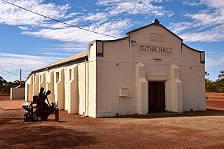
Gutha is a townsite in the Mid West region of Western Australia, 32 kilometres (20 mi) north of Morawa.

Latham is a small town in the Mid West region of Western Australia. It is named after Latham Rock, a large granite rock close to the townsite. The rock was named for an early pastoralist who established a watering place for stock being droved through the area.
Manmanning is a small Wheatbelt town in Western Australia.
South Kumminin in a small town in the Shire of Narembeen in the Wheatbelt region of Western Australia.

Kununoppin is a small town in the Wheatbelt region of Western Australia. The town is located on the Nungarin–Wyalkatchem Road and in the Shire of Trayning local government area, 257 kilometres (160 mi) north east of the state capital, Perth, Western Australia. At the 2006 census, Kununoppin had a population of 151.
Howatharra is a small town in the Mid West region of Western Australia, between Geraldton and Binnu. It is situated just off the North West Coastal Highway and on the Oakagee River.
Muntadgin is a townsite off the Great Eastern Highway on Brissenden Road, situated between the towns of Bruce Rock and Southern Cross in the Wheatbelt region of Western Australia. At the 2016 census, Muntadgin had a population of 51.

Cardiff is a rural town in the Shire of Collie in the South West region of Western Australia.

