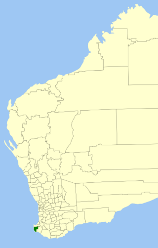
The Shire of Augusta Margaret River is a local government area in the south-west corner of the South West region of Western Australia, approximately 270 kilometres (168 mi) south of Perth. The shire covers an area of 2,243 square kilometres (866 sq mi) and had a population of over 14,000 at the 2016 Census, about half of whom live in the towns of Margaret River and Augusta.

The Shire of Plantagenet is a local government area in the Great Southern region of Western Australia, managed from the town of Mount Barker, 360 kilometres (224 mi) south of Perth and 50 kilometres (31 mi) north of Albany. The shire covers an area of 4,792 square kilometres (1,850 sq mi) and includes the communities of Narrikup, Rocky Gully, Kendenup and Porongurup.

Cranbrook is a small town in the Shire of Cranbrook in the Great Southern region of Western Australia between Katanning, Kojonup and Mount Barker, situated 320 km south of Perth. It is billed as "The Gateway to the Stirlings", referring to the nearby Stirling Range National Park. At the 2006 census, Cranbrook had a population of 280.

Cervantes is a town in Western Australia located off of Indian Ocean Drive about 198 kilometres (123 mi) north-north-west of the state capital, Perth in the Shire of Dandaragan local government area. At the 2016 census, Cervantes had a population of 527. The town was named after a ship that was wrecked nearby. The ship, in turn, was named after Miguel de Cervantes, author of Don Quixote.

Beacon is a town in Western Australia, in the Shire of Mount Marshall. It is 42 km (26 mi) north of Bencubbin and 333 km (207 mi) northeast of Perth by road.

Yealering is a town in the Wheatbelt region of Western Australia, approximately 220 km south-east of Perth between the towns of Wickepin and Corrigin. It is located beside the lake of the same name. While the town's population is small, it services a large agricultural district in the northern Wickepin Shire. At the 2016 census, Yealering had a population of 104.
Tincurrin is a small town in the Wheatbelt region of Western Australia, 250 kilometres (155 mi) south-east of Perth and within the Shire of Wickepin.

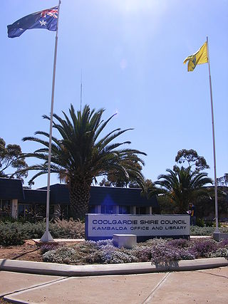
The Shire of Coolgardie is a local government area in the Goldfields–Esperance region of Western Australia, lying roughly west and south of the city of Kalgoorlie. The Shire covers an area of 30,400 square kilometres (11,738 sq mi), and its seat of government is the town of Coolgardie, although the twin towns of Kambalda East and Kambalda West contain two-thirds of the Shire's population.

Pingelly is a town and shire located in the Wheatbelt region of Western Australia, 158 kilometres (98 mi) from Perth via the Brookton Highway and Great Southern Highway. The town is also located on the Great Southern railway line.

Badgingarra is a small town in the Wheatbelt region of Western Australia, about 205 kilometres (127 mi) north of Perth in the Shire of Dandaragan. It lies on the Brand Highway adjacent to the Badgingarra National Park.

The Shire of Shark Bay is a local government area of Western Australia in the Gascoyne region. It has an area of 25,423 km2 and a population of about 950. It is made up of two peninsulas and Shark Bay, located at the westernmost point of Australia. There is one town in the Shire of Shark Bay, Denham, which is the administrative centre for the Shire. There are also a number of small communities; they are Useless Loop, Monkey Mia, Nanga and Hamelin Pool. The Overlander and The Billabong are roadhouses.

Jurien Bay is a coastal town in the Wheatbelt region of Western Australia, 220 kilometres (137 mi) north of Perth facing the Indian Ocean.

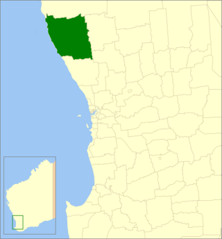
The Shire of Dandaragan is a local government area located in the Wheatbelt region of Western Australia, about 200 kilometres (124 mi) north of the state capital, Perth. The Shire covers an area of 6,716 square kilometres (2,593 sq mi) and its seat of government is the town of Jurien Bay.

Koorda is a town in the north eastern Wheatbelt region of Western Australia, approximately 236 kilometres (147 mi) east of Perth and 43 kilometres (27 mi) north of Wyalkatchem at the northeastern end of the Cowcowing Lakes. It is the main town in the Shire of Koorda. At the 2016 census Koorda had a population of 414. The surrounding areas produce wheat and other cereal crops. The town is a receival site for Cooperative Bulk Handling.

The City of Kalgoorlie–Boulder is a local government area in the Goldfields–Esperance region of Western Australia, about 550 kilometres (342 mi) east of the state capital, Perth. Covering an area of 95,575 square kilometres (36,902 sq mi), the city is larger than the country of Portugal with a land area of 92,212 square kilometres (35,603 sq mi). Its seat of government is the town of Kalgoorlie; all but 244 of the city's population live in either Kalgoorlie or Boulder.

The Shire of Laverton is a local government area in the Goldfields-Esperance region of Western Australia, about 370 kilometres (230 mi) northeast of the city of Kalgoorlie and about 950 kilometres (590 mi) east-northeast of the state capital, Perth. The Shire covers an area of 179,798 square kilometres (69,420 sq mi), and its seat of government is the town of Laverton.

Dandaragan is a small town in the Wheatbelt region of Western Australia. The name of Dandaragan was first recorded in 1850 as the name of a nearby gulley and spring or watering hole known as Dandaraga spring. The word is Indigenous Australian in origin and is thought to mean good kangaroo country.

Pithara is a small town in the wheatbelt region of Western Australia. It is located about 240 km north of Perth, in the Shire of Dalwallinu. At the 2011 census, Pithara had a population of 257, a 25% fall from the previous 2006 census.

Kununoppin is a small town in the Wheatbelt region of Western Australia. The town is located on the Nungarin–Wyalkatchem Road and in the Shire of Trayning local government area, 257 kilometres (160 mi) north east of the state capital, Perth, Western Australia. At the 2006 census, Kununoppin had a population of 151.
Muntadgin is a townsite off the Great Eastern Highway on Brissenden Road, situated between the towns of Bruce Rock and Southern Cross in the Wheatbelt region of Western Australia. At the 2016 census, Muntadgin had a population of 51.


