
The townsite of Piawaning is located in the northern agricultural region, 160 km north-east of Perth and 28 km north-east of New Norcia. At the 2006 census, Piawaning had a population of 309.

Bolgart is a townsite north of Toodyay in Western Australia. It is in the Shire of Victoria Plains.

Tammin is a town in the central agricultural region of Western Australia, 184 kilometres (114 mi) east of Perth and midway between the towns of Cunderdin and Kellerberrin on the Great Eastern Highway.

The town of Hyden is located 292 kilometres (181 mi) east-southeast of Perth, Western Australia in the Shire of Kondinin. Hyden is home to Wave Rock, Mulka's Cave and Hippos Yawn, all popular local tourist attractions.

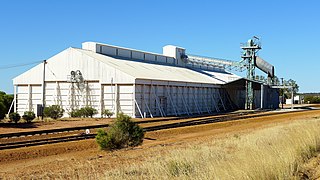
Doodlakine is a town 220 km (140 mi) east of Perth, Western Australia. It is within the Shire of Kellerberrin along the Great Eastern Highway. The town has a crossing loop for trains on the Perth-to-Kalgoorlie railway and serves as a stop on the MerredinLink rural train service.

Bruce Rock is a town in the eastern Wheatbelt region of Western Australia, approximately 243 kilometres (151 mi) east of Perth and 48 kilometres (30 mi) southwest of Merredin. It is the main town in the Shire of Bruce Rock.

Pingelly is a town and shire located in the Wheatbelt region of Western Australia, 158 kilometres (98 mi) from Perth via the Brookton Highway and Great Southern Highway. The town is also located on the Great Southern railway line.

Trayning is a town in the north-eastern Wheatbelt region of Western Australia, 236 kilometres (147 mi) east of the state capital, Perth, on the Nungarin–Wyalkatchem Road. At the 2006 census, Trayning had a population of 122.

Ardath is a small town in the Wheatbelt region of Western Australia 20 kilometres (12 mi) south of the town of Bruce Rock.

Lake King is a town in the eastern Wheatbelt region of Western Australia, 464 kilometres (288 mi) from Perth along State Route 40 between Kelmscott and Ravensthorpe. As of 2016, the town had a population of 95. The 2011 census recorded both the population of the town and the surrounding area for a population of 332.
Bonnie Rock is a small town in the Wheatbelt region of Western Australia.

Bullaring is a small town located in the Shire of Corrigin in the Wheatbelt region of Western Australia.

Kondut is a small town in Wheatbelt region of Western Australia.
Kulja is a small town in the Wheatbelt region of Western Australia. The town is situated along the Bonnie Rock to Burakin Road.

Latham is a small town in the Mid West region of Western Australia. It is named after Latham Rock, a large granite rock close to the townsite. The rock was named for an early pastoralist who established a watering place for stock being droved through the area.
Manmanning is a small Wheatbelt town in Western Australia.
Pingaring is a small town in the Wheatbelt region of Western Australia.

Yoting is a small town located between Quairading and Bruce Rock in the Wheatbelt region of Western Australia.
Canna is a small town in the Mid West region of Western Australia. It is located between the towns of Morawa and Mullewa on the Mullewa-Wubin Road. At the 2006 census, Canna had a population of 81.
Muntadgin is a townsite off the Great Eastern Highway on Brissenden Road, situated between the towns of Bruce Rock and Southern Cross in the Wheatbelt region of Western Australia. At the 2016 census, Muntadgin had a population of 51.


