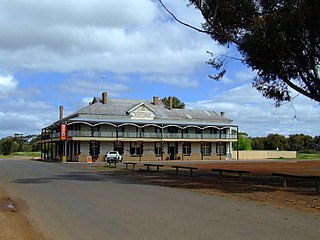
Dumbleyung is a town and shire in the Wheatbelt region of Western Australia, 267 kilometres (166 mi) south-east of Perth between Wagin and Lake Grace on State Route 107.
Laverton, originally known as British Flag, is a town in the Goldfields region of Western Australia, and the centre of administration for the Shire of Laverton. The town of Laverton is located at the western edge of the Great Victoria Desert, 957 kilometres (595 mi) north-northeast of the state capital, Perth, and 124 kilometres (77 mi) east-northeast of the town of Leonora, with an elevation of 461 metres (1,512 ft).

Dalwallinu, colloquially called Dally, is a town in the Wheatbelt region of Western Australia, located 248 km from Perth via the Great Northern Highway. Agriculture and supporting industries are the town's primary economic activities. The town is the first town on the Wildflower Way, a tourist route that stretches north to Mullewa. The town has an elevation of 335 metres (1,099 ft). At the 2016 census, Dalwallinu had a population of 699.

Croydon is an outback town and locality within the Shire of Croydon in Queensland, Australia. It is a terminus for the Normanton to Croydon railway line, which operates the Gulflander tourist train. In the 2021 census, the locality of Croydon had a population of 215 people.

The Shire of Ngaanyatjarraku is a remote local government area in Western Australia near the Northern Territory/South Australian border. It is 1,542 km (958 mi) from Perth.
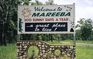
Mareeba is a rural town and locality in the Shire of Mareeba in Far North Queensland, Australia. Between 2008 and 2013, it was within the Tablelands Region. The town's name is derived from an Aboriginal word meaning meeting of the waters. In the 2021 census, the locality of Mareeba had a population of 11,825 people.

Wyalkatchem is a town in the central Wheatbelt region, 192 kilometres (119 mi) east-north-east of Perth, 35 kilometres (22 mi) east of Dowerin and 44 kilometres (27 mi) south of Koorda. At the 2021 census, Wyalkatchem had a population of 358.

Denmark is a coastal town located on Wilson Inlet in the Great Southern region of Western Australia, 423 kilometres (263 mi) south-south-east of the state capital of Perth. At the 2016 census, Denmark had a population of 2,558; however, the population can be several times the base population during tourist seasons.

Moss Vale is a town in the Southern Highlands of New South Wales, Australia, in the Wingecarribee Shire. It is located on the Illawarra Highway, which connects to Wollongong and the Illawarra coast via Macquarie Pass.

Brookton is a town in the Wheatbelt region of Western Australia, 138 kilometres (86 mi) from the state capital, Perth via the Brookton Highway where it crosses the Great Southern Highway. The town is on the Great Southern railway line. It is within, and is the seat of government for, the Shire of Brookton. At the 2016 census, Brookton had a population of 975.

Williams is a town located in the Wheatbelt region of Western Australia, 161 kilometres (100 mi) south-southeast of the state capital, Perth along Albany Highway and 32 kilometres (20 mi) west of Narrogin. The Williams River passes through the town. At the 2016 census, Williams had a population of 411.

Bakers Hill is a town 73 kilometres (45 mi) east of Perth, Western Australia on the Great Eastern Highway. The town is located within the Shire of Northam, between Wundowie and Clackline. At the 2021 census, Bakers Hill had a population of 1276.

Lockhart River is a town in the Aboriginal Shire of Lockhart River and a coastal locality split between the Aboriginal Shire of Lockhart River and the Shire of Cook, on the Cape York Peninsula in Queensland, Australia. The town is an Aboriginal community. From 1924 to 1967, the Lockhart River Mission was run by the Anglican Church. In the 2021 census, the locality of Lockhart River had a population of 640 people.

Kowanyama is a town and coastal locality in the Aboriginal Shire of Kowanyama, Queensland, Australia.

Kukerin is a small town in the Wheatbelt region of Western Australia, 302 kilometres (188 mi) south-east of Perth between Dumbleyung and Lake Grace just off Dumbleyung Lake Grace Road on State Route 107. The town itself is small but services a considerable agricultural region in the eastern Shire of Dumbleyung. At the 2021 census, Kukerin and its surrounding areas had a population of 55.

Pingelly is a town and shire located in the Wheatbelt region of Western Australia, 158 kilometres (98 mi) from Perth via the Brookton Highway and Great Southern Highway. The town is also located on the Great Southern railway line.

The Shire of Dumbleyung is a local government area in the Wheatbelt region of Western Australia, about 40 kilometres (25 mi) east of Wagin and about 275 kilometres (171 mi) southeast of Perth, the state capital. The Shire covers an area of 2,540 square kilometres (981 sq mi), and is involved in grain and livestock production and various biodiversity industries including cereals, summer crops, oil mallees, yabbies, emus, poultry and trout. Its seat of government is the town of Dumbleyung.

Trangie is a town in the Orana region of New South Wales, Australia. The town is on the Mitchell Highway 485 kilometres (301 mi) north west of the state capital Sydney. It is part of Narromine Shire local government area. At the 2021 census, Trangie had a population of 768. Trangie is on the Main Western railway line, New South Wales
Dongolocking is a locality within the Shire of Dumbleyung, 49 kilometres (30 mi) north-east of Wagin. The population of Dongolocking live within private farm house dwellings scattered within the locality's boundaries, living and working on farms managing live stock and producing wheat and other cereal crops. The only remnants of the original townsite is the Dongolocking Hall, and the (disused) tennis courts, which is maintained and used for events such as annual Christmas social gatherings. The original hall was replaced in 1960 by the current town hall due to deterioration. The towns legacy can also be found in the town of Katanning where the original Dongolocking School Building was transported to for use on the Katanning Primary School site, where it is still used by the Education Department today.
Merilup is a locality in the Wheatbelt region of Western Australia, 309 kilometres (192 mi) south-east of Perth between Dumbleyung and Lake Grace just south of Kukerin. The construction of three schools was scattered for use within the area between 1922 and December 1950 when the final school was closed and consolidated in Kukerin's school. The population of Merilup live within private farm house dwellings scattered within the locality's boundaries, living and working on farms managing live stock and producing a range of broadacre crops. Today the area relies on the townsite of Kukerin, from which it shares a postcode, for essential services such as groceries and postage. At the 2021 census, Merilup had a population of 13.

