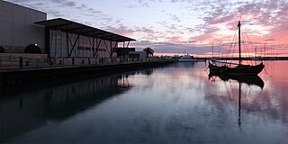
Geraldton is a coastal city in the Mid West region of the Australian state of Western Australia, 424 kilometres (263 mi) north of the state capital, Perth.

The City of Wanneroo is a local government area with city status in the northern suburbs of Perth, Western Australia. It is centred approximately 25 kilometres (15.5 mi) north of Perth's central business district and forms part of the northern boundary of the Perth metropolitan area. Wangara encompasses the federal divisions of Cowan, Moore and Pearce.

The Wheatbelt is one of nine regions of Western Australia defined as administrative areas for the state's regional development, and a vernacular term for the area converted to agriculture during colonisation. It partially surrounds the Perth metropolitan area, extending north from Perth to the Mid West region, and east to the Goldfields-Esperance region. It is bordered to the south by the South West and Great Southern regions, and to the west by the Indian Ocean, the Perth metropolitan area, and the Peel region. Altogether, it has an area of 154,862 square kilometres (59,793 sq mi).

Augusta is a town on the south-west coast of Western Australia, where the Blackwood River emerges into Flinders Bay. It is the nearest town to Cape Leeuwin, on the furthest southwest corner of the Australian continent. In the 2001 census it had a population of 1,091; by 2016 the population of the town was 1,109.

North Dandalup is a small town in the Peel region of Western Australia along the South Western Highway between Serpentine and Pinjarra. Its local government area is the Shire of Murray. At the 2011 census, North Dandalup had a population of 346.

Calingiri is a town located north-east of Perth, near New Norcia in Western Australia. It is in the Shire of Victoria Plains.

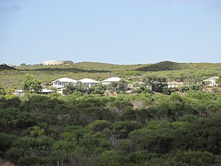
Kalbarri is a coastal town in the Mid West region located 592 km (368 mi) north of Perth, Western Australia. The town is located at the mouth of the Murchison River which has an elevation of 6 metres (20 ft). It is connected by public transport to Perth via Transwa coach services N1 and N2.

Gingin is a town in Western Australia, located on the Brand Highway 67 kilometres (42 mi) north of the Perth city centre. It is the council seat for the Shire of Gingin local government area. Gingin had a population of 852 at the 2016 census. The town's economy is mostly based on its agriculture, although there has been an increasing focus on science with the establishment of the Australian International Gravitational Observatory and Gravity Discovery Centre. There is also a small military airfield, RAAF Gingin, located nearby.

Moore is an electoral district of the Legislative Assembly in the Australian state of Western Australia.

Lancelin is a small fishing and tourist town 127 km north of Perth, Western Australia. It is within the Shire of Gingin at the end of Lancelin Road, and a few kilometres away from the scenic highway Indian Ocean Drive.
Ledge Point is a small coastal township 105 km north of Perth, Western Australia. It was established to service the local fishing and crayfishing industries.
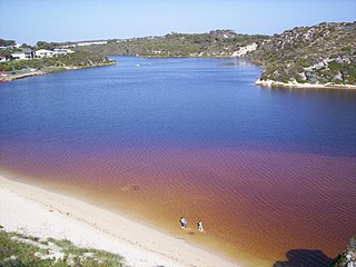
Moore River is a river in the Wheatbelt region of Western Australia.
Binningup is a town on the coast of the South West region of Western Australia between Mandurah and Bunbury. At the 2016 census, Binningup had a population of 1,227.
Chittering is a town and rural district approximately 70 km NNE of Perth, Western Australia. It is located along the Brockman River within the Shire of Chittering. It lies between the towns of Gingin and Toodyay, in the Wheatbelt region.

Regans Ford is a small town located in the Wheatbelt region of Western Australia, about 110 kilometres (70 mi) north of Perth in the Shire of Dandaragan.
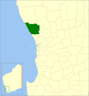
The Shire of Gingin is a local government area in the Wheatbelt region of Western Australia, just beyond the northern fringe of the Perth metropolitan area. The Shire covers an area of 3,211 square kilometres (1,240 sq mi) and its seat of government is the town of Gingin.

Yued is a region inhabited by the Yued people, one of the fourteen groups of Noongar Aboriginal Australians who have lived in the South West corner of Western Australia for approximately 40,000 years.
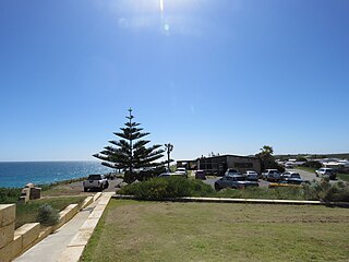
Seabird is a small coastal town north of Perth, Western Australia in the Shire of Gingin, situated halfway between Two Rocks and Lancelin overlooking the Indian Ocean.
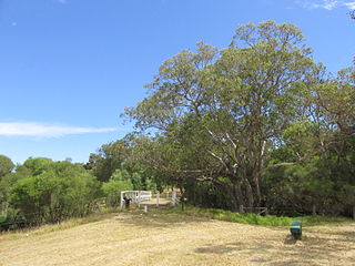
Neergabby is a locality and farming area within the Shire of Gingin, located around 20 km north of Perth metropolitan area's northern limit.
Gabbadah is a locality within the Shire of Gingin, located around 30 km north of Perth metropolitan area's northern limit.


