Burakin, Western Australia

Last updated

Burakin
Western Australia
Dowerin-Kalannie Road, Burakin, 2014(3).JPG
Dowerin-Kalannie Road, Burakin, 2014
Australia Western Australia location map.svg
Red pog.svg
Burakin
Burakin, Western Australia
Coordinates 30°31′26″S117°10′23″E / 30.524°S 117.173°E / -30.524; 117.173 Coordinates: 30°31′26″S117°10′23″E / 30.524°S 117.173°E / -30.524; 117.173
Population30 (SAL 2021) [1]
Established1928
Postcode(s) 6467
Elevation359 m (1,178 ft)
Area342.5 km2 (132.2 sq mi)
Location
  • 242 km (150 mi) NNE of Perth
  • 45 km (28 mi) NW of Koorda
LGA(s) Shire of Wongan-Ballidu
State electorate(s) Moore
Federal division(s) Durack

Burakin is a small town near Kalannie in the eastern Wheatbelt region of Western Australia.

The townsite was gazetted in 1928. [2] The name is an Aboriginal word of unknown meaning, and was suggested by the Wongan Hills Road Board in 1927. The original spelling was to have been Borrikin. [3]

Burakin is the junction for the branch railway line to Bonnie Rock. The line was completed on 27 April 1931, but services beyond Beacon were withdrawn from late 1997. [4]

In 2000 and 2001 Burakin was the epicentre of a series of earthquakes now known as the Burakin Swarm – a significant series of seismographic events that are considered important in understanding the South West Seismic Zone. [5] [6]

Related Research Articles

<span class="mw-page-title-main">Dalwallinu, Western Australia</span> Town in Western Australia

Dalwallinu, colloquially called Dally, is a town in the Wheatbelt region of Western Australia, located 248 km from Perth via the Great Northern Highway. Agriculture and supporting industries are the town's primary economic activities. The town is the first town on the Wildflower Way, a tourist route that stretches north to Mullewa. The town has an elevation of 335 metres (1,099 ft). At the 2016 census, Dalwallinu had a population of 699.

<span class="mw-page-title-main">Morawa, Western Australia</span> Town in Western Australia

Morawa is a town in the Mid West region of Western Australia. It is located within the Shire of Morawa, approximately 370 kilometres (230 mi) north of the state capital Perth, on the railway line between Wongan Hills and Mullewa.

<span class="mw-page-title-main">Yalgoo, Western Australia</span> Town in Western Australia

Yalgoo is a town in the Mid-west region, 499 kilometres (310 mi) north-north-east of Perth, Western Australia and 118 kilometres (73 mi) east-north-east of Mullewa. Yalgoo is in the local government area of the Shire of Yalgoo.

<span class="mw-page-title-main">Bolgart, Western Australia</span> Town in Western Australia

Bolgart is a townsite north of Toodyay in Western Australia. It is in the Shire of Victoria Plains.

<span class="mw-page-title-main">Moorine Rock, Western Australia</span> Town in Western Australia

Moorine Rock is located in the eastern agricultural region of Western Australia, 347 km east of Perth and 22 km west south west of Southern Cross.

<span class="mw-page-title-main">Wubin, Western Australia</span> Town in Western Australia

Wubin is located in the northern Wheatbelt region of Western Australia, 272 kilometres (169 mi) north-northeast of Perth and 21 kilometres (13 mi) north of Dalwallinu.

Yerecoin is a small town located in the Wheatbelt region of Western Australia, in the Shire of Victoria Plains,156 kilometres (97 mi) north-northeast of the state capital, Perth.

<span class="mw-page-title-main">Cadoux, Western Australia</span> Town in Western Australia

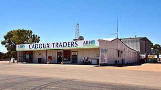
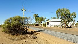
Cadoux is a town in the northeastern Wheatbelt region of Western Australia. It is about 180 kilometres (112 mi) northeast of Perth, within the Shire of Wongan-Ballidu.

<span class="mw-page-title-main">Wyalkatchem, Western Australia</span> Town in Western Australia

Wyalkatchem is a town in the central Wheatbelt region, 192 kilometres (119 mi) east-north-east of Perth, 35 kilometres (22 mi) east of Dowerin and 44 kilometres (27 mi) south of Koorda. At the 2021 census, Wyalkatchem had a population of 358.

<span class="mw-page-title-main">Hyden, Western Australia</span> Town in Western Australia

The town of Hyden is located 292 kilometres (181 mi) east-southeast of Perth, Western Australia in the Shire of Kondinin. Hyden is home to Wave Rock, Mulka's Cave and Hippos Yawn, all popular local tourist attractions.

<span class="mw-page-title-main">Doodlakine, Western Australia</span> Town in the Wheatbelt region of Western Australia

Doodlakine is a town 220 km (140 mi) east of Perth, Western Australia. It is within the Shire of Kellerberrin along the Great Eastern Highway. The town has a crossing loop for trains on the Perth-to-Kalgoorlie railway and serves as a stop on the MerredinLink rural train service.

<span class="mw-page-title-main">Three Springs, Western Australia</span> Town in Western Australia

Three Springs is a town located 313 kilometres (194 mi) north of Perth, Western Australia on the Midlands Road, which until the opening of the Brand Highway in 1975 was the main road route from Perth to the state's north. The town is the seat of the Shire of Three Springs. Its economy is based on agriculture and mining.

<span class="mw-page-title-main">Arthur River, Western Australia</span> Town in the Wheatbelt region of Western Australia

Arthur River is a small town located in the Wheatbelt region of Western Australia, between Williams and Kojonup on the Albany Highway.

<span class="mw-page-title-main">Yilliminning, Western Australia</span> Small town in southwestern Australia

Yilliminning is a small town located in the southern Wheatbelt region of Western Australia, 212 kilometres (132 mi) southeast of the state capital, Perth and 23 kilometres (14 mi) east of Narrogin. At the 2006 census, Yilliminning had a population of 337.

<span class="mw-page-title-main">Trayning, Western Australia</span> Town in Western Australia

Trayning is a town in the north-eastern Wheatbelt region of Western Australia, 236 kilometres (147 mi) east of the state capital, Perth, on the Nungarin–Wyalkatchem Road. At the 2006 census, Trayning had a population of 122.

<span class="mw-page-title-main">Koorda, Western Australia</span> Town in Western Australia

Koorda is a town in the north eastern Wheatbelt region of Western Australia, approximately 236 kilometres (147 mi) east of Perth and 43 kilometres (27 mi) north of Wyalkatchem at the northeastern end of the Cowcowing Lakes. It is the main town in the Shire of Koorda. At the 2016 census Koorda had a population of 414. The surrounding areas produce wheat and other cereal crops. The town is a receival site for Cooperative Bulk Handling.

Yuna is a small town in the Mid West region of Western Australia, in the Shire of Chapman Valley, 62 kilometres (39 mi) northeast of the city of Geraldton.

<span class="mw-page-title-main">Ajana, Western Australia</span> Town in Western Australia

Ajana is a townsite within the Shire of Northampton in Western Australia. It is located at the junction of Ajana-Kalbarri Road and Ajana Back Road, 53 kilometres (33 mi) by road north of Northampton, 61 kilometres (38 mi) by road southwest of Kalbarri, and 531 kilometres (330 mi) west-northwest of Perth in the Mid West region.

<span class="mw-page-title-main">Borden, Western Australia</span> Town in Western Australia

Borden is a small town in the Great Southern region of Western Australia. The town is located 325 kilometres (202 mi) south east of the state capital, Perth and 111 kilometres (69 mi) north of Albany on Chester Pass Road. At the 2006 census, Borden and the surrounding area had a population of 164.

The South West Seismic Zone is a major intraplate earthquake province located in the south west of Western Australia. It was known earlier as the Yandanooka – Cape Riche Lineament, corresponds to the physiographic boundary known as the Meckering Line, and also the junction between Swanland and Salinaland.

The zone exists within an Archaean Shield structure called the Yilgarn Block. The identified geological subdivisions within this Precambrian structure do not show an obvious relation to the seismicity.

References

  1. Australian Bureau of Statistics (28 June 2022). "Burakin (Suburb and Locality)". Australian Census 2021 QuickStats. Retrieved 28 June 2022.  OOjs UI icon edit-ltr-progressive.svg
  2. Western Australia. Department of Lands and Surveys (1929), Townsite of Burakin, Ninghan District, Dept. of Lands & Surveys W.A, retrieved 21 August 2022
  3. "History of country town names – B". Western Australian Land Information Authority. Retrieved 8 June 2007.
  4. Rails through the Wodjil Milne, Rod Australian Railway Historical Society Bulletin, January, 1999 pp3-9
  5. "UWA Seismic Events in WA – Burakin Swarm". 2005. Archived from the original on 11 July 2008. Retrieved 20 April 2011.
  6. Australia. Department of Industry, Tourism and Resources (30 June 2002), "Geoscience Australia (30 June 2002)", Annual Report, Department of Industry, Tourism and Resources (539 of 2002): 199, ISSN   1443-8267

Commons-logo.svg Media related to Burakin, Western Australia at Wikimedia Commons