Korrelocking, Western Australia

Last updated

Korrelocking
Western Australia
Korrelocking town hall.jpg
Korrelocking town hall, 2013
Australia Western Australia location map.svg
Red pog.svg
Korrelocking
Korrelocking, Western Australia
Coordinates 31°12′S117°28′E / 31.200°S 117.467°E / -31.200; 117.467
Population58 (SAL 2021) [1]
Established1911
Postcode(s) 6485
Elevation343 m (1,125 ft)
Location
LGA(s) Shire of Wyalkatchem
State electorate(s) Central Wheatbelt
Federal division(s) Durack

Korrelocking is a small town situated between Wyalkatchem and Trayning in the Wheatbelt region of Western Australia. At the 2006 census, Korrelocking had a population of 76. [2]

During the construction of the Merredin to Dowerin railway line the government decided to establish a station in the area. The Yuragin progress association petitioned for a townsite to be declared at the station.

The town was gazetted in 1911, shortly before the opening of the railway line. [3]

In 1932 the Wheat Pool of Western Australia announced that the town would have two grain elevators, each fitted with an engine, installed at the railway siding, [4] which in effect saw Korrelocking as one of the first five bulk wheat locations on the Western Australian Government Railways network, and a site of the beginning of bulk wheat handling in Western Australia. [5]

The name of the town is an Aboriginal word for a nearby water well that had been recorded when the area had been surveyed in 1892. The meaning of the name is not known.

A bioblitz was conducted in 2012 in a bush reserve between Korrelocking and Wyalkatchem. 54 people took part and collected samples of scorpions, pseudoscorpions, isopods, spiders. and centipedes, including some new species. [6]

Related Research Articles

<span class="mw-page-title-main">Narembeen, Western Australia</span> Town in the Wheatbelt, Western Australia

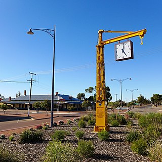
Narembeen is a town in the Wheatbelt region of Western Australia. It is 286 km, almost due east, from Perth, the capital of WA. It is the major settlement in the Shire of Narembeen, in which the major industries are growing cereal crops and raising cattle and sheep. The surrounding areas produce wheat and other cereal crops. The town is a receival site for Cooperative Bulk Handling.

<span class="mw-page-title-main">Kalannie, Western Australia</span> Town in the Wheatbelt region of Western Australia

Kalannie is a small town in the Shire of Dalwallinu, in the Wheatbelt region of Western Australia, approximately 259 kilometres (161 mi) north-east of the state capital, Perth.

<span class="mw-page-title-main">Tammin, Western Australia</span> Town in Western Australia

Tammin is a town in the central agricultural region of Western Australia, 184 kilometres (114 mi) east of Perth and midway between the towns of Cunderdin and Kellerberrin on the Great Eastern Highway.

<span class="mw-page-title-main">Bodallin, Western Australia</span> Town in the Wheatbelt region of Western Australia

Bodallin is a town located around half way between Merredin and Southern Cross in Western Australia.

<span class="mw-page-title-main">Moorine Rock, Western Australia</span> Town in Western Australia

Moorine Rock is located in the eastern agricultural region of Western Australia, 347 km east of Perth and 22 km west south west of Southern Cross.

<span class="mw-page-title-main">Wyalkatchem, Western Australia</span> Town in Western Australia

Wyalkatchem is a town in the central Wheatbelt region, 192 kilometres (119 mi) east-north-east of Perth, 35 kilometres (22 mi) east of Dowerin and 44 kilometres (27 mi) south of Koorda. At the 2021 census, Wyalkatchem had a population of 358.

<span class="mw-page-title-main">Bencubbin, Western Australia</span> Town in the Wheatbelt region of Western Australia

Bencubbin is a town in Western Australia in the north eastern Wheatbelt, 275 km north-east of Perth. The town lies within the Shire of Mount Marshall and is home to approximately 294 people as of 2011. Surveyor General John Septimus Roe first surveyed the region in 1836 and he was followed by sandalwood cutters and stockmen, but it was not until 1908 that the first permanent settlers arrived.

<span class="mw-page-title-main">Trayning, Western Australia</span> Town in Western Australia

Trayning is a town in the north-eastern Wheatbelt region of Western Australia, 236 kilometres (147 mi) east of the state capital, Perth, on the Nungarin–Wyalkatchem Road. At the 2006 census, Trayning had a population of 122.

<span class="mw-page-title-main">Ardath, Western Australia</span> Town in the Wheatbelt region of Western Australia

Ardath is a small town in the Wheatbelt region of Western Australia 20 kilometres (12 mi) south of the town of Bruce Rock.

<span class="mw-page-title-main">Koorda, Western Australia</span> Town in Western Australia

Koorda is a town in the north eastern Wheatbelt region of Western Australia, approximately 236 kilometres (147 mi) east of Perth and 43 kilometres (27 mi) north of Wyalkatchem at the northeastern end of the Cowcowing Lakes. It is the main town in the Shire of Koorda. At the 2016 census Koorda had a population of 414. The surrounding areas produce wheat and other cereal crops. The town is a receival site for Cooperative Bulk Handling.

<span class="mw-page-title-main">Miling, Western Australia</span> Town in Western Australia

Miling is a small town in the Shire of Moora, 200 kilometres (124 mi) north of Perth, Western Australia. At the 2021 census, it had a population of 101.

<span class="mw-page-title-main">Gabbin, Western Australia</span> Town in Western Australia

Gabbin is a small town in the Wheatbelt region of Western Australia.

<span class="mw-page-title-main">Kulja, Western Australia</span> Town in the Wheatbelt region of Western Australia

Kulja is a small town in the Wheatbelt region of Western Australia. The town is situated along the Bonnie Rock to Burakin Road.

<span class="mw-page-title-main">Maya, Western Australia</span> Town in Western Australia

Maya is a small town in the Mid West region of Western Australia.

<span class="mw-page-title-main">Pithara, Western Australia</span> Town in Western Australia

Pithara is a small town in the wheatbelt region of Western Australia. It is located about 240 km north of Perth, in the Shire of Dalwallinu. At the 2011 census, Pithara had a population of 257, a 25% fall from the previous 2006 census.

<span class="mw-page-title-main">Kununoppin</span> Town in Western Australia

Kununoppin is a small town in the Wheatbelt region of Western Australia. The town is located on the Nungarin–Wyalkatchem Road and in the Shire of Trayning local government area, 257 kilometres (160 mi) north east of the state capital, Perth, Western Australia. At the 2006 census, Kununoppin had a population of 151.

Bowgada is a small town in Western Australia located on the Mullewa Wubin Road 366 kilometres (227 mi) north of Perth in the Mid West region.

Bunjil is a small town in Western Australia located on the Mullewa Wubin Road 326 kilometres (203 mi) north of Perth in the Mid West region. At the 2021 census, it had a population of 61.

<span class="mw-page-title-main">Yelbeni, Western Australia</span> Town in Western Australia

Yelbeni is a small town 222 km east-northeast of Perth, Western Australia along the Nungarin-Wyalkatchem Road situated in the Wheatbelt region of Western Australia. At the 2006 census, Yelbeni had a population of 118.

Welbungin is a small town located just off the Koorda–Southern Cross road 287 km (178 mi) from Perth in the Wheatbelt region of Western Australia.

References

  1. Australian Bureau of Statistics (28 June 2022). "Korrelocking (suburb and locality)". Australian Census 2021 QuickStats. Retrieved 28 June 2022.  OOjs UI icon edit-ltr-progressive.svg
  2. Australian Bureau of Statistics (25 October 2007). "Korrelocking (State Suburb)". 2006 Census QuickStats. Retrieved 16 July 2011.
  3. "History of country town names – K". Western Australian Land Information Authority. Archived from the original on 14 March 2022. Retrieved 20 March 2011.
  4. "Country elevators". The West Australian . Perth: National Library of Australia. 6 July 1932. p. 10. Retrieved 6 April 2013.
  5. "BULK HANDLING". The West Australian . Vol. XLIX, no. 9, 524. Western Australia. 5 January 1933. p. 50. Retrieved 4 October 2021 via National Library of Australia.
  6. "2012 BioBlitz at Korrelocking". Bennelongia. 26 September 2012. Retrieved 16 September 2016.

Commons-logo.svg Media related to Korrelocking, Western Australia at Wikimedia Commons